TR: 5/1-5/8, 2012 [Rock Harbor-Windigo via Minong]
Moderator: Tom
-
Rafiki

- IR Expert
- Posts: 541
- Joined: Thu Apr 08, 2010 11:11 am
- Isle Royale Visits: 7
- Location: Chicago, IL
TR: 5/1-5/8, 2012 [Rock Harbor-Windigo via Minong]
Coming to an Isle Royale Forum near you. Got back yesterday and have much to share, so stay tuned as I work myself back into the daily routine of things. I will get to writing it soon. I promise.
343.1 Miles Hiked: 2004 (3 Days), 2010 (11 Days), 2011 (13 Days), 2012 X 2 (8 + 12 Days), 2013 (9 Days/Paddling), 2019 (30 Days/Paddling)
-
fonixmunkee

- Forum Moderator
- Posts: 954
- Joined: Tue Sep 11, 2007 10:58 am
- Isle Royale Visits: 18
- Location: Soupe Towne, WI
- Has thanked: 47 times
- Been thanked: 60 times
-
Rafiki
- IR Expert
- Posts: 541
- Joined: Thu Apr 08, 2010 11:11 am
- Isle Royale Visits: 7
- Location: Chicago, IL
Re: May 1st - May 8th 2012 Trip Report
I tend to write a lot on any subject matter I speak upon in this forum, so this report will not be any different. Prepare for a long-winded reinteration. I will take you day by day thoughout the next coming week.
May 1st Tuesday
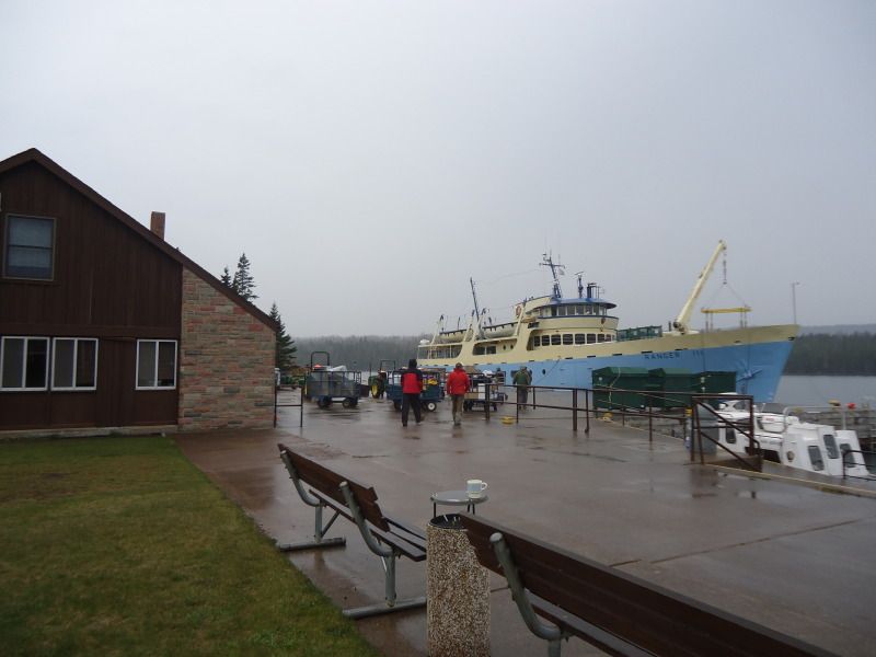
This is my first solo backpacking trip I have ever taken. It is weird not having my girlfriend with me. I arrived at the Ranger III dock in Houghton, MI at 8:15am eastern time. Everything will be in eastern time from here on out. I have the pleasure of meeting Ranger Greg and Lorrie for the first time. They were the two that assisted me with my reservation on the boat. I park my car in the upper deck because they are supposedly repaving the lower gated lot. The Ranger departed at right around 9am just as scheduled.
There were about a dozen other people on the vessel, but none of them were public vistors like myself. I spoke with a girl named Katie towards the end of my voyage who was doing various mammal and fishes studies with a team of researchers that would be scattered throughout the island. She reconfirmed that I was the only visitor on the boat and that while she didn't know everyone else on the boat, she knew they were either researchers like herself or park staff. It took us a little over an hour to reach the open Lake Superior waters and exit the channel that leads away from Houghton. During this period of time, I met Scottt, a retired fireman from Flint, MI near the front of the ship on the 2nd floor deck. He has been working on the Ranger III for the past 8 years. The ride was boring as could be. I spent some time exploring the ship and shifted back and forth from sleeping and reading.
As we were approaching Mott Island, this is were I encountered Katie and another crew member. The crew member asked me if I was going to Rock Harbor with them after Mott Island or if I was going to hitch a ride with a ranger at Mott to go to a different point. I told him the plan called for me to go to Rock Harbor according to the information given to me by Ranger Greg over at Houghton. WIth a nod, he departed and returned to his duties. It got me thinking that I really did not want to go to Rock Harbor only to have to walk to Moskey Basin. It now became a mission of mine to see if I could find a ranger that would not mind giving me a ride provided that he or she was doing patrols at Three Mile, Daisy Farm, or Moskey Basin. We got to Mott Island around 2:20pm, a little later than the expected time of 2pm. I as told that it would be about 45 minutes before leaving for Rock Harbor as they unloaded researchers, staff, and gear.
I took the opportunity explore Mott Island to which I had only seen before on my way to Three Mile while on previous trips traveled upon the Rock Harbor Trail. I also used the time to try to find a willing Ranger that would take me to a place other than Rock Harbor. In steps Ranger Pete. He was the first Ranger I saw away from the crowds of rangers greeting the researchers. My first thoughtd were to ask him where I could walk around for the next 30-45 minute and how I could get to the bridge I saw intersecting the two parts of Mott Island, but before I could get a word out, he introeduced himself as being Ranger Pete and asked me if I was Tim. With a smile of surprise, I of course told him I was and that it was a pleasure to meet him. He then proceeded forward to ask me if I wanted a ride to a site other than Rock Harbor. I asked him where he planned on going and he told me Three Mile and Daisy Farm. I asked if Moskey was on his agenda at all. Unfortunately, he said it was not. Regardless, I was still happy to take advantage of him being able to take me to Daisy Farm. he said that he would be leaving in about an hour so that I should meet back with him at 3:30pm. He explained that if I wanted to walk a small part of the Mott Island Loop, I could gain access to it on my left or that if I wanted to check out the bridge that I eventually spoke of that I could access it on my right. Since I only had an hour, not enough time to do the 3 mile Moott Loop without pushing it, I opted to sightsee my way to the bridge.
Before leaving, I grabbed my backpack from the Ranger III and told the captain, at least the one that was subsituting for the normal captain (the normal captain was back on the mainland tending to his wife who was striken with cancer, I pray for a quick recovery from her treatments) that I was going to get off at Nott Island and have a ranger take me to Daisy Farm. He asked for my name just so he could keep it fresh in his mind even though I was the only vistor on the boat and our interaction was through. I checked out the bridge as planned and saw various cabins that rangers and researchers call home. I also saw a couple of back entrance docking areas near the cabins where the rangers could park boats if they choose not to park them at the main Mott Harbor. It began consistently letting down a pitter patter of light rain shortly after starting my walk and by the time I got back, I was slightly damp. It was 3:15pm once I returned. I changed into my rain gear, and in the prcess of doing so, Ranger Pete told me that Ranger Rob was actually going to be taking me to Daisy Farm along with two other researchers. I shook his hand and told him that I hoped to see him again on my return in October. He said he was likely to be here, so I do hope to encounter him again.
At 3:30pm I hopped on the boat with the other two and Ranger Rob. Once of the two people on board was named Ethan. He was a Senior at the Michigan Tech. College in Houghton. He was with his professor to repair beaver enclosures. I would figure out this out on my trip back on the Ranger III when I had the opportunity to bump into them once again. On a couple of other side notes, it should be noted that I recalled having meeting Ranger Rob before last year. He is the Ranger that stays at the Daisy Farm Ranger Station. A very nice fellow, just like all of the other Rangers of course. I love Isle Royale Rangers. They are so friendly and helpful. It should also be noted that the Ranger III still had not left by the time we were departing. So the 45 minute wait that was supposedly expected actually went longer than predicted. At the rate it would take her to get going, she surly would not have left untail at least 4pm. Thus, at best I doubt I would have made it to Rock Harbor any earlier than 4:30pm. This whole time I had the plans of getting there by 3pm, if not, maybe slightly later. Thank God for my encounter with Ranger Pete and Rob. If it were not for them, I am not certain if I would have made it to Moskey Basin by dark.
The ride from Mott to Daisy Farm took slightly less than 15 minutes. We got there around 3:45pm. By the time I got off the boat, I realized that I hadn't been issued a permit by any of the rangers. I brought this up to Rob. He was a little shocked by the matter and went in search of a pen to write my itinerary out, but said that he had left it back at Mott and to tell him what sites I planned on visiting. I explained my route and with a smile and a wave, I was on my way. by the time I adjusted everything on my backpack and put my heart rate monitor on along with taking a quick pee, I was not on my way until 4:02pm.
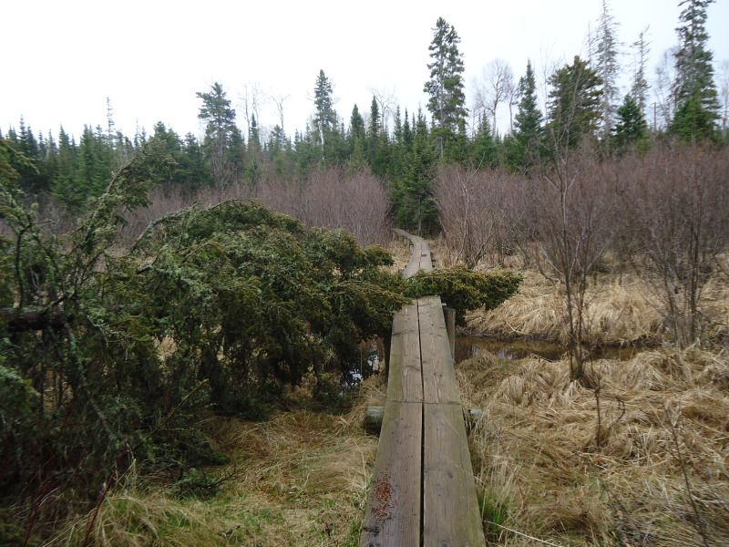
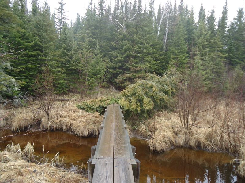
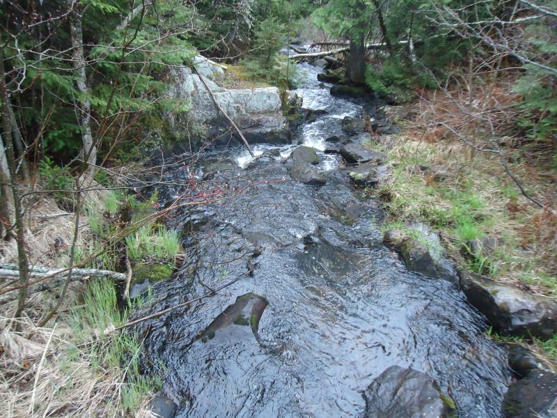
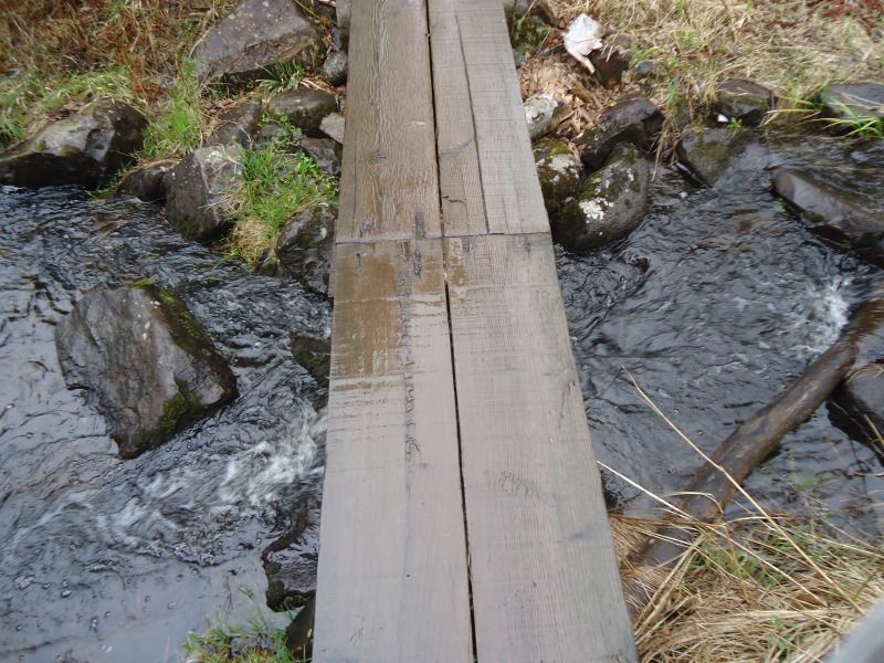
The rain continued to slowly pitter patter for half of the distance to Moskey. The first half is actually the more difficult of the two parts because the first part is bluffy and rocky, while the second is smooter and flater. I slipped and almost fell on three different occassions on the first half due to all the rain. I did not see any wildlife along the way unless you count a cloud of hoovering gnat like bugs. I did notice three different mounds of moose scat, none were warm or steamy. Before entering Moskey Basin campgrounds, one will encounter three different boardwalks and a creak like stream. First, the stream will appear followed by a boardwalk every quarter of a mile. I arriced at the Moskey post at 5:36pm. No one was there.
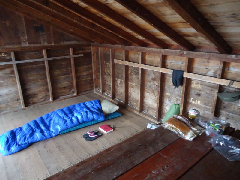
10 minutes after arriving and selecting my shelter, the rain returned, but this time a little heavier. I quickly pulled the picnic table into the shelter, which really was not quickly at all because it was not an easy task. Actually, it was a real pain in the rear especially when the metal leg of the thing slipped and crashed into my shin which would later lead to a deep bruise. Thank God I did not break anything. Then came my lovely first day surprise. I had been carrying a 4lb paperweight around this whole time, otherwise known as my tent. What I mean by this is that the Carbon Reflex 2 person tent that I bought for this occassion in particular was not freestanding like the Carbon Reflex 3 tent that my girlfriend and I share when we go on trips together. Why was this an issue? Well because it will not stand up in the shlter by itself. It needs to be staked down otherwise it just collapses. Great right?!? Well not really because the only reason I bought this tent was because I wanted to use it as a thermal wind barrier in the shelters I planned to stay at. I knew at this time of year, I would get a shelter where ever I went except for maybe Todd Harbor. Therefore, I never planned to use the tent outside of the shelther and that is why it proved to be useless for me on this trip. Lucky for me, I brought a fleece and a pair of sweatpants that I was initially bummed about bringing, because I know the only time I would use them is at night, but I doubted it because I would be in the tent and my warmth would be shielded inside. Now that I did not have a tent to speak of, these extra items of clothing proved to be useful. In the future though, during this time of year, I will just make it a point to wear warmer clothes, or at least bring them, but say tp hell with the tent if all of the places I plan to stay at have shelters.
Coming to the above conclusion about the tent, I began laying out things, setting up my sleeping area, and filtering water. I had 24ozs of water when I left Daisy Farm out of my two 36oz bottles and I still had 24ozs when I got to Moskey. However, aftering eating 5 handfuls of wasabi trail mix, 2 handfuls of cheddar pizza crackers, and 6 dried peach slices, I easily drank half of what was left of my water supply. I filled a total of 2 bottles of water if you count the water that was used for cooking my dehydrated meal. After eating dinner and doing a little reading, I turned the lights out at 10:50pm. According to my heart rate monitor, I burned 548 calories while walking 3.9 miles with an Average heart rate of 105bpm and a Max heart rate of 125bpm.
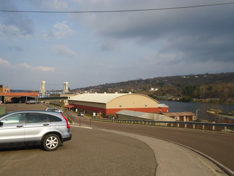
A couple of pictures of the Ranger III Ferry parked in Houghton Harbor as well as the Houghton bridge in the background:
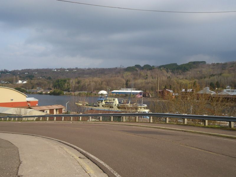
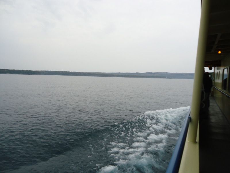
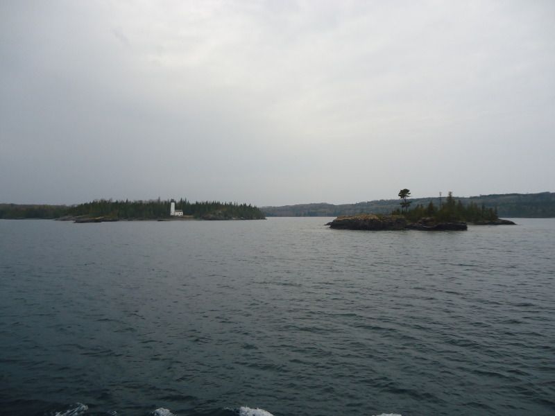
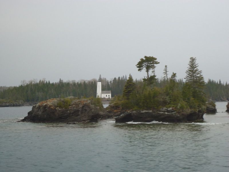
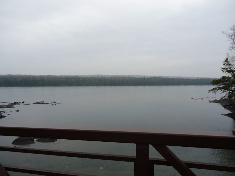
Some pictures taken while on the boat and while passing the Rock Harbor Light House:
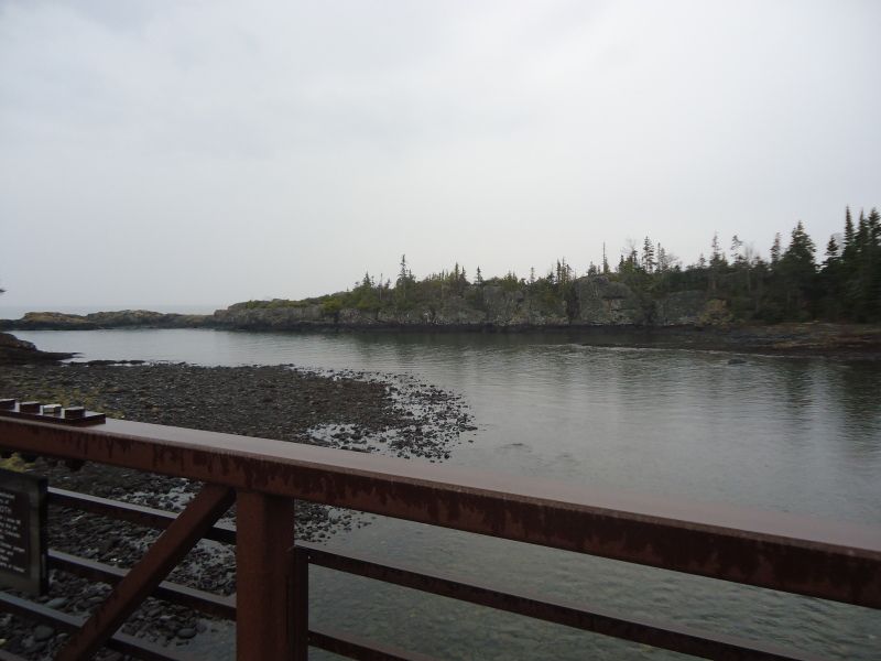
Some pictures of Mott Island and the bridge I was talking about that connected the two side. Also a picture of the Ranger III parked at Mott Island:
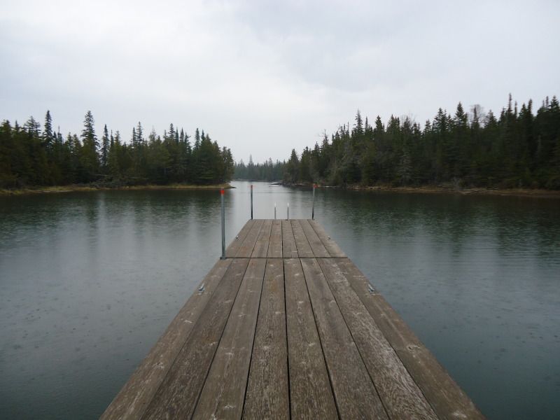
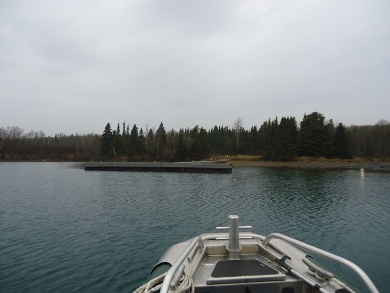
A picture taken while on one of the Ranger's boats. I wanted to take a video, but I couldn't get my camera out of my life jacket until we go near the Daisy Farm dock:
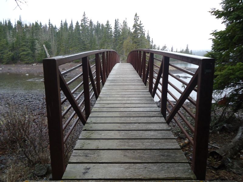
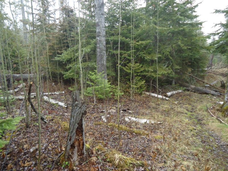
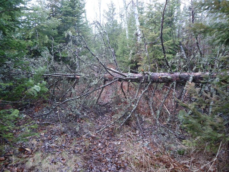
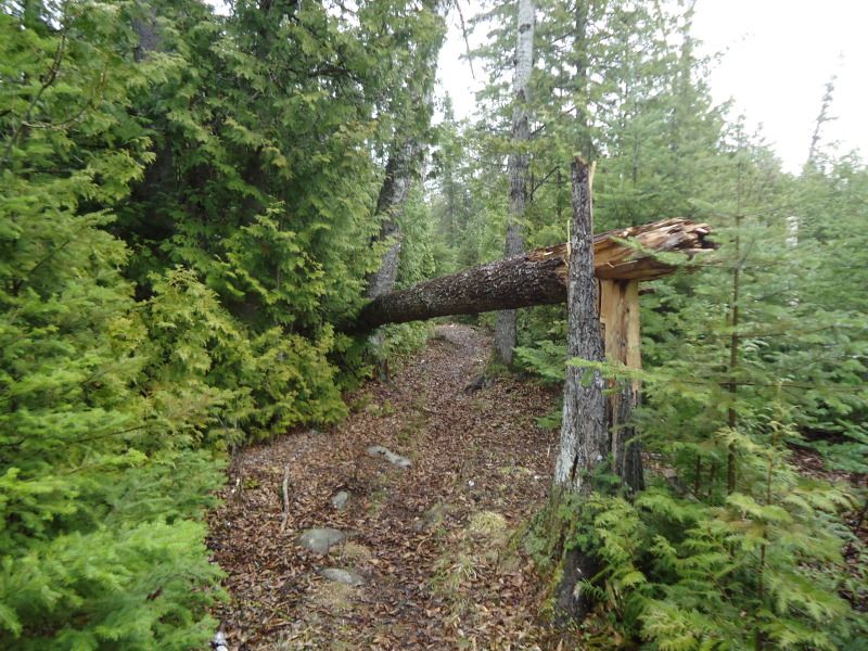
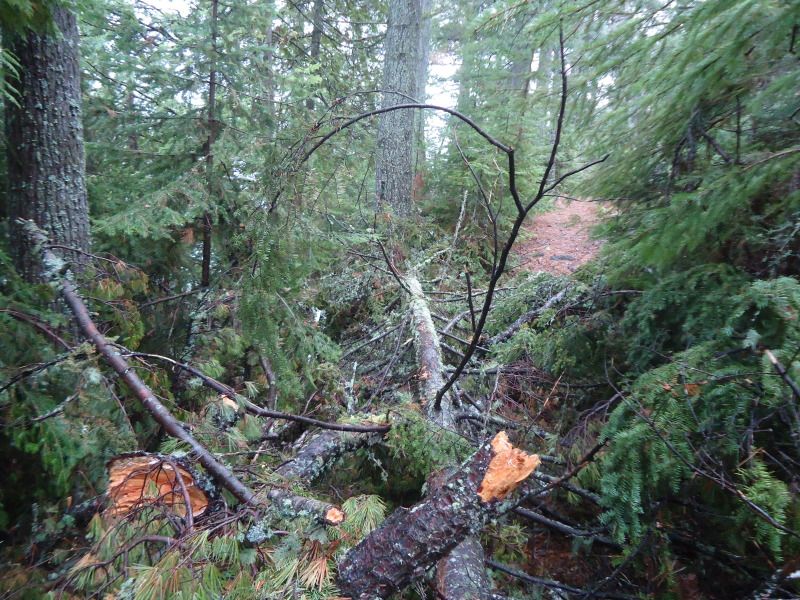
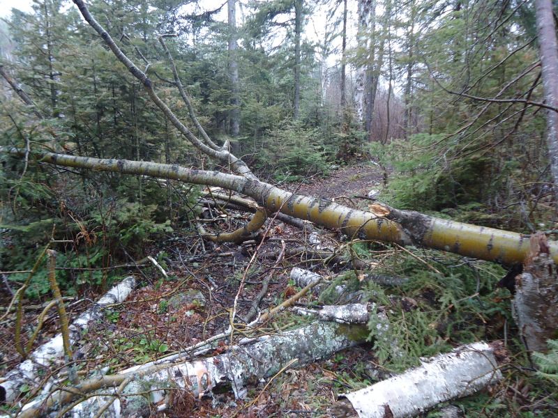
Entering Moskey, the first down tree I saw. Also some picture of my setup:

May 1st Tuesday
This is my first solo backpacking trip I have ever taken. It is weird not having my girlfriend with me. I arrived at the Ranger III dock in Houghton, MI at 8:15am eastern time. Everything will be in eastern time from here on out. I have the pleasure of meeting Ranger Greg and Lorrie for the first time. They were the two that assisted me with my reservation on the boat. I park my car in the upper deck because they are supposedly repaving the lower gated lot. The Ranger departed at right around 9am just as scheduled.
There were about a dozen other people on the vessel, but none of them were public vistors like myself. I spoke with a girl named Katie towards the end of my voyage who was doing various mammal and fishes studies with a team of researchers that would be scattered throughout the island. She reconfirmed that I was the only visitor on the boat and that while she didn't know everyone else on the boat, she knew they were either researchers like herself or park staff. It took us a little over an hour to reach the open Lake Superior waters and exit the channel that leads away from Houghton. During this period of time, I met Scottt, a retired fireman from Flint, MI near the front of the ship on the 2nd floor deck. He has been working on the Ranger III for the past 8 years. The ride was boring as could be. I spent some time exploring the ship and shifted back and forth from sleeping and reading.
As we were approaching Mott Island, this is were I encountered Katie and another crew member. The crew member asked me if I was going to Rock Harbor with them after Mott Island or if I was going to hitch a ride with a ranger at Mott to go to a different point. I told him the plan called for me to go to Rock Harbor according to the information given to me by Ranger Greg over at Houghton. WIth a nod, he departed and returned to his duties. It got me thinking that I really did not want to go to Rock Harbor only to have to walk to Moskey Basin. It now became a mission of mine to see if I could find a ranger that would not mind giving me a ride provided that he or she was doing patrols at Three Mile, Daisy Farm, or Moskey Basin. We got to Mott Island around 2:20pm, a little later than the expected time of 2pm. I as told that it would be about 45 minutes before leaving for Rock Harbor as they unloaded researchers, staff, and gear.
I took the opportunity explore Mott Island to which I had only seen before on my way to Three Mile while on previous trips traveled upon the Rock Harbor Trail. I also used the time to try to find a willing Ranger that would take me to a place other than Rock Harbor. In steps Ranger Pete. He was the first Ranger I saw away from the crowds of rangers greeting the researchers. My first thoughtd were to ask him where I could walk around for the next 30-45 minute and how I could get to the bridge I saw intersecting the two parts of Mott Island, but before I could get a word out, he introeduced himself as being Ranger Pete and asked me if I was Tim. With a smile of surprise, I of course told him I was and that it was a pleasure to meet him. He then proceeded forward to ask me if I wanted a ride to a site other than Rock Harbor. I asked him where he planned on going and he told me Three Mile and Daisy Farm. I asked if Moskey was on his agenda at all. Unfortunately, he said it was not. Regardless, I was still happy to take advantage of him being able to take me to Daisy Farm. he said that he would be leaving in about an hour so that I should meet back with him at 3:30pm. He explained that if I wanted to walk a small part of the Mott Island Loop, I could gain access to it on my left or that if I wanted to check out the bridge that I eventually spoke of that I could access it on my right. Since I only had an hour, not enough time to do the 3 mile Moott Loop without pushing it, I opted to sightsee my way to the bridge.
Before leaving, I grabbed my backpack from the Ranger III and told the captain, at least the one that was subsituting for the normal captain (the normal captain was back on the mainland tending to his wife who was striken with cancer, I pray for a quick recovery from her treatments) that I was going to get off at Nott Island and have a ranger take me to Daisy Farm. He asked for my name just so he could keep it fresh in his mind even though I was the only vistor on the boat and our interaction was through. I checked out the bridge as planned and saw various cabins that rangers and researchers call home. I also saw a couple of back entrance docking areas near the cabins where the rangers could park boats if they choose not to park them at the main Mott Harbor. It began consistently letting down a pitter patter of light rain shortly after starting my walk and by the time I got back, I was slightly damp. It was 3:15pm once I returned. I changed into my rain gear, and in the prcess of doing so, Ranger Pete told me that Ranger Rob was actually going to be taking me to Daisy Farm along with two other researchers. I shook his hand and told him that I hoped to see him again on my return in October. He said he was likely to be here, so I do hope to encounter him again.
At 3:30pm I hopped on the boat with the other two and Ranger Rob. Once of the two people on board was named Ethan. He was a Senior at the Michigan Tech. College in Houghton. He was with his professor to repair beaver enclosures. I would figure out this out on my trip back on the Ranger III when I had the opportunity to bump into them once again. On a couple of other side notes, it should be noted that I recalled having meeting Ranger Rob before last year. He is the Ranger that stays at the Daisy Farm Ranger Station. A very nice fellow, just like all of the other Rangers of course. I love Isle Royale Rangers. They are so friendly and helpful. It should also be noted that the Ranger III still had not left by the time we were departing. So the 45 minute wait that was supposedly expected actually went longer than predicted. At the rate it would take her to get going, she surly would not have left untail at least 4pm. Thus, at best I doubt I would have made it to Rock Harbor any earlier than 4:30pm. This whole time I had the plans of getting there by 3pm, if not, maybe slightly later. Thank God for my encounter with Ranger Pete and Rob. If it were not for them, I am not certain if I would have made it to Moskey Basin by dark.
The ride from Mott to Daisy Farm took slightly less than 15 minutes. We got there around 3:45pm. By the time I got off the boat, I realized that I hadn't been issued a permit by any of the rangers. I brought this up to Rob. He was a little shocked by the matter and went in search of a pen to write my itinerary out, but said that he had left it back at Mott and to tell him what sites I planned on visiting. I explained my route and with a smile and a wave, I was on my way. by the time I adjusted everything on my backpack and put my heart rate monitor on along with taking a quick pee, I was not on my way until 4:02pm.
The rain continued to slowly pitter patter for half of the distance to Moskey. The first half is actually the more difficult of the two parts because the first part is bluffy and rocky, while the second is smooter and flater. I slipped and almost fell on three different occassions on the first half due to all the rain. I did not see any wildlife along the way unless you count a cloud of hoovering gnat like bugs. I did notice three different mounds of moose scat, none were warm or steamy. Before entering Moskey Basin campgrounds, one will encounter three different boardwalks and a creak like stream. First, the stream will appear followed by a boardwalk every quarter of a mile. I arriced at the Moskey post at 5:36pm. No one was there.
10 minutes after arriving and selecting my shelter, the rain returned, but this time a little heavier. I quickly pulled the picnic table into the shelter, which really was not quickly at all because it was not an easy task. Actually, it was a real pain in the rear especially when the metal leg of the thing slipped and crashed into my shin which would later lead to a deep bruise. Thank God I did not break anything. Then came my lovely first day surprise. I had been carrying a 4lb paperweight around this whole time, otherwise known as my tent. What I mean by this is that the Carbon Reflex 2 person tent that I bought for this occassion in particular was not freestanding like the Carbon Reflex 3 tent that my girlfriend and I share when we go on trips together. Why was this an issue? Well because it will not stand up in the shlter by itself. It needs to be staked down otherwise it just collapses. Great right?!? Well not really because the only reason I bought this tent was because I wanted to use it as a thermal wind barrier in the shelters I planned to stay at. I knew at this time of year, I would get a shelter where ever I went except for maybe Todd Harbor. Therefore, I never planned to use the tent outside of the shelther and that is why it proved to be useless for me on this trip. Lucky for me, I brought a fleece and a pair of sweatpants that I was initially bummed about bringing, because I know the only time I would use them is at night, but I doubted it because I would be in the tent and my warmth would be shielded inside. Now that I did not have a tent to speak of, these extra items of clothing proved to be useful. In the future though, during this time of year, I will just make it a point to wear warmer clothes, or at least bring them, but say tp hell with the tent if all of the places I plan to stay at have shelters.
Coming to the above conclusion about the tent, I began laying out things, setting up my sleeping area, and filtering water. I had 24ozs of water when I left Daisy Farm out of my two 36oz bottles and I still had 24ozs when I got to Moskey. However, aftering eating 5 handfuls of wasabi trail mix, 2 handfuls of cheddar pizza crackers, and 6 dried peach slices, I easily drank half of what was left of my water supply. I filled a total of 2 bottles of water if you count the water that was used for cooking my dehydrated meal. After eating dinner and doing a little reading, I turned the lights out at 10:50pm. According to my heart rate monitor, I burned 548 calories while walking 3.9 miles with an Average heart rate of 105bpm and a Max heart rate of 125bpm.
A couple of pictures of the Ranger III Ferry parked in Houghton Harbor as well as the Houghton bridge in the background:
Some pictures taken while on the boat and while passing the Rock Harbor Light House:
Some pictures of Mott Island and the bridge I was talking about that connected the two side. Also a picture of the Ranger III parked at Mott Island:
A picture taken while on one of the Ranger's boats. I wanted to take a video, but I couldn't get my camera out of my life jacket until we go near the Daisy Farm dock:
Entering Moskey, the first down tree I saw. Also some picture of my setup:
343.1 Miles Hiked: 2004 (3 Days), 2010 (11 Days), 2011 (13 Days), 2012 X 2 (8 + 12 Days), 2013 (9 Days/Paddling), 2019 (30 Days/Paddling)

-
Rafiki
- IR Expert
- Posts: 541
- Joined: Thu Apr 08, 2010 11:11 am
- Isle Royale Visits: 7
- Location: Chicago, IL
Re: May 1st - May 8th 2012 Trip Report
Justed editted my above 1st Day post to conclude where I left off before my girlfriend came along. Now time for Day 2.
May 2nd Wednesday
Had my alarm set for 7am, but it was so warm and toasty in my bag, combined with the soft bird noises coming from outside and the rain dripping off the shingles of the roof that I decided to sleep until 8:51am. What a lazy bones I was.
So I had a couple of dreams last time. One in particular is me being in jail. I don't know why I am in jail or how I got there, but I was. There were others in there with me, but I spoke to none of them. They all seemed a little crazy. Then, and I don't know why I did this, but I checked myself into solitary confinement, as if it were an option that the prison guards allowed me to select. When I selected the option, even the prison guard looked at me like are you sure you want to do this, I nodded and swiped my prison card to gain access only to find out that I have 5 years to go on my sentence which will now be spent out in confinement. I wanted desperately to get out, but was stuck and watched the seconds and minutes slowly tick away until I was awoken by my alarm clock and go back to sleep back to sleep for a couple of hours. I think I had this dream, because at times I do missy company even at the very start of my trip. For instance, my girlfriend who usually accompanies me or for that matter other IsleRoyale vistors to discuss experiences with.
Going to bed last night was somewhat spooky with no one around at all. When I did wake up at times throughout the night, I would eyeball around the shelter before rearing myself back to bed. When I did finally wake up at 8:51am, my back was sore from the sleeping conditions that it had not gotten use to yet. I streched for 10 minutes and that seemed to have eased the soreness out of it slightly, but there still remained a sense of uncomfortableness in the colums of my lower back. Hopefully, it will go away as the day progresses.
(I am pausing here for a second to notify everyone that as I write out this trip report, I am trying to write it in past tense. However, when I journaled it out, a lot of the time I was writing in present tense. Therefore, as I read my journal and type it out to be read by others, I am trying to shift everything into a past tense form. However, this is becoming burdensome because it is interrupting my typing flow and slowing me down. As you can see I write a lot while on my trips, so this is going to take long enough as it is. With that noted, I am no longer going to worry about what tense I am writing in. There will be times I speak in present tense and shift into past tense, please forgive the back and forthness of these two tenses. Rather than writing out things perfectly, it is my goal to write things out as quickly as possible with the hopes that this special note will guide you along way and steer you away from any confusion in my writing style.)
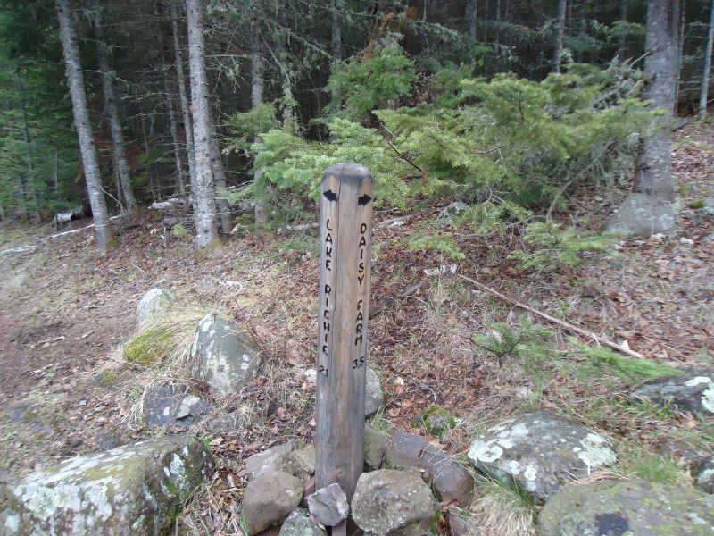
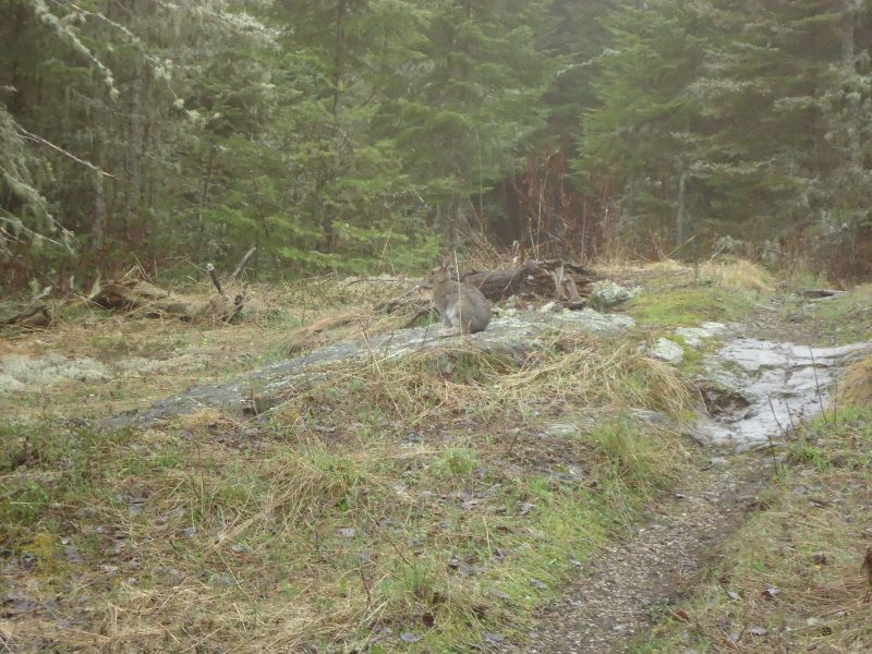
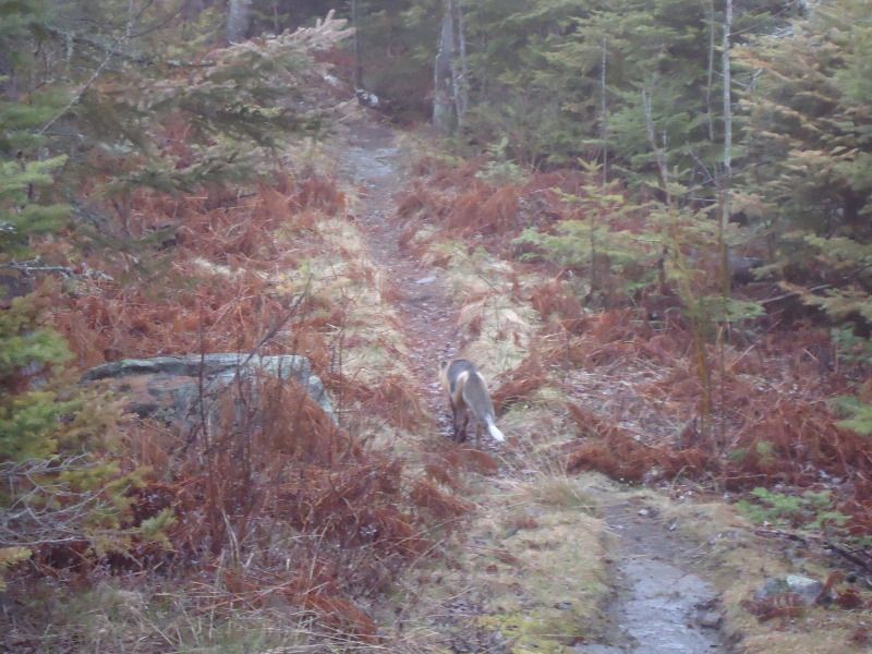
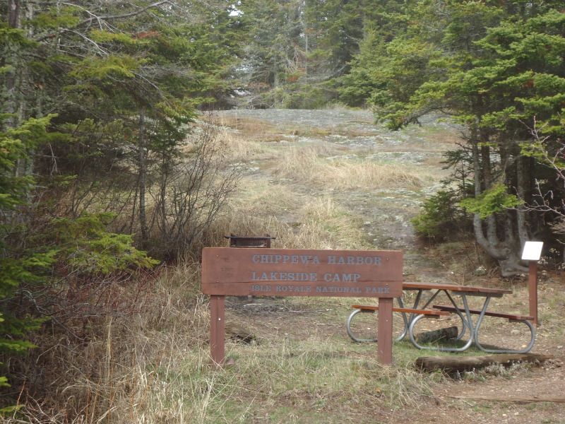
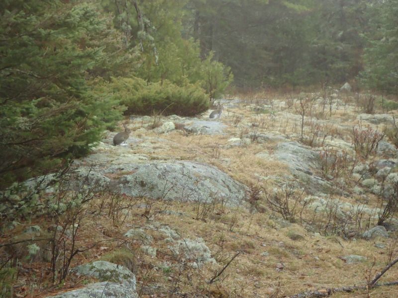
I had a granola bar for breakfast and departed for a day hike to Chippewa Harbor at 10:52am. I arrived at the Chippewa/Lake Richie marker at 11:39am. During this portion of the hike I saw 5 snowshoed rabbits and a fox that was mangey looking and moist-coated with dew. I got a picture of it skimpering away, but I wanted a btter one of him looking at me like when I initially saw him. After following him for about .2 miles in the reverse direction back to Moskey, I gave up and continued back on my journey toward Chippewa. Oddly enough, once I got to the maker it said 4.3 miles to Chippewa, but according to my National Geographic map, it is only 4.1 miles so I dont know which one it is. We'll just say 4.2 miles. I arrived at the first portage point at 12:26pm, the second portage point at 12:52pm, the mason lake marker at 1:07pm, and Chippewa Harbor at 1:12pm. There was a total of 23 boardwalks from the marker to Chippewa. The 18ths one is located near a racing stream that notifies you of its presense as you scale your way along side of it.
I took a lunch break at Chippewa to eat a granola bar, 3 handfuls of trail mix, 1 handful of dried cherries, and a bowl of soup. I filtered a bottle and a half of water while my water boiled for my soup. I drank 20ozs on the hike over her and another 16oz while I hung out at Chippewa.
Sometime during this hike I decided that I did not want to see a moose while visiting the island. Ok so correct that, at least not while I was hiking. I remember when Shelly and I were here on our first trip together and a pair of them corssed our path like they were a cat crossing the street in my neighborhood. All I can imagine is one of them crossing my path while I am here by myself and worrying that it is a ninja moose that is going to spring out at me from nowhere by using some stealthy moose skills that I am unaware of him or her possesing. I was so worried about mooses, that I imagined that when I got to Chippewa Harbor, there would be a community of moose having a secret meeting that no human was suppose to know of and in I wall all skippidy-do-da off the trail and they turn and look at me. All hell breaks loose and I have a stampede of moose chasing after me. Forget that, if I see any moose, I want it to be from the safety of my shelter and nowhere else.
On my walk back, I am just going to wear my t-shirt and a long sleeve with pajama pants and long johns. I sweated quite a bit on the way over here with my sweatpants, hiking pants, rainpants, sweatshirt, and rain jacket on top of all the things previously mentioned. I need to air out a little because I do not want to go to sleep in sweat drenched clothes. I am going to keep my rain jacket on because unfortunately I did not bring my long brim hiking hat and need to have a way to protect myself from the sun by throwing the hood of my jacket over my head. I cannot afford to get burned on my neck and head.
Before I head out of Chippewa, I'm going to check out the shelter graffiti. I'm back at Moskey now. I took some pictures of the shelter graffiti at Chippewa. While I was stepping out of the last shelter I was a little nervous when I heard a bunch of grunting and squeaking coming from under the shelter. I shut the door and stepped back inside only to see a ball of rolling fur race out from under the shelter and quickly back to where it came from. I waited for it to come out again before I noticed that it was three crazy squirrels wrestling with one another. About the note on the 23 boardwalks, 11 boardwalks follow after the second portage point from chippewa harbor and 12 boardwalks before reaching the Lake Richie/Moskey Marker after passing the second portage.
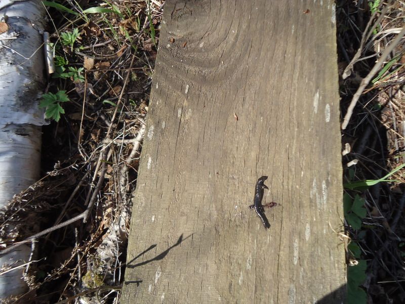
I left Chippewa Harbor at 3:28pm. I got to the Mason Marker at 3:33pm. I got to the first portage point at 3:48pm. I got to the second portage point at 4:11pm. I got to the Lake Richie/Moskey Marker at 5:34pm. On the way back to Moskey, I drank 20oz of water and another 24oz at the Moskey dock. I refilled both water bottles after I dumped my remaining 12oz into my stove pot for dinner. I saw a snowshoed rabbit and a dead newt (or salamander) on my journey back. The return trip was harder. I sweat like a mule with my rain jacket on that I wore only to protect myself from sunburn. Even now as it goes on 8pm, my shirt is still drenched in sweat. I really wish I would have brought my hiking hat. Oh well, I probably would have still sweat a decent amount anyways with my butt also damp with sweat.
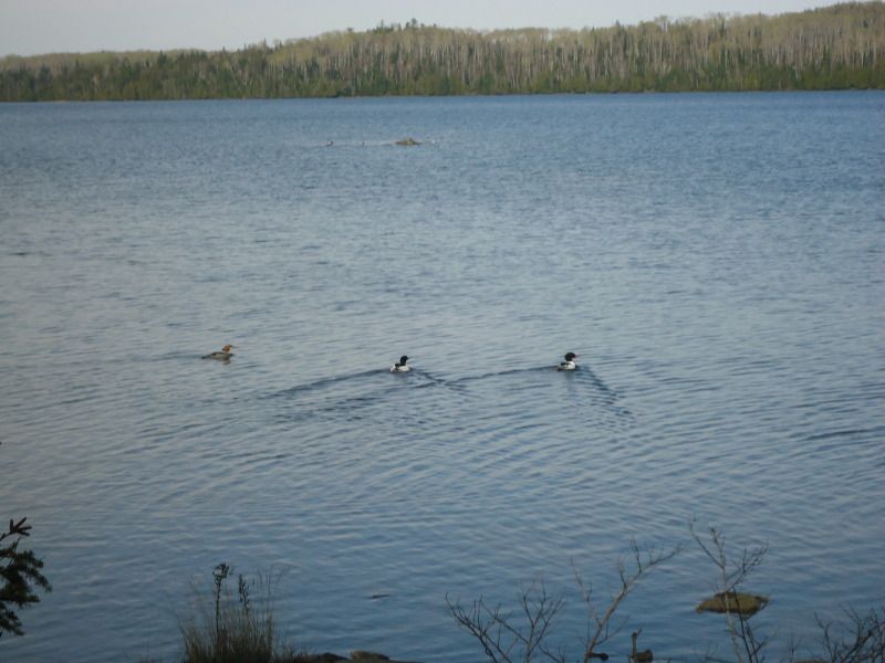
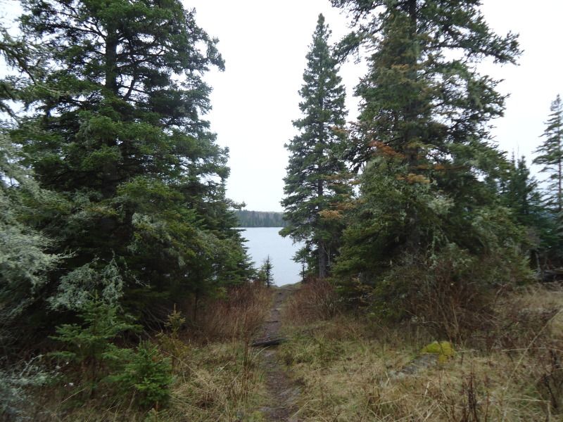
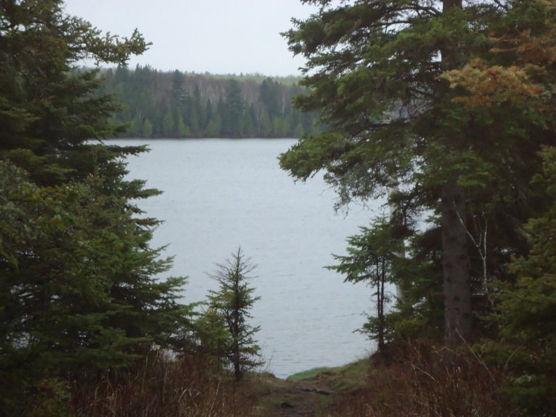
Once I got back to the shelter I ate 4 peach slices and 3 handfuls of pineapple nut trail mix. After taking a snack break, I took an hour stroll around Moskey to check out each shelters graffiti and to take some pictures. Throughout the course of doing so, I saw several loons swimming around together and an occassional one diving underwater. At one point, I even saw 11 of them fly way together. When I got back I rinsed the mudd off that accumlated on my rainpants and cleaned off my heart monitor strap. While doing so, I noticed some loons swimming near the coast and ran back to get my camera. Just like the fox earlier, the loons were already on their way towards the middle of the basin. I still took a shot of them swinning away along with a picture of a group of them to the right of those.
Once I got back to the shelter, the water had boiled for my meal. As I waited for it to rehydrate, I reviewed the map for my hike to McCargoe tomorrow. Throughout the course of the evening, I had another 14oz of water. Speaking of evening, the sun starts to set around 8pm. This is about when the temperature starts to get cooler too. While you could probably hike until about 9pm, I say this as I look outside at 8:57pm, it could be somewhat dark in the deeply forested area with a lot of canopy and overhang. Therefore, I would not suggest beyond 8:30pm if at all possible. By 9:15pm, you would definitely need a headlamp to carry on without a doubt. I am not sure when the sun rises because it was very misty out this morning combined with me getting up at 9am.
On a completely different note, I am glad I brought gloves. They came in handy when I first began hiking this morning. They were great at night in my sleeping bag too. And they even came in handy when my pot was too hot to touch with my bare hand. On another topic, I doubled up on socks last night. They keep my feet toasty. I'm going to pass on doing this tonight, but will have them on stand by in case I need them.
The filter will need to be cleaned soon. If I remember correctly, when clean and fully operational, my filter usually only takes 100 pumps to filter 36oz of water. Today, when I got back to Moskey, it took me 120 pumps for the first bottle and 140 pumps for the second bottle. Oh, and one last thing, I love my lightweight traveling Sharp mini clock that my girlfriend got for us. It is super light and I love the teperature gauge on it even though I an not sure if it works perfectly. The alarms sounds nice and loud though. At 9:08pm the temperature is said to be 61 degrees out. I am not sure about that even though it was a warm day out. After doing some reading, lights out at 10:35pm with many night time stories to tell of tomorrow when I wake up. In the meantime, I hiked a total of 12.6 miles today. 2 hours and 20 minutes from Moskey to Chippewa with an Average heart rate of 111bpm and a Max heart rate of 147bpm. 911 calories burned. 2 hours and 6 minutes from Chippewa to Moskey with an Average heart rate of 122bpm and a Max heart rate of 158bpm. 1058 calories burned.
Reverse angle of the down tree I saw while coming into Moskey Basin:
One of many rabbits on saw while I was on my way to Chippewa Harbor and the Fox that I went chasing after:
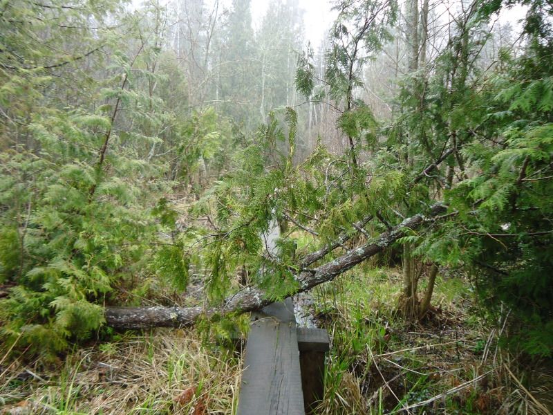
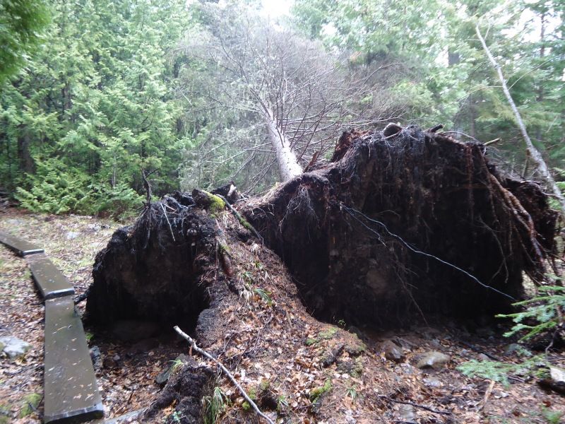
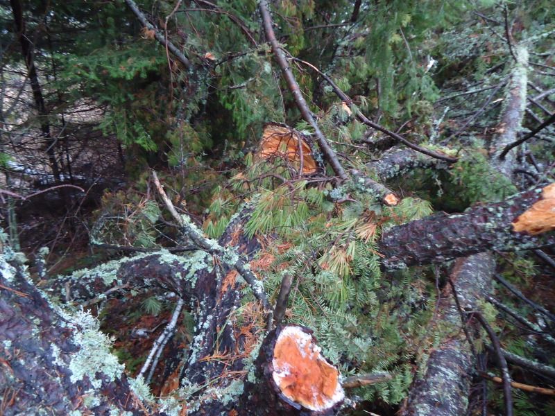
A down tree immediately after breaking from from the trail that leads to Lake Richie. If you look at the first picture on the left side you will see where it begins. THAT IS ONE LONG TREE!!! And if you look to the right in the first picture you will see what I encounter up close in my second picture. Picture number three is just a random encounter with another down tree:

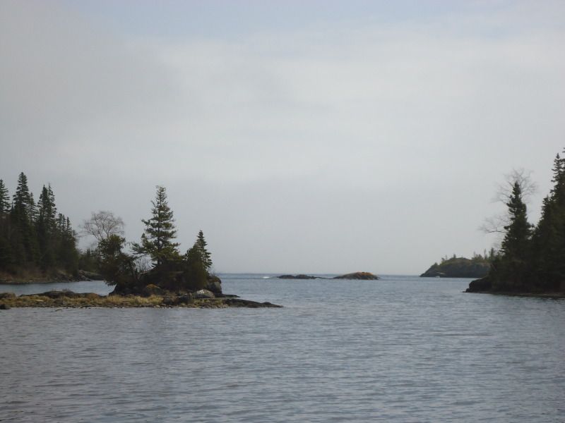
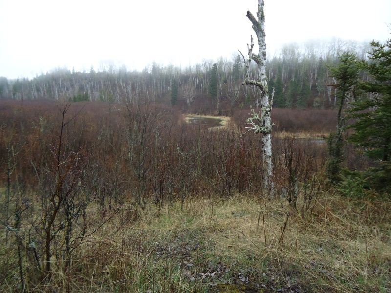
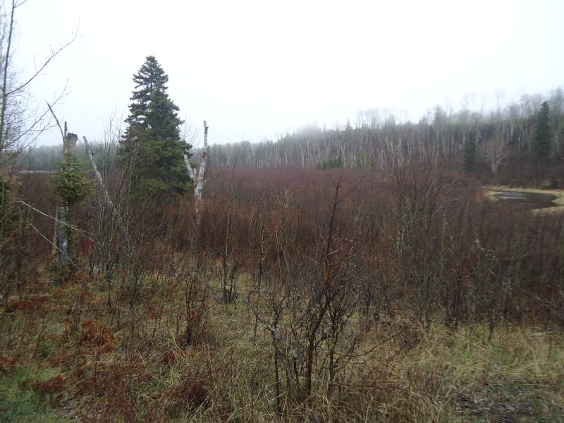
A couple of pictures at Chippewa Harbor:
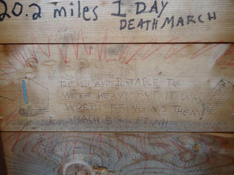
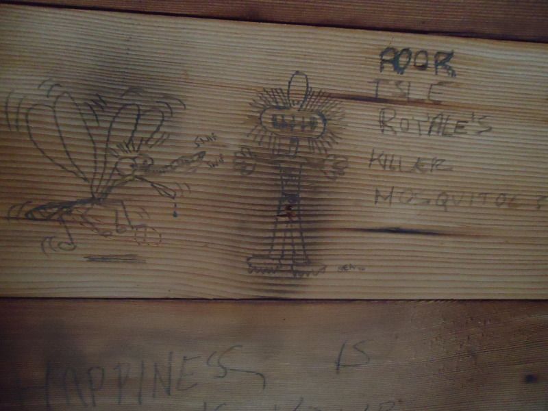
Some shelter graffiti found at the Chippewa Harbor shelters. Picture #3 about some kids bringing a Wii, like someone would actually do that, cracked me up just imagining the image of someone going through all that:

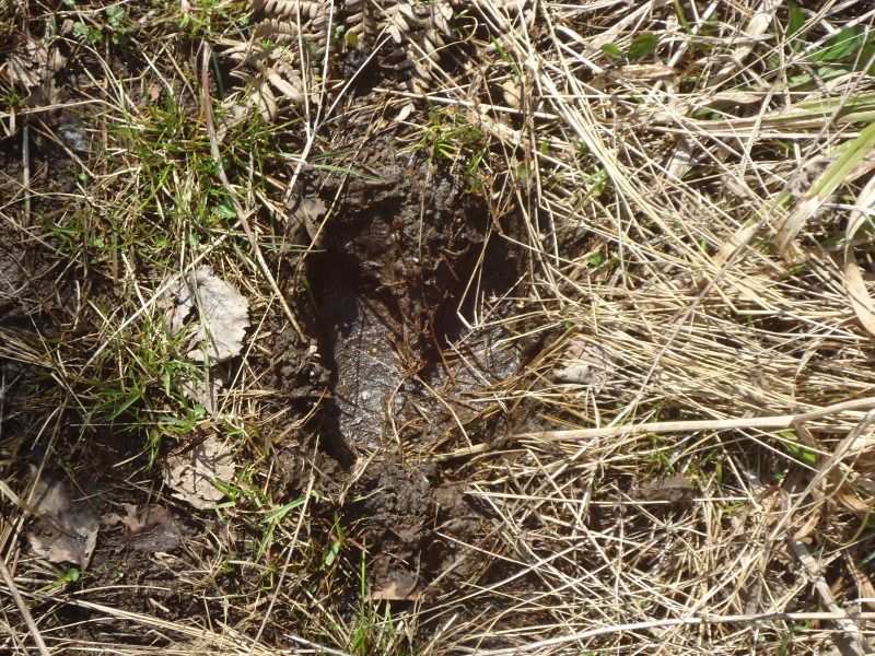
A moose print and a dead newt that I encountered on my return trip back to Moskey Basin:
Random loon sightings at Moskey Basin:
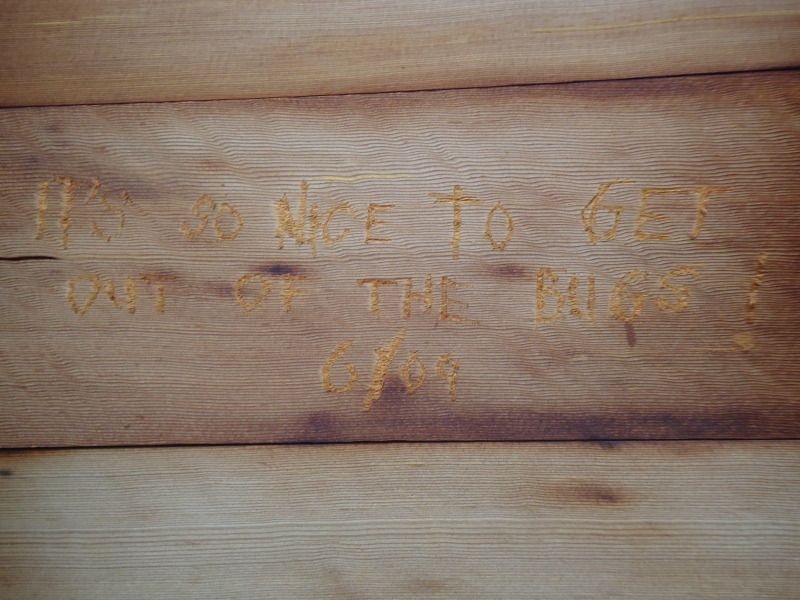
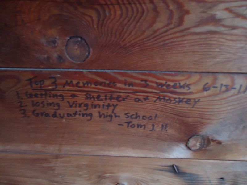
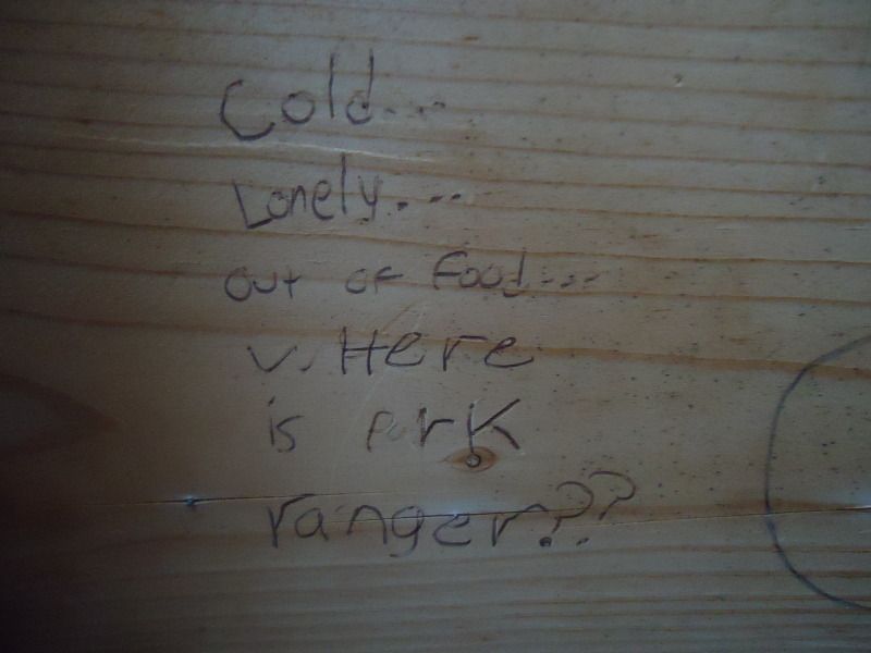
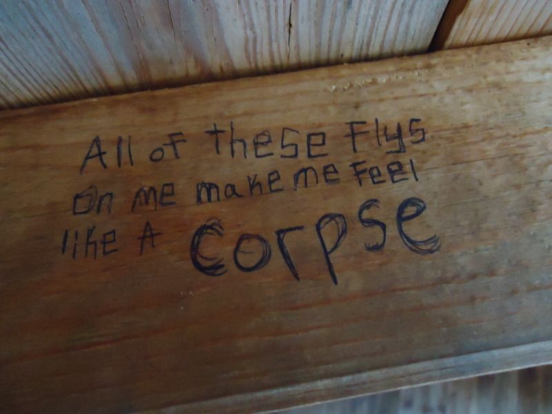
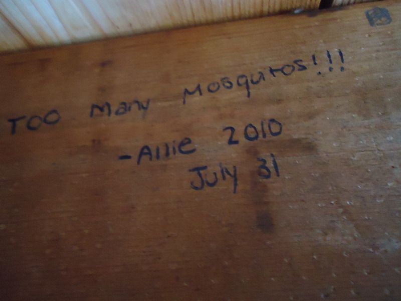
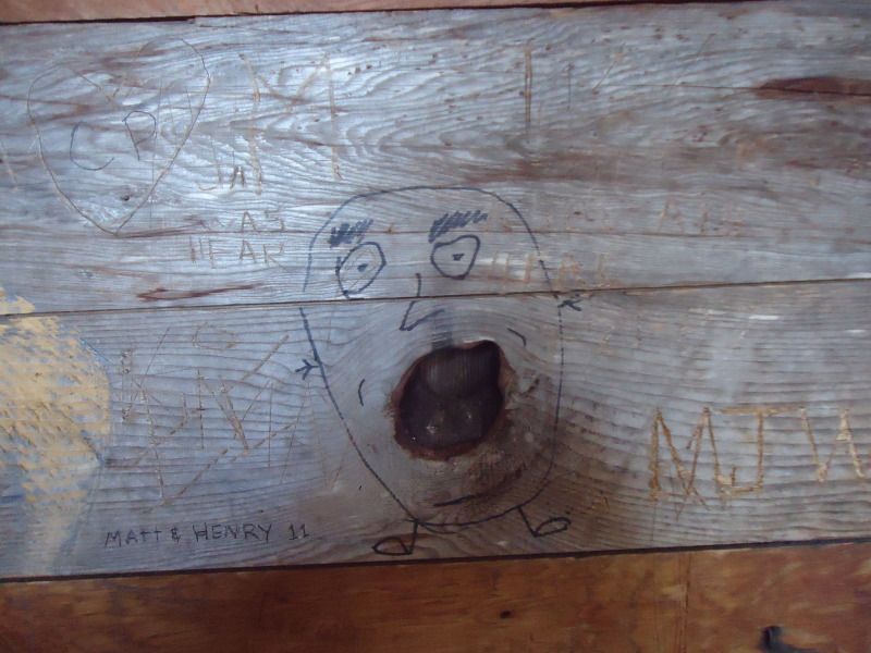
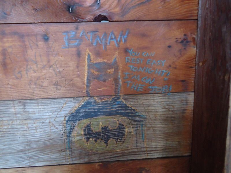
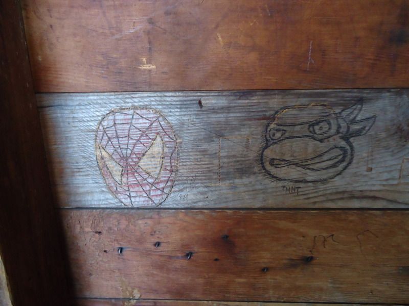
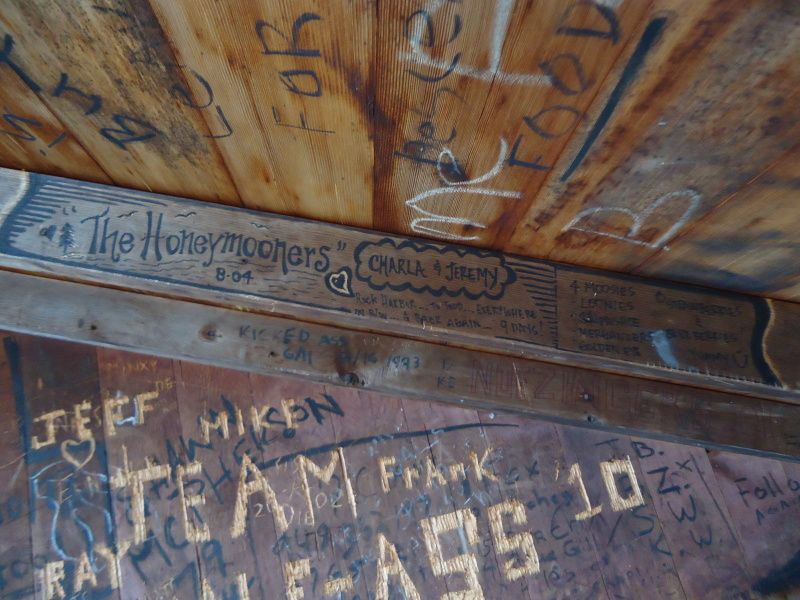
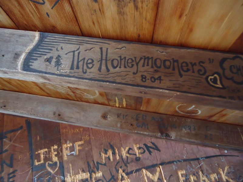
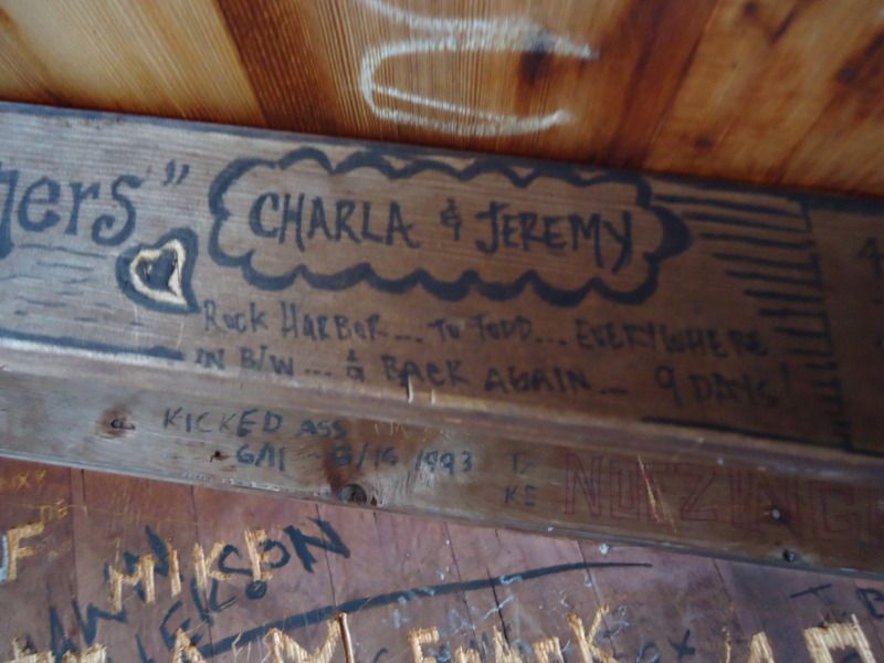
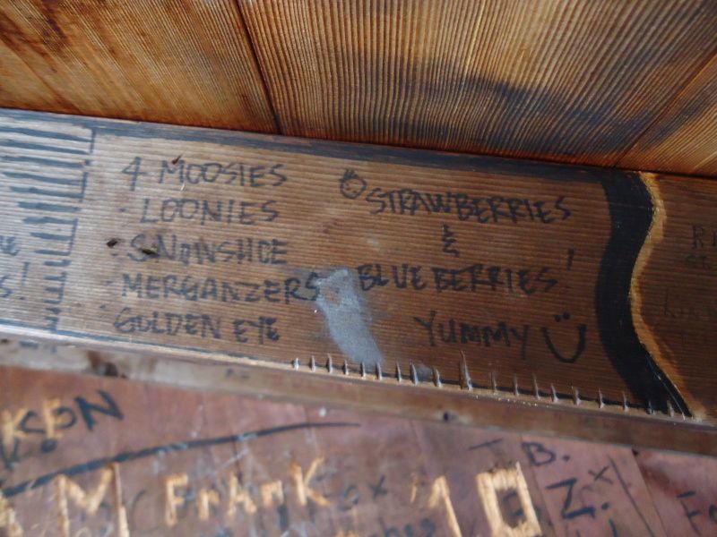
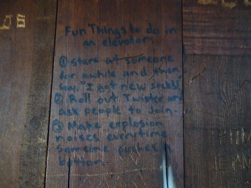
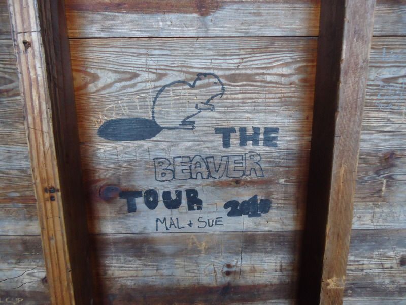
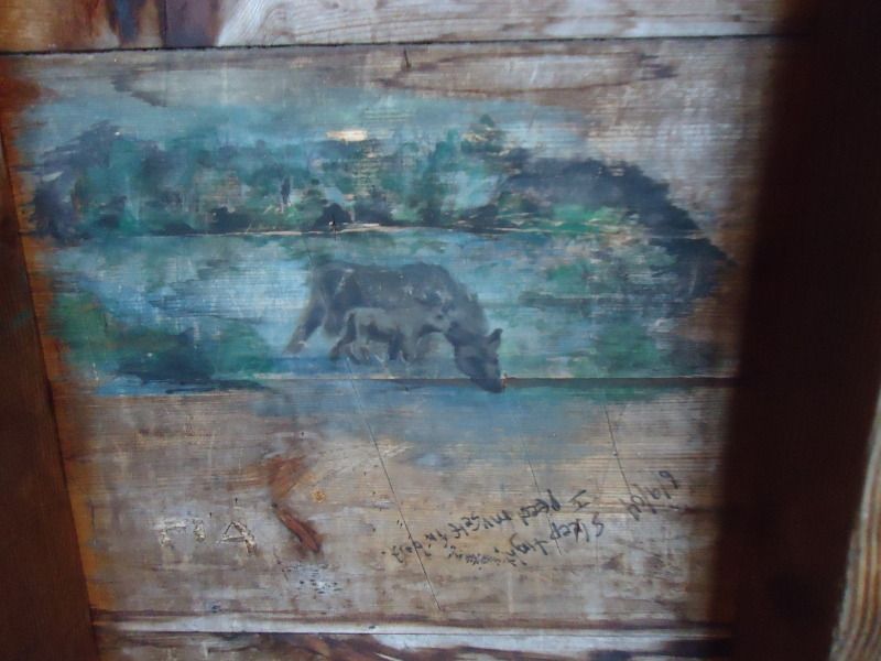
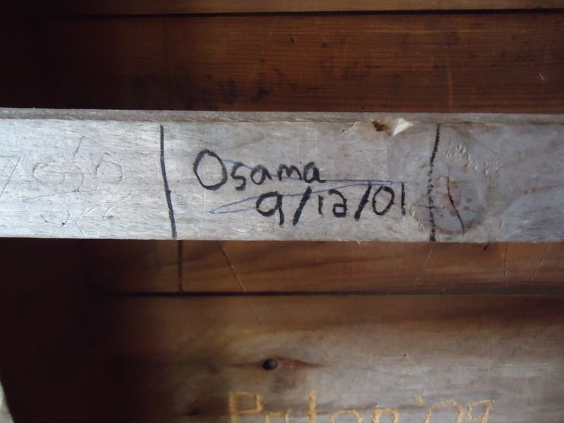
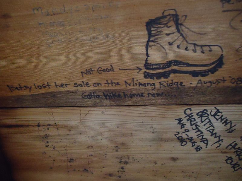
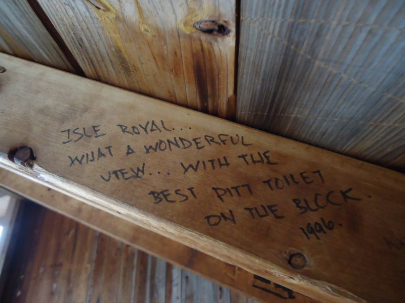
Random Shelter Graffiti at Moskey Basin Shelters. Picture #2 - Sad, but hilarious. Picture #3 Distgustingly funny and relateable. Picture #6 - I sure wish Batman was there for me at night, I would have went to be a lot sooner. Pictures #8-11 - I though was quite a piece of work:
May 2nd Wednesday
Had my alarm set for 7am, but it was so warm and toasty in my bag, combined with the soft bird noises coming from outside and the rain dripping off the shingles of the roof that I decided to sleep until 8:51am. What a lazy bones I was.
So I had a couple of dreams last time. One in particular is me being in jail. I don't know why I am in jail or how I got there, but I was. There were others in there with me, but I spoke to none of them. They all seemed a little crazy. Then, and I don't know why I did this, but I checked myself into solitary confinement, as if it were an option that the prison guards allowed me to select. When I selected the option, even the prison guard looked at me like are you sure you want to do this, I nodded and swiped my prison card to gain access only to find out that I have 5 years to go on my sentence which will now be spent out in confinement. I wanted desperately to get out, but was stuck and watched the seconds and minutes slowly tick away until I was awoken by my alarm clock and go back to sleep back to sleep for a couple of hours. I think I had this dream, because at times I do missy company even at the very start of my trip. For instance, my girlfriend who usually accompanies me or for that matter other IsleRoyale vistors to discuss experiences with.
Going to bed last night was somewhat spooky with no one around at all. When I did wake up at times throughout the night, I would eyeball around the shelter before rearing myself back to bed. When I did finally wake up at 8:51am, my back was sore from the sleeping conditions that it had not gotten use to yet. I streched for 10 minutes and that seemed to have eased the soreness out of it slightly, but there still remained a sense of uncomfortableness in the colums of my lower back. Hopefully, it will go away as the day progresses.
(I am pausing here for a second to notify everyone that as I write out this trip report, I am trying to write it in past tense. However, when I journaled it out, a lot of the time I was writing in present tense. Therefore, as I read my journal and type it out to be read by others, I am trying to shift everything into a past tense form. However, this is becoming burdensome because it is interrupting my typing flow and slowing me down. As you can see I write a lot while on my trips, so this is going to take long enough as it is. With that noted, I am no longer going to worry about what tense I am writing in. There will be times I speak in present tense and shift into past tense, please forgive the back and forthness of these two tenses. Rather than writing out things perfectly, it is my goal to write things out as quickly as possible with the hopes that this special note will guide you along way and steer you away from any confusion in my writing style.)
I had a granola bar for breakfast and departed for a day hike to Chippewa Harbor at 10:52am. I arrived at the Chippewa/Lake Richie marker at 11:39am. During this portion of the hike I saw 5 snowshoed rabbits and a fox that was mangey looking and moist-coated with dew. I got a picture of it skimpering away, but I wanted a btter one of him looking at me like when I initially saw him. After following him for about .2 miles in the reverse direction back to Moskey, I gave up and continued back on my journey toward Chippewa. Oddly enough, once I got to the maker it said 4.3 miles to Chippewa, but according to my National Geographic map, it is only 4.1 miles so I dont know which one it is. We'll just say 4.2 miles. I arrived at the first portage point at 12:26pm, the second portage point at 12:52pm, the mason lake marker at 1:07pm, and Chippewa Harbor at 1:12pm. There was a total of 23 boardwalks from the marker to Chippewa. The 18ths one is located near a racing stream that notifies you of its presense as you scale your way along side of it.
I took a lunch break at Chippewa to eat a granola bar, 3 handfuls of trail mix, 1 handful of dried cherries, and a bowl of soup. I filtered a bottle and a half of water while my water boiled for my soup. I drank 20ozs on the hike over her and another 16oz while I hung out at Chippewa.
Sometime during this hike I decided that I did not want to see a moose while visiting the island. Ok so correct that, at least not while I was hiking. I remember when Shelly and I were here on our first trip together and a pair of them corssed our path like they were a cat crossing the street in my neighborhood. All I can imagine is one of them crossing my path while I am here by myself and worrying that it is a ninja moose that is going to spring out at me from nowhere by using some stealthy moose skills that I am unaware of him or her possesing. I was so worried about mooses, that I imagined that when I got to Chippewa Harbor, there would be a community of moose having a secret meeting that no human was suppose to know of and in I wall all skippidy-do-da off the trail and they turn and look at me. All hell breaks loose and I have a stampede of moose chasing after me. Forget that, if I see any moose, I want it to be from the safety of my shelter and nowhere else.
On my walk back, I am just going to wear my t-shirt and a long sleeve with pajama pants and long johns. I sweated quite a bit on the way over here with my sweatpants, hiking pants, rainpants, sweatshirt, and rain jacket on top of all the things previously mentioned. I need to air out a little because I do not want to go to sleep in sweat drenched clothes. I am going to keep my rain jacket on because unfortunately I did not bring my long brim hiking hat and need to have a way to protect myself from the sun by throwing the hood of my jacket over my head. I cannot afford to get burned on my neck and head.
Before I head out of Chippewa, I'm going to check out the shelter graffiti. I'm back at Moskey now. I took some pictures of the shelter graffiti at Chippewa. While I was stepping out of the last shelter I was a little nervous when I heard a bunch of grunting and squeaking coming from under the shelter. I shut the door and stepped back inside only to see a ball of rolling fur race out from under the shelter and quickly back to where it came from. I waited for it to come out again before I noticed that it was three crazy squirrels wrestling with one another. About the note on the 23 boardwalks, 11 boardwalks follow after the second portage point from chippewa harbor and 12 boardwalks before reaching the Lake Richie/Moskey Marker after passing the second portage.
I left Chippewa Harbor at 3:28pm. I got to the Mason Marker at 3:33pm. I got to the first portage point at 3:48pm. I got to the second portage point at 4:11pm. I got to the Lake Richie/Moskey Marker at 5:34pm. On the way back to Moskey, I drank 20oz of water and another 24oz at the Moskey dock. I refilled both water bottles after I dumped my remaining 12oz into my stove pot for dinner. I saw a snowshoed rabbit and a dead newt (or salamander) on my journey back. The return trip was harder. I sweat like a mule with my rain jacket on that I wore only to protect myself from sunburn. Even now as it goes on 8pm, my shirt is still drenched in sweat. I really wish I would have brought my hiking hat. Oh well, I probably would have still sweat a decent amount anyways with my butt also damp with sweat.
Once I got back to the shelter I ate 4 peach slices and 3 handfuls of pineapple nut trail mix. After taking a snack break, I took an hour stroll around Moskey to check out each shelters graffiti and to take some pictures. Throughout the course of doing so, I saw several loons swimming around together and an occassional one diving underwater. At one point, I even saw 11 of them fly way together. When I got back I rinsed the mudd off that accumlated on my rainpants and cleaned off my heart monitor strap. While doing so, I noticed some loons swimming near the coast and ran back to get my camera. Just like the fox earlier, the loons were already on their way towards the middle of the basin. I still took a shot of them swinning away along with a picture of a group of them to the right of those.
Once I got back to the shelter, the water had boiled for my meal. As I waited for it to rehydrate, I reviewed the map for my hike to McCargoe tomorrow. Throughout the course of the evening, I had another 14oz of water. Speaking of evening, the sun starts to set around 8pm. This is about when the temperature starts to get cooler too. While you could probably hike until about 9pm, I say this as I look outside at 8:57pm, it could be somewhat dark in the deeply forested area with a lot of canopy and overhang. Therefore, I would not suggest beyond 8:30pm if at all possible. By 9:15pm, you would definitely need a headlamp to carry on without a doubt. I am not sure when the sun rises because it was very misty out this morning combined with me getting up at 9am.
On a completely different note, I am glad I brought gloves. They came in handy when I first began hiking this morning. They were great at night in my sleeping bag too. And they even came in handy when my pot was too hot to touch with my bare hand. On another topic, I doubled up on socks last night. They keep my feet toasty. I'm going to pass on doing this tonight, but will have them on stand by in case I need them.
The filter will need to be cleaned soon. If I remember correctly, when clean and fully operational, my filter usually only takes 100 pumps to filter 36oz of water. Today, when I got back to Moskey, it took me 120 pumps for the first bottle and 140 pumps for the second bottle. Oh, and one last thing, I love my lightweight traveling Sharp mini clock that my girlfriend got for us. It is super light and I love the teperature gauge on it even though I an not sure if it works perfectly. The alarms sounds nice and loud though. At 9:08pm the temperature is said to be 61 degrees out. I am not sure about that even though it was a warm day out. After doing some reading, lights out at 10:35pm with many night time stories to tell of tomorrow when I wake up. In the meantime, I hiked a total of 12.6 miles today. 2 hours and 20 minutes from Moskey to Chippewa with an Average heart rate of 111bpm and a Max heart rate of 147bpm. 911 calories burned. 2 hours and 6 minutes from Chippewa to Moskey with an Average heart rate of 122bpm and a Max heart rate of 158bpm. 1058 calories burned.
Reverse angle of the down tree I saw while coming into Moskey Basin:
One of many rabbits on saw while I was on my way to Chippewa Harbor and the Fox that I went chasing after:
A down tree immediately after breaking from from the trail that leads to Lake Richie. If you look at the first picture on the left side you will see where it begins. THAT IS ONE LONG TREE!!! And if you look to the right in the first picture you will see what I encounter up close in my second picture. Picture number three is just a random encounter with another down tree:
A couple of pictures at Chippewa Harbor:
Some shelter graffiti found at the Chippewa Harbor shelters. Picture #3 about some kids bringing a Wii, like someone would actually do that, cracked me up just imagining the image of someone going through all that:
A moose print and a dead newt that I encountered on my return trip back to Moskey Basin:
Random loon sightings at Moskey Basin:
Random Shelter Graffiti at Moskey Basin Shelters. Picture #2 - Sad, but hilarious. Picture #3 Distgustingly funny and relateable. Picture #6 - I sure wish Batman was there for me at night, I would have went to be a lot sooner. Pictures #8-11 - I though was quite a piece of work:
343.1 Miles Hiked: 2004 (3 Days), 2010 (11 Days), 2011 (13 Days), 2012 X 2 (8 + 12 Days), 2013 (9 Days/Paddling), 2019 (30 Days/Paddling)
-
Rafiki
- IR Expert
- Posts: 541
- Joined: Thu Apr 08, 2010 11:11 am
- Isle Royale Visits: 7
- Location: Chicago, IL
Re: May 1st - May 8th 2012 Trip Report
I realize that my Trip Report might be a little overwhelming. So for those of you reading this, how would you prefer me to continue on. Should I be specific and to the point? While this particular entry above did not have any mention about downed trees and debris, you can be sure that future entries to do contain such information. I can discuss many things such as: Wildlife, Trail Times, Trail Conditions, Temeperatues, Sun Rise and Sun Set times, advice on this to bring and avoid, etc. I realize that maybe some of you would prefer me not to go into the details of how I experienced things on a personal level. Maybe you have no interested in my heart rate information either. You just let me know how you would like me to continue on. If me just typing out things exactly how they are written in my journal works for you, I will continue to do so. By the time I am through with writing out an account for all of my days on the island, I will edit in some pictures underneath each days entry.
343.1 Miles Hiked: 2004 (3 Days), 2010 (11 Days), 2011 (13 Days), 2012 X 2 (8 + 12 Days), 2013 (9 Days/Paddling), 2019 (30 Days/Paddling)

-
Rafiki
- IR Expert
- Posts: 541
- Joined: Thu Apr 08, 2010 11:11 am
- Isle Royale Visits: 7
- Location: Chicago, IL
Re: May 1st - May 8th 2012 Trip Report
May 3rd Thursday (with paragraphs and edits to the first two days so they have paragraphs too  )
)
I had trouble sleeping last night. It was not that I was scared, although there were many things to be creeped out by, it was that I just wasn't tired. I ate 2 handfuls of cherries to help me settle my hunger and get to bed. As far as those night time stories are concerned, it all began around 10:15pm.
All of a sudden out of nowhere, I hear rapid splashing and commotion in front of the waters near shelter 8 at the west end of the campgrounds. It continued at a consistant rate and I knew that by the sounds of the splashes, they weren't coming from loons diving for food or making a rukis cleaning off. Whatever was out there was making more noise than swimmers doing laps at mt local YMCA. I grabbed my headlamp and shined it in the direction of the noise, but where ever the noise was coming from, my light was not bright enough to reach it. Without any thouhts of trying to get closer, I raced back inside of my shelter. I could hear the noise in the water for a solid 5-10 minutes as it oddly trailed away before I could no longer hear it. If I were to guess, and I believe my guess is completely incorrect, the sound came from a moose crossing the basin even though I do not think it would have a reason to do so.
10 minutes passed while I read my book, when out of nowhere, a loud snort/hoot rages throughout the basin. It is definitely a moose call and the moose making the shout sounds monstrous. With one eye on my book and one eye on my screen face of my shelter, I freeze in terror. Just when I am about to go back to reading after a couple of minutes of staring, the beast roars out another snort. At this point, I tell God that not only so I not want to see any moose on the trail, I also do not want to see their shadows or mammoth sized bodies in front of my shelter at night. It would be just to terrifying to see a moose slowly creep up on me in the moonlight while I am reading. I'd have a heart attack. So with this new revision in mind, if I see any moose, I only want to see them in daylight from the safety of my shelter. Preferably ones that don't let out wild moose hoots if possible.
Of course before I finally go to sleep, there had to be one last thrill for the night right? Well I think whatever was letting out those snorts galloped past the rear of the shelter as its hoaves made noises on the boardwalk it crossed. I say galloped, because it was going at such a pace and it had to have been as heavy as a horse. There was definitely a moose in my neighborhood. Thankfully, on a more peaceful note, as I closed my eyes for sleep, the hooting of an owl could be heard. Needless to say, I prefered his hooting over the mooses.
While lights went out at 10:35pm, I probably did not make it too sleep until after 11:30pm. I awoke at 6:20am. I peeked outside when I hit the snooze button of my alarm clock at 6am. There was a morning light that penetrated through the mist of the basin. My guess is that the sun probably rises around 5:30am. According to my clock, the temperature was 45 degrees out. It night be accurate it might not be. I had a granola bar for breakfast before I started packing my stuff up.
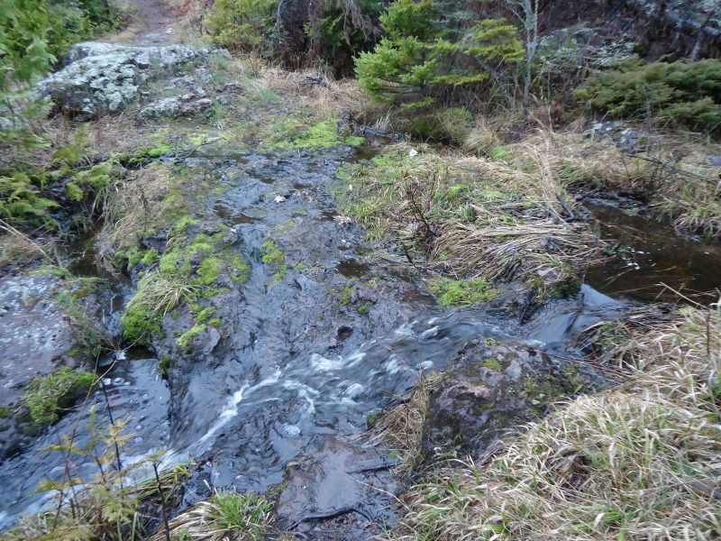
One sthin I forgot to mention about yesterday is that there is 6 boardwalks between Moskey and the Lake Richie/Chippewa Harbor marker. Once you hit the 6th boardwalk, you are two-thirds of the way to the Lake Richie/Chippewa marker. I left this morning at 8:04am and got to the marker at 8:48pm. I got to the bottom of Lake Richie at 8:52am. I got to the Lake Richie campgrounds at 8:54am. I exited the camgrounds at 8:59am. I got to the 1st portage point at 9:17am. I got to the 2nd portage point at 9:27am. I got to the 4rd portage point at 10:10am. I got to the 4th portage point at 10:22am. I got to the west chickenbone/Hatchet Lake/East Chickenbone marker at 10:33am. I got to the West Chickenbone campgrounds at 10:36am. I got to the end of the Chickenbone campgrounds at 10:41am. I got to the 1st portage point going towards McCargoe at 11:28pm. I got to the McCargoe/East Chickenbone marker at 11:39am. I got to the 2nd portage point at 11:42am. I got to the McCargoe campground at 11:50am. There were 12 boardwalks between Lake Richie and the West Chickenbone/Hatchet Lake/East Chickenbone marker. There are 19 boardwalks between West Chickenbone and McCargoe.
I know this will sound crazy, but I only left with one full 26oz water bottle and did not take one sip from it on the entire way to McCargoe. I honestly just was not all that thirsty. When I arrived, I drank 18oz of water. I looked around to see if any of the shelters already had the picnic tables inside of them, but to my despair, no one had decided to bring theres in. In the end, I just picked the shelter closest to the water. One thing I noticed with a lot of the shelters at these campgrounds is the fact that there were a lot of dead flies in them. I am not sure how they got in, but the evidence points to the door frames. Not all of the doors on the campgrounds seem to have doors that meet completely flush with their frames. I noticed a lot of tape has been put around the frames of some of the doors, and with that noted, for future reference, I would bring a small roll of tape to cover cracks in the door during the bug season or I would suggest avoding doors with cracks between them and the frame if one does not have tape handy.
After I got the picnic table inside, I fltered 2 bottles of water. The first bottle took forever, as in over 200 pumps. I cleaned the filter, but stupid me, I dunk the wrong end of the filter in the water, ths possibly allowing parasites to touch the clean nozzle end. I put it under the fire of my stove for a minute, not sure if the will do anything, but I figured it was worth a shot. After the filter was cleann, it only took 80 pumps to filter my water bottle. Furthermore, it was easier to pump with less resistance. Once it starts taking me 125 pumps or more to fill a bottle, I will always move on to cleaning the filter before I continue to clean more water. Its not worth the time to pump a million times with an unclean filter and find yourself with only a half a bottle so show for.
When I returned to the shelter I laid out all of my stuff and set up my sleeping quarters. With my shelter set up the way I wanted it, it was time for lunch! I had 6 handfuls of wasabi trail mix, and a granola bar. After I ate, I grabbed 3 handfuls of pistashios and walked around eating them as I looked at shelter graffiti. I had the intentions of checking out the tent sites for single tent campers in case I did not get a shelter in the future, but nature finally called in the second sense after being on the island for a couple of days so that plan had to be put on hold. After a heaping pile of fiberous doodie passed, it was off to check out the tent sites as initially planned.
There are three of them and none of them looked any better or more special than the other and all are far away from the water. While I checked them out, I had another 2 handfuls of pistachios. When I arrived back to my shelter, I examined my map and realized that it will be 23 miles from Todd Harbor to Windigo. Yikes. I hope my legs are ready!
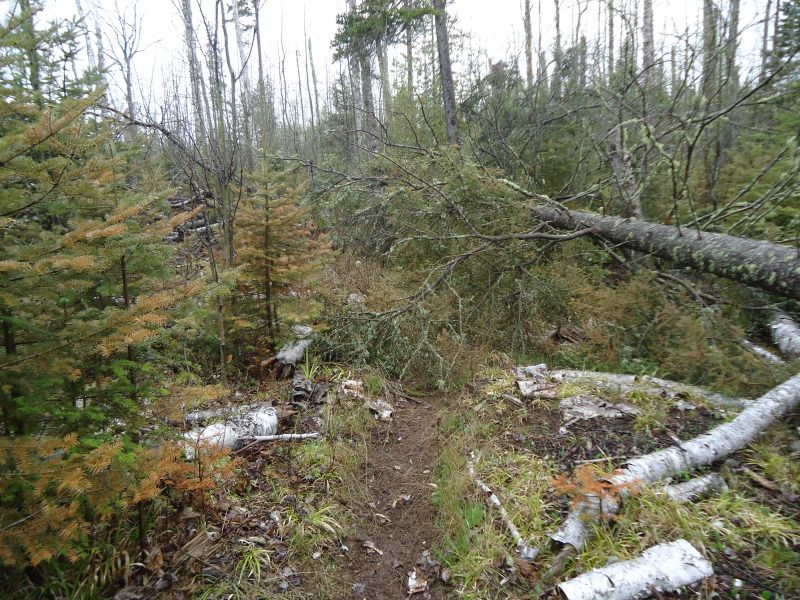
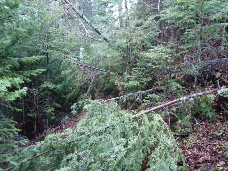
At around 7pm, I began boiling water for dinner. For dinner I had a dehydrated entree, 6 handfuls of cheddar pizza crackers, and 3 peach slices. Returning back to my hike today, there are a couple of things that I forgot to mention. First, I saw 4 snowshore rabbits and a dead gartner snake. Second, and even more note worthy, they're were three downed trees that were a bummer to go through. One at the point near reaching the Hatche Lake/Chickenbone West marker on my way from Lake Richie and two on the wst Chicenbone route to McCargoe. The first one was not that horrible, but the secound ne completely blocked the trail and I had to do a balancing beam act to get accross it. These two obstacles have me me debate on whether or not to do the East Chickenbone/West Chickenbone/McCargoe Cove loop tomorrow. Seriously, its a real pain to get through one of the trees in particular. On a final note, I forget to mention that there are two down trees on the trail leading to Chippewa Harbor. I forgot to mention this yesterday. The one that is right at the begining of the trail is a real bummer to get through, while another one along the way was not a bigger.
Alright well that is a wrap. If I have forgotten anything, I will mention it tomorrow. I hiked a total of 8.8 miles today. It took me 4 hours and 46 minutes to hike from Moskey Basin to McCargoe Cove. My Average heartrate was 106bpm and my Max heartrate was 139bpm. I burned a total of 1328 calories. Before brushing my teeth tonight, I ran out of floss. Now I have to reuse my last strand for the remainder of my trip. Lights go out at 10:46pm. As of right now, I have not seen anyone for exactly 55 hours.
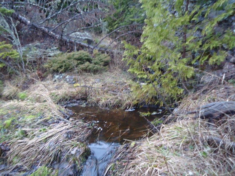
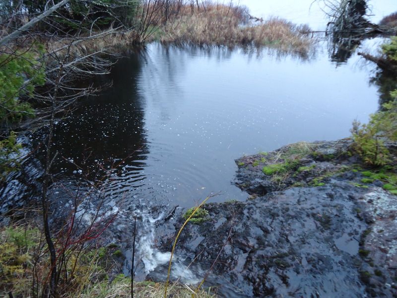
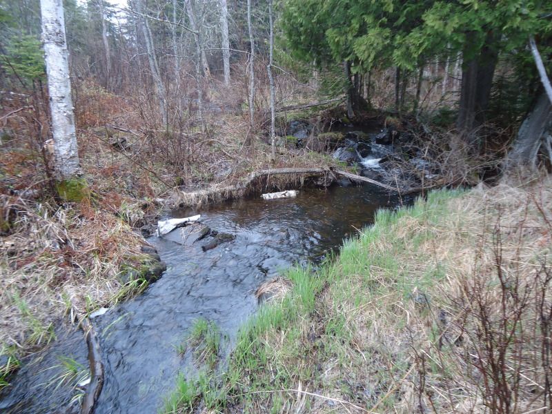
Everything in between Moskey Basin and West Chickenbone including the hill leading to the Lake Richie opening in the first couple of pictures, a couple of waterpaths I had to cross, a pair of rabbits and some down trees:
Some pictures taken from accross from West Chickenbone after I passed it:
The worse pile of down trees I encountered on my whole trip. This cluster of stumps, sticks, twigs, branches, and whatever else you can name was found on my path going from West Chickenbone to McCargoe Cove. The first picture shows where I just came from and the path I had just walked off. I had to balance my way accross that fallen tree in front of me. When I turned around, I encountered the sight found in picture #2. You can see anything. and that is because there is nothing to see except a face full of tree. The way was completely blocked and clustered. I felt like I was in bootcamp trying to meander my way through all of that crap. Picture #3 shows me looking back at the stuff I went through. Picture #4 was something I would have rather encountered instead:
Less than a mile from McCargoe Cove:
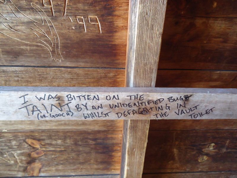
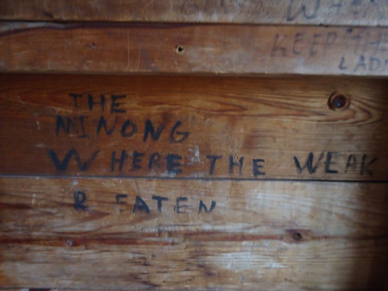
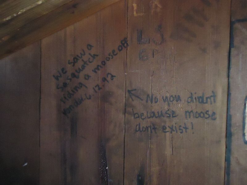
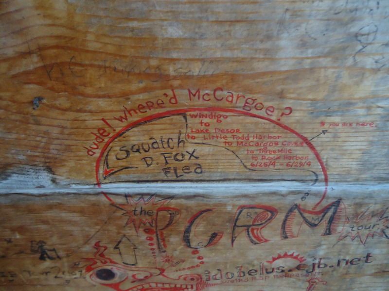
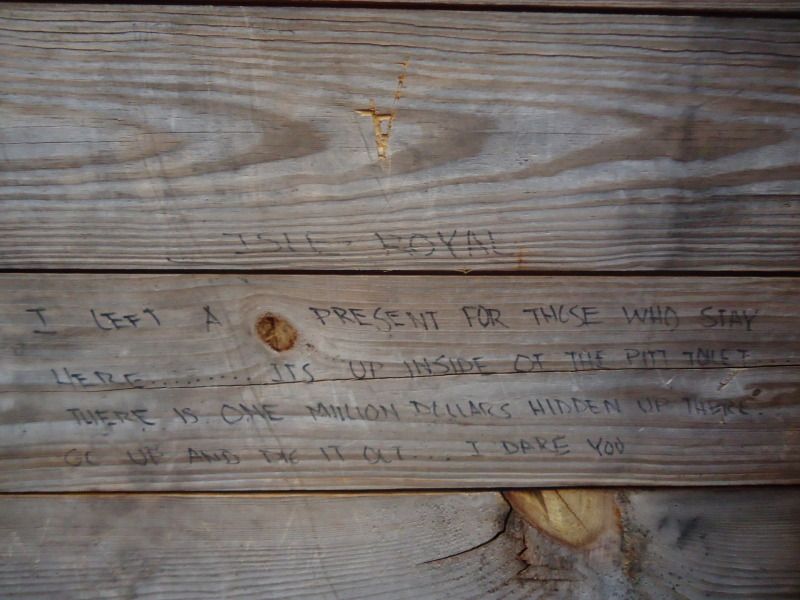
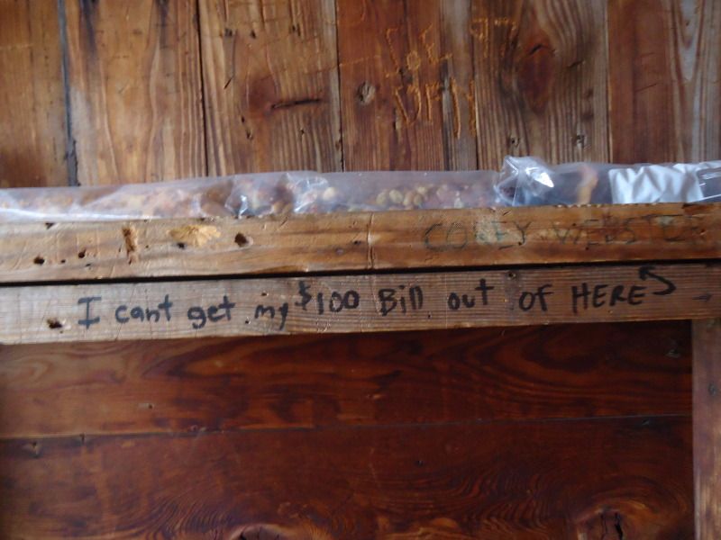
McCargoe Cove Shelter Graffiti. Picture #2 - I felt really bad for this person. Picture #3 - A funny warning to many that know not what they are getting into. Picture #4 - I could relate to this picture because when I first went to Isle Royale with my girlfriend, neither my girlfriend nor I say a moose and started wondering if they actually existed Picture #8 - I laughed as I imagined a young person trying to see there really was a $100 bill shoved in between the crack.
I had trouble sleeping last night. It was not that I was scared, although there were many things to be creeped out by, it was that I just wasn't tired. I ate 2 handfuls of cherries to help me settle my hunger and get to bed. As far as those night time stories are concerned, it all began around 10:15pm.
All of a sudden out of nowhere, I hear rapid splashing and commotion in front of the waters near shelter 8 at the west end of the campgrounds. It continued at a consistant rate and I knew that by the sounds of the splashes, they weren't coming from loons diving for food or making a rukis cleaning off. Whatever was out there was making more noise than swimmers doing laps at mt local YMCA. I grabbed my headlamp and shined it in the direction of the noise, but where ever the noise was coming from, my light was not bright enough to reach it. Without any thouhts of trying to get closer, I raced back inside of my shelter. I could hear the noise in the water for a solid 5-10 minutes as it oddly trailed away before I could no longer hear it. If I were to guess, and I believe my guess is completely incorrect, the sound came from a moose crossing the basin even though I do not think it would have a reason to do so.
10 minutes passed while I read my book, when out of nowhere, a loud snort/hoot rages throughout the basin. It is definitely a moose call and the moose making the shout sounds monstrous. With one eye on my book and one eye on my screen face of my shelter, I freeze in terror. Just when I am about to go back to reading after a couple of minutes of staring, the beast roars out another snort. At this point, I tell God that not only so I not want to see any moose on the trail, I also do not want to see their shadows or mammoth sized bodies in front of my shelter at night. It would be just to terrifying to see a moose slowly creep up on me in the moonlight while I am reading. I'd have a heart attack. So with this new revision in mind, if I see any moose, I only want to see them in daylight from the safety of my shelter. Preferably ones that don't let out wild moose hoots if possible.
Of course before I finally go to sleep, there had to be one last thrill for the night right? Well I think whatever was letting out those snorts galloped past the rear of the shelter as its hoaves made noises on the boardwalk it crossed. I say galloped, because it was going at such a pace and it had to have been as heavy as a horse. There was definitely a moose in my neighborhood. Thankfully, on a more peaceful note, as I closed my eyes for sleep, the hooting of an owl could be heard. Needless to say, I prefered his hooting over the mooses.
While lights went out at 10:35pm, I probably did not make it too sleep until after 11:30pm. I awoke at 6:20am. I peeked outside when I hit the snooze button of my alarm clock at 6am. There was a morning light that penetrated through the mist of the basin. My guess is that the sun probably rises around 5:30am. According to my clock, the temperature was 45 degrees out. It night be accurate it might not be. I had a granola bar for breakfast before I started packing my stuff up.
One sthin I forgot to mention about yesterday is that there is 6 boardwalks between Moskey and the Lake Richie/Chippewa Harbor marker. Once you hit the 6th boardwalk, you are two-thirds of the way to the Lake Richie/Chippewa marker. I left this morning at 8:04am and got to the marker at 8:48pm. I got to the bottom of Lake Richie at 8:52am. I got to the Lake Richie campgrounds at 8:54am. I exited the camgrounds at 8:59am. I got to the 1st portage point at 9:17am. I got to the 2nd portage point at 9:27am. I got to the 4rd portage point at 10:10am. I got to the 4th portage point at 10:22am. I got to the west chickenbone/Hatchet Lake/East Chickenbone marker at 10:33am. I got to the West Chickenbone campgrounds at 10:36am. I got to the end of the Chickenbone campgrounds at 10:41am. I got to the 1st portage point going towards McCargoe at 11:28pm. I got to the McCargoe/East Chickenbone marker at 11:39am. I got to the 2nd portage point at 11:42am. I got to the McCargoe campground at 11:50am. There were 12 boardwalks between Lake Richie and the West Chickenbone/Hatchet Lake/East Chickenbone marker. There are 19 boardwalks between West Chickenbone and McCargoe.
I know this will sound crazy, but I only left with one full 26oz water bottle and did not take one sip from it on the entire way to McCargoe. I honestly just was not all that thirsty. When I arrived, I drank 18oz of water. I looked around to see if any of the shelters already had the picnic tables inside of them, but to my despair, no one had decided to bring theres in. In the end, I just picked the shelter closest to the water. One thing I noticed with a lot of the shelters at these campgrounds is the fact that there were a lot of dead flies in them. I am not sure how they got in, but the evidence points to the door frames. Not all of the doors on the campgrounds seem to have doors that meet completely flush with their frames. I noticed a lot of tape has been put around the frames of some of the doors, and with that noted, for future reference, I would bring a small roll of tape to cover cracks in the door during the bug season or I would suggest avoding doors with cracks between them and the frame if one does not have tape handy.
After I got the picnic table inside, I fltered 2 bottles of water. The first bottle took forever, as in over 200 pumps. I cleaned the filter, but stupid me, I dunk the wrong end of the filter in the water, ths possibly allowing parasites to touch the clean nozzle end. I put it under the fire of my stove for a minute, not sure if the will do anything, but I figured it was worth a shot. After the filter was cleann, it only took 80 pumps to filter my water bottle. Furthermore, it was easier to pump with less resistance. Once it starts taking me 125 pumps or more to fill a bottle, I will always move on to cleaning the filter before I continue to clean more water. Its not worth the time to pump a million times with an unclean filter and find yourself with only a half a bottle so show for.
When I returned to the shelter I laid out all of my stuff and set up my sleeping quarters. With my shelter set up the way I wanted it, it was time for lunch! I had 6 handfuls of wasabi trail mix, and a granola bar. After I ate, I grabbed 3 handfuls of pistashios and walked around eating them as I looked at shelter graffiti. I had the intentions of checking out the tent sites for single tent campers in case I did not get a shelter in the future, but nature finally called in the second sense after being on the island for a couple of days so that plan had to be put on hold. After a heaping pile of fiberous doodie passed, it was off to check out the tent sites as initially planned.
There are three of them and none of them looked any better or more special than the other and all are far away from the water. While I checked them out, I had another 2 handfuls of pistachios. When I arrived back to my shelter, I examined my map and realized that it will be 23 miles from Todd Harbor to Windigo. Yikes. I hope my legs are ready!
At around 7pm, I began boiling water for dinner. For dinner I had a dehydrated entree, 6 handfuls of cheddar pizza crackers, and 3 peach slices. Returning back to my hike today, there are a couple of things that I forgot to mention. First, I saw 4 snowshore rabbits and a dead gartner snake. Second, and even more note worthy, they're were three downed trees that were a bummer to go through. One at the point near reaching the Hatche Lake/Chickenbone West marker on my way from Lake Richie and two on the wst Chicenbone route to McCargoe. The first one was not that horrible, but the secound ne completely blocked the trail and I had to do a balancing beam act to get accross it. These two obstacles have me me debate on whether or not to do the East Chickenbone/West Chickenbone/McCargoe Cove loop tomorrow. Seriously, its a real pain to get through one of the trees in particular. On a final note, I forget to mention that there are two down trees on the trail leading to Chippewa Harbor. I forgot to mention this yesterday. The one that is right at the begining of the trail is a real bummer to get through, while another one along the way was not a bigger.
Alright well that is a wrap. If I have forgotten anything, I will mention it tomorrow. I hiked a total of 8.8 miles today. It took me 4 hours and 46 minutes to hike from Moskey Basin to McCargoe Cove. My Average heartrate was 106bpm and my Max heartrate was 139bpm. I burned a total of 1328 calories. Before brushing my teeth tonight, I ran out of floss. Now I have to reuse my last strand for the remainder of my trip. Lights go out at 10:46pm. As of right now, I have not seen anyone for exactly 55 hours.
Everything in between Moskey Basin and West Chickenbone including the hill leading to the Lake Richie opening in the first couple of pictures, a couple of waterpaths I had to cross, a pair of rabbits and some down trees:
Some pictures taken from accross from West Chickenbone after I passed it:
The worse pile of down trees I encountered on my whole trip. This cluster of stumps, sticks, twigs, branches, and whatever else you can name was found on my path going from West Chickenbone to McCargoe Cove. The first picture shows where I just came from and the path I had just walked off. I had to balance my way accross that fallen tree in front of me. When I turned around, I encountered the sight found in picture #2. You can see anything. and that is because there is nothing to see except a face full of tree. The way was completely blocked and clustered. I felt like I was in bootcamp trying to meander my way through all of that crap. Picture #3 shows me looking back at the stuff I went through. Picture #4 was something I would have rather encountered instead:
Less than a mile from McCargoe Cove:
McCargoe Cove Shelter Graffiti. Picture #2 - I felt really bad for this person. Picture #3 - A funny warning to many that know not what they are getting into. Picture #4 - I could relate to this picture because when I first went to Isle Royale with my girlfriend, neither my girlfriend nor I say a moose and started wondering if they actually existed
343.1 Miles Hiked: 2004 (3 Days), 2010 (11 Days), 2011 (13 Days), 2012 X 2 (8 + 12 Days), 2013 (9 Days/Paddling), 2019 (30 Days/Paddling)
-
johnhens
- Forum Moderator
- Posts: 1993
- Joined: Wed Oct 03, 2007 4:10 pm
- Isle Royale Visits: 34
- Location: Big Rock, IL
- Has thanked: 56 times
- Been thanked: 112 times
Re: May 1st - May 8th 2012 Trip Report
If there was any mud on the trail behind the shelter at Moskey, did you notice any wolf and moose tracks that might have been from the ruckus?
Any loons calling there at night?
Any loons calling there at night?

Re: May 1st - May 8th 2012 Trip Report
Great job on the trip report Rafiki, I have my first trip in August with my sisters and the details made my stomach flutter with excitement.
Dusty
Dusty
"Wilderness is not a luxury but a necessity of the human spirit." NWP
-
fonixmunkee
- Forum Moderator
- Posts: 954
- Joined: Tue Sep 11, 2007 10:58 am
- Isle Royale Visits: 18
- Location: Soupe Towne, WI
- Has thanked: 47 times
- Been thanked: 60 times
-
Rafiki
- IR Expert
- Posts: 541
- Joined: Thu Apr 08, 2010 11:11 am
- Isle Royale Visits: 7
- Location: Chicago, IL
Re: May 1st - May 8th 2012 Trip Report
John: I honestly did not check out the scene of things after I woke up. I knew the scuffle occured around shelter 8, but cannot be certain if it was right in front of it, to the right of it at the end of the basin, or accross from the shelter. It was in that vicinity and it was loud that much can be sure. I would have done the detective work had I not be on my way out to McCargoe that day or if I at least knew where to begin searching (i.e. accross, to the side, or in front of the shelter). Now that you asked me whether or not I looked into things in the morning, and I've had time to think about it, I really wish I would have take an hour aside from my day to look into things. I am curious to know if perhaps there was a wolf and moose encounter. Furthermore, what I really wish is that I had a bright enough light to shine into the area when everything was breaking down. I was just too scared to get too close. I did not want to become involved with whatever was going on, because I could not see in the dark.
Dusty: Thank you for your compliments on my details. When I first started writing my trip report, I knew it was going to be a long process. As you can see, just one day of my trip report is almost as long as an average persons trip report in general. The thing I most hoped for was that it would just be appreciated by someone and that I did not waste my time going into extra details that I was concerned about no one maybe caring for. So thank you for your post. I am glad I could get you excited and worked up for your trip. That was a goal of mine with being as specific as possible. I know when I read peoples trip reports, I want to feel like I am there. And while I might not be a great writer, if you are like me, I still love hearing a long drawn out "suck me in" kind of Isle Royale tale that someone has experienced. Things get better I promise. Be prepared for my May 6th entry, while it will be super long, it will be really really really intense.
Fox: Thanks for your comment on the details. I think you have a trip coming up in the next coming weeks. Hope my report is giving you a little taste of things to come. I promise to have pictures attached to these days once I finish the report and have time to load them on photobucket.
343.1 Miles Hiked: 2004 (3 Days), 2010 (11 Days), 2011 (13 Days), 2012 X 2 (8 + 12 Days), 2013 (9 Days/Paddling), 2019 (30 Days/Paddling)
-
Rafiki
- IR Expert
- Posts: 541
- Joined: Thu Apr 08, 2010 11:11 am
- Isle Royale Visits: 7
- Location: Chicago, IL
Re: May 1st - May 8th 2012 Trip Report
May 4th Friday (Part I)
I woke up at 7:24am. It is supposedly 41 degrees out. I'm glad that I have my fleece. Although, I wish I had more than just slike long johns and pajama pants. Unfortunately, my sweat pants are damp from my last trip even though I wore my rainpants. The water must have soaked up through the bottom of the legs because only the knees to the bottoms are wet. Same somewhat applies to my hiking pants, which I wouldn't want to wear anyways because they are not as warm as my sweatpants. I'm not freezing, so its not thhat big of a deal, although I do notice the cold wanting to penetrate my legs.
I had some sad dreams about weird scenerios involving losing family members in different tragic ways. I don't know what those were all about, but I think it has something slightly to do with missing my family and girlfriend along with not seeing anyone for such a long period of time. It is after all been 63 hours without seeing anyone yet. Almost a 3 full days.
I ate a granola bar for breakfast and drank some water as I debated on whether or not to do the McCargoe/Chickenbone Lake Loop. After taking a dump that had the consisentcy of pancake mix (something you might now want to have known, but man or man, I have been eating such a high fiber diet on this trip, nearly 30 grams of fiber per day, that things are really loose), I have decided that I will be doing the loop and that I will be going counter clockwise from McCargoe to West Chickenbone to East Chickenbone, back to McCargoe. I am brings some pineapple nut trail mix, some pistachos, and a granola bar. Since I only have 32oz of water left, I am going to bring my filter too just in case. My sweatpants still aren't dry so all I am going to throw over them is my hiking pants and rain pants. I am simply going to with my undershirt, long sleeve, sweatshirt, and rain jacket. I am leaving the fleece behind because I know it will get a little warmer out and I know I will get warmer as I hike.
On a side note, I think I may be getting athletes foot. My feet itch, but I have avoided scratching them except for last night when I was going to bed. After scratching them lighty, I did not notice any burning sensation, but like I said I only scratched at them ever so gently.
As it turns out, I only brought pistachios and a granola bar. I forgot I was doing a loop, so I didn't feel the need to bring so much food. I also brough my fleece because the water filter would have been bouncing annoyinglu on my butt in my backpack. Bringing the fleece not only prevented that, but it also allowed me to put the backpack cover on the bag even though it didn't look like it was going to rain. Without the fleece, the cover had nothing on the bottom of the bag to hold on to.
I left at 11:02am. I got to the 1st portage point at 11:07am. I got to the west and east chickenbone marker at 11:09am. I got to the 2nd portage point at 11:20am. I got to the west chickenbone campgrounds at 11:57am. I got to the end of the west chickenbon campgrounds at 12:02pm. I got to the Lake Richie/Hatchet/East Chickenbone marker at 12:04pm. I got to the portage point in betweet east chickenbone at 12:19pm. I got to the Daisy Farm/East Chickenbone Marker at 12:38pm. I got to the East Chickenbone campground intersection at 12:40pm. I took a 24 minute break here to check out the campgrounds. drink water, and to eat a granola bar and 2 handfuls of pistachos. I arrived at the water intersection mark at 1:06pm (you have to walk down a slope if you want to get water at this site, something that makes this my least favorite site). On my to the West Chickenbone/McCargoe marker my left foot started hurting at the front region near the middle of my big toe joint. I took a 5 minute break to readjust my boot and take some pictures on a boardwalk crossing (By the way, it turned out to be only .1 mile away from the marker, it was close enough to where you could hear the water flowing past the bridge when standing at the marker. In otherwords, go out of your way to check it out if you are going to west chickenbone to McCargoe or vice versa.) I got to the West Chickenbone/McCargoe marker at 1:51pm. I got to the 1st portage point that I passed earlier at 1:53pm. I got back to the McCargoe Campgrounds at 1:58pm.
I did not see any animals except for 16 loons or ducks flying from the water along the trail leading to West Chickenbone. I could not tell what there were because they had enough distance on my eyes. I did see another dead gartner snake not as though that counts for anything. Finally, I did see I downed tree that appeared to have been gnawed away by a beaver judging by the chew marks located accross the point where the tree was chipped away at.
While I was hiking I thought about how fall is probably the best time of year to come to Isle Royale. There is no bugs if you go late enough, fewer people than in the summer, mild temperatures, and not many downed trees unless there is a horrible storm mid-season. The only thing you have to worry about in late fall is the male mooses rutting. Some other added bonuses is that there might be cairns on the path for you so you can find your way better (not the same probably will apply to my trip on the minong in the upcoming days because the winter might knock alot of the cairns down) and the trails will be easy to distinguish with all the foot traffic on them in the summer (this is not to say that the trails were hard to see at this point in my trip.)
Earlier on my way to East Chickenbone, I thought about how I was thinking this morning that if I saw a moose from my shelter it would without a doubt solidify McCargoe Cove as being my favorite campgrounds on the island. Then I thought to myself, what if I see a moose at East Chickenbone? What will I think of that less desirable campground then?
Well let me fill you in by saying that once I arrived there, as you can tell from the list of wildlife I saw, no I didn't see any moose, but I did have my beliefs reconfirmed about East Chickenbone. I checked out their 3 campgrounds and all of them looked like a barren wasteland that sizzles in the summer with barely any shade cover. The trek just to get down the hill to get water will take you two minutes not to mention the extra time it will take you just to veer left and follow the water path for however long it takes to gain access to the water. I am guessing probably another 5 minutes and the whole time all you'll be thionking about is "Man does it suck to filter water as it is, but damn, now I gotta climb that mountain of a hill to get back to my campsite." Ha Ha Ha. Forget about East Chickenbone. The place doesn't even have picnic benches, not that West Chickenbone does, but come on, give the campers something to feed off about these campgrounds, no pun intended. Oh and get this, even the privy is ghetto. One of the planks on the door is busted in so anyone can see you doing your business.
A scary stumped that looked like a fox seated in a standing position looking at me while walking on the Greenstone trail to East Chickenbone. The first one is the stump from a distance and the second is an up close one. The last picture is just a random long board walk before reaching East Chickenbone.
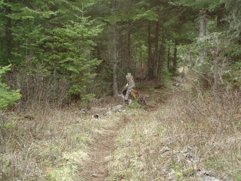
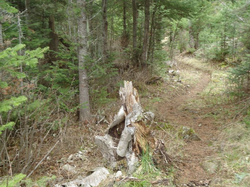
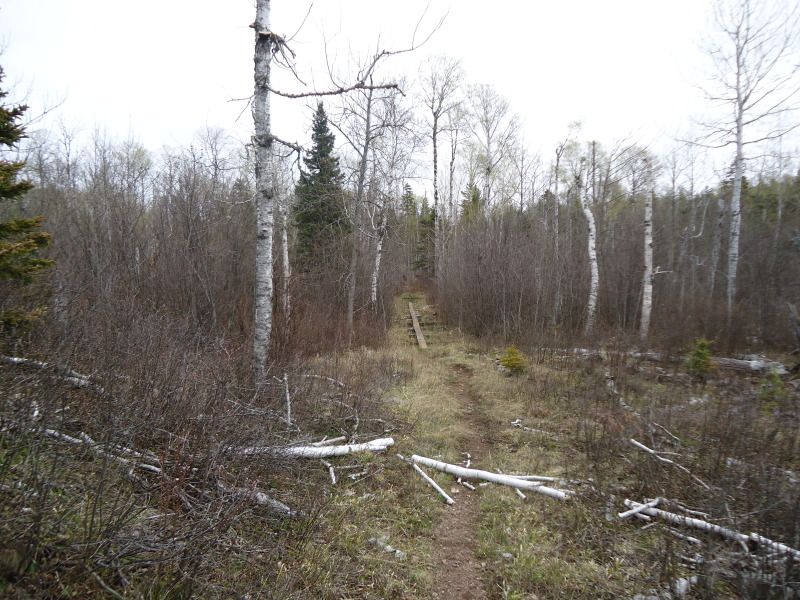
A fallen tree that I think was chewed down by a beaver:
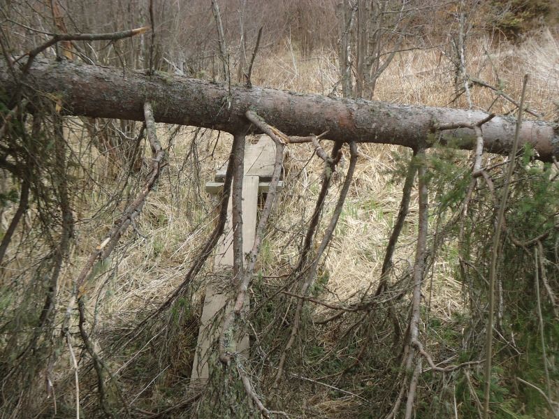
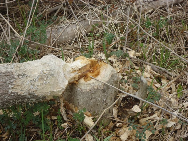
The boardwalk that you would cross over on your way from East Chickenbone to McCargoe Cove. This boardwalk is 100 or so steps away from the West Chickenbone/McCargoe Cove Marker:
I woke up at 7:24am. It is supposedly 41 degrees out. I'm glad that I have my fleece. Although, I wish I had more than just slike long johns and pajama pants. Unfortunately, my sweat pants are damp from my last trip even though I wore my rainpants. The water must have soaked up through the bottom of the legs because only the knees to the bottoms are wet. Same somewhat applies to my hiking pants, which I wouldn't want to wear anyways because they are not as warm as my sweatpants. I'm not freezing, so its not thhat big of a deal, although I do notice the cold wanting to penetrate my legs.
I had some sad dreams about weird scenerios involving losing family members in different tragic ways. I don't know what those were all about, but I think it has something slightly to do with missing my family and girlfriend along with not seeing anyone for such a long period of time. It is after all been 63 hours without seeing anyone yet. Almost a 3 full days.
I ate a granola bar for breakfast and drank some water as I debated on whether or not to do the McCargoe/Chickenbone Lake Loop. After taking a dump that had the consisentcy of pancake mix (something you might now want to have known, but man or man, I have been eating such a high fiber diet on this trip, nearly 30 grams of fiber per day, that things are really loose), I have decided that I will be doing the loop and that I will be going counter clockwise from McCargoe to West Chickenbone to East Chickenbone, back to McCargoe. I am brings some pineapple nut trail mix, some pistachos, and a granola bar. Since I only have 32oz of water left, I am going to bring my filter too just in case. My sweatpants still aren't dry so all I am going to throw over them is my hiking pants and rain pants. I am simply going to with my undershirt, long sleeve, sweatshirt, and rain jacket. I am leaving the fleece behind because I know it will get a little warmer out and I know I will get warmer as I hike.
On a side note, I think I may be getting athletes foot. My feet itch, but I have avoided scratching them except for last night when I was going to bed. After scratching them lighty, I did not notice any burning sensation, but like I said I only scratched at them ever so gently.
As it turns out, I only brought pistachios and a granola bar. I forgot I was doing a loop, so I didn't feel the need to bring so much food. I also brough my fleece because the water filter would have been bouncing annoyinglu on my butt in my backpack. Bringing the fleece not only prevented that, but it also allowed me to put the backpack cover on the bag even though it didn't look like it was going to rain. Without the fleece, the cover had nothing on the bottom of the bag to hold on to.
I left at 11:02am. I got to the 1st portage point at 11:07am. I got to the west and east chickenbone marker at 11:09am. I got to the 2nd portage point at 11:20am. I got to the west chickenbone campgrounds at 11:57am. I got to the end of the west chickenbon campgrounds at 12:02pm. I got to the Lake Richie/Hatchet/East Chickenbone marker at 12:04pm. I got to the portage point in betweet east chickenbone at 12:19pm. I got to the Daisy Farm/East Chickenbone Marker at 12:38pm. I got to the East Chickenbone campground intersection at 12:40pm. I took a 24 minute break here to check out the campgrounds. drink water, and to eat a granola bar and 2 handfuls of pistachos. I arrived at the water intersection mark at 1:06pm (you have to walk down a slope if you want to get water at this site, something that makes this my least favorite site). On my to the West Chickenbone/McCargoe marker my left foot started hurting at the front region near the middle of my big toe joint. I took a 5 minute break to readjust my boot and take some pictures on a boardwalk crossing (By the way, it turned out to be only .1 mile away from the marker, it was close enough to where you could hear the water flowing past the bridge when standing at the marker. In otherwords, go out of your way to check it out if you are going to west chickenbone to McCargoe or vice versa.) I got to the West Chickenbone/McCargoe marker at 1:51pm. I got to the 1st portage point that I passed earlier at 1:53pm. I got back to the McCargoe Campgrounds at 1:58pm.
I did not see any animals except for 16 loons or ducks flying from the water along the trail leading to West Chickenbone. I could not tell what there were because they had enough distance on my eyes. I did see another dead gartner snake not as though that counts for anything. Finally, I did see I downed tree that appeared to have been gnawed away by a beaver judging by the chew marks located accross the point where the tree was chipped away at.
While I was hiking I thought about how fall is probably the best time of year to come to Isle Royale. There is no bugs if you go late enough, fewer people than in the summer, mild temperatures, and not many downed trees unless there is a horrible storm mid-season. The only thing you have to worry about in late fall is the male mooses rutting. Some other added bonuses is that there might be cairns on the path for you so you can find your way better (not the same probably will apply to my trip on the minong in the upcoming days because the winter might knock alot of the cairns down) and the trails will be easy to distinguish with all the foot traffic on them in the summer (this is not to say that the trails were hard to see at this point in my trip.)
Earlier on my way to East Chickenbone, I thought about how I was thinking this morning that if I saw a moose from my shelter it would without a doubt solidify McCargoe Cove as being my favorite campgrounds on the island. Then I thought to myself, what if I see a moose at East Chickenbone? What will I think of that less desirable campground then?
Well let me fill you in by saying that once I arrived there, as you can tell from the list of wildlife I saw, no I didn't see any moose, but I did have my beliefs reconfirmed about East Chickenbone. I checked out their 3 campgrounds and all of them looked like a barren wasteland that sizzles in the summer with barely any shade cover. The trek just to get down the hill to get water will take you two minutes not to mention the extra time it will take you just to veer left and follow the water path for however long it takes to gain access to the water. I am guessing probably another 5 minutes and the whole time all you'll be thionking about is "Man does it suck to filter water as it is, but damn, now I gotta climb that mountain of a hill to get back to my campsite." Ha Ha Ha. Forget about East Chickenbone. The place doesn't even have picnic benches, not that West Chickenbone does, but come on, give the campers something to feed off about these campgrounds, no pun intended. Oh and get this, even the privy is ghetto. One of the planks on the door is busted in so anyone can see you doing your business.
A scary stumped that looked like a fox seated in a standing position looking at me while walking on the Greenstone trail to East Chickenbone. The first one is the stump from a distance and the second is an up close one. The last picture is just a random long board walk before reaching East Chickenbone.
A fallen tree that I think was chewed down by a beaver:
The boardwalk that you would cross over on your way from East Chickenbone to McCargoe Cove. This boardwalk is 100 or so steps away from the West Chickenbone/McCargoe Cove Marker:
343.1 Miles Hiked: 2004 (3 Days), 2010 (11 Days), 2011 (13 Days), 2012 X 2 (8 + 12 Days), 2013 (9 Days/Paddling), 2019 (30 Days/Paddling)