
Who: Long-time hiking partners & friends Johnny Mac, Hodge, and myself. Usually we have a bigger grew, but adult-stuff gets in the way for many people. But not us...we aren't adults.
Where: From Grand Portage to McCargoe via the Voyageur II; McCargoe to a backcountry site half-way between McCargoe and Lane Cove; Lane Cove to Three Mile or Daisy Farm; Daisy Farm to Moskey Basin; Moskey Basin to Chippewa, then back home on the VII.
What: We scrapped our original plan to hike the Minong ridge trail again in favor of something easier. So this was our alternative trek, which turned out to be great. It was also our first trip that incorporated some cross-country, thanks to motivation from IncaRoads. We just decided to do one night on backcountry on Angleworm Lake because it broke our 13+ mile hike from McCargoe to Lane Cove up a bit. We were also flexible on the third night, either at Daisy Farm or Three Mile. None of had ever been to Angleworm, Lane Cove, or Moskey, hence this trip.
When: May 25th to May 30th.
If you prefer to skip my boring trip report and see the pictures, click here: https://plus.google.com/photos/11822535 ... 3290101409
Day 0, Friday 24 May 13: We got up to Grand Portage and stayed in the casino. It was a bit more expensive than usual, surely because of the holiday weekend, but $88 for a comfortable night's stay and a warm shower in the morning was worth it. We hit the bar, had a few cheap High Lifes and played some darts, then turned in at a relatively decent time to get up for the boat ride in the morning.
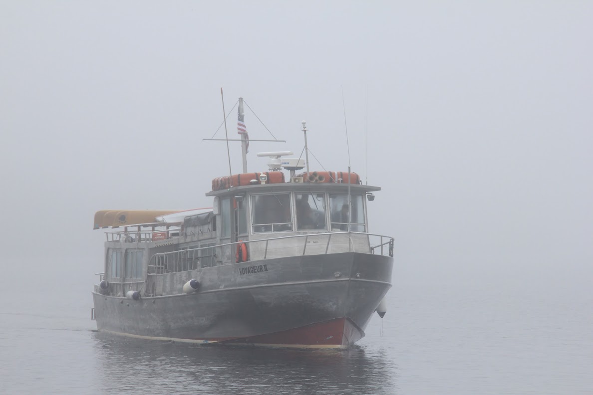
Day 1, Saturday, 25 May 13: We were the last ones to get to the VII dock this morning. That never happens. We blame the gas station for not opening until 0700. Either way, we didn't make the boat late (yaay!), and as a matter of fact, the boat got underway early as everyone had shown up and checked in. We almost had a scare for a few minutes because we forgot that the NPS fees are collected on the dock, and no longer in the cost of the ticket. We managed to scrape together our user fees and joined a large group onboard the VII. I don't think I've seen this many people on the VII before! There were wolf-moose study members, a large group of geologists, and a few smaller hiking groups. The boat ride over was uneventful, and before we knew it, we were in Windigo where Ranger Val gave us our LNT brief.
We dropped most of the wolf-moose study team at Windigo, and the rest of us were underway to McCargoe. There was still quite a bit of snow on the north shore of the island, so it made for a very pretty ride. When we got into McCargoe, our group was the only ones getting off. There was already a large group of fishermen at McCargoe, and one of them was using a pack raft to float and fish the cove. As we would later find out, he hauled that pack raft all the way from Lane Cove...an interesting feat when you see how much downfall littered the trail to Lane Cove.
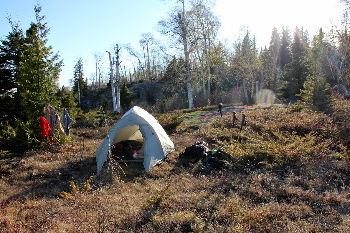
We filtered water to fill up our packs, and then set off to find a good place to stay in the backcountry along the way to Lane Cove...we weren't up for hiking the 13+ miles in one day with only 5-6 hours of daylight left. We had studied the topo maps and were hoping to get to either Sargent Lake, Lake Wagejo, or Angleworm Lake...whichever looked easiest. Ranger Val had advised us earlier that it was easier to get to Angleworm, as you could descend down the ridge the trail was on, instead of having to go up and over the rest of the ridge, then back down it, to get to Wagejo or Sargent. So after about 4.5 miles of hiking down the trail east towards Lane Cove, we found a nice rock shelf to follow down about .3-.4 miles to the shores of Angleworm Lake.
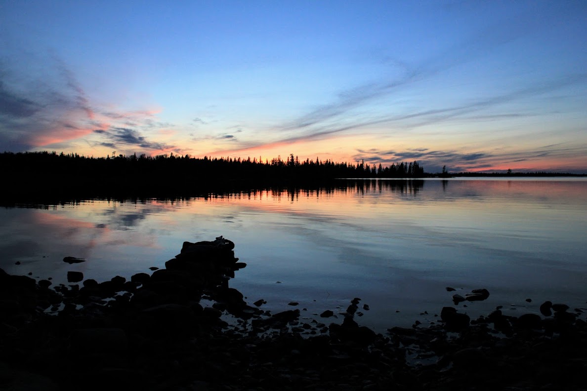
And let me tell you, did this backcountry experience level up our trips to Isle Royale. I'm not entirely sure why we weren't doing this to begin with. The solitude. The fact that maybe no one has camped here before. The remoteness of it all. It was fantastic. We found a great place along the shore with a cliff face behind us. The ground was soft with crunchy lichen. There was plenty of rocks and downed logs to sit on. We quickly set up camp, cooked dinner, and just enjoyed where we were at. We watched loons and mergansers play all night on the lake. Beavers plied the water, going about their business with little care to us being there. As the sun set, the temperatures dripped dramatically. We bundled up and watched the sun go down, sipping whisky and smoking pipes & cigars.

Johnny Mac's hammock at Angleworm
The rest of our camp at Angleworm
Sunset on Angleworm
Soon, the (full?) moon came up, and headlamps were not required. The moon was so bright and vibrant, it cast our shadows on the rock cliff behind us. After the temperature finally dipped to a low of maybe 25 or so, I decided to crawl into my sleeping bag and call it a night. Frost was starting to form on the tent and gear. This really completed the sight...a full moon above camp, sparkling brightly from frost. I slept like a rock that night on a soft bed of crunchy lichen.
Oh yeah, guess what? No bugs. Zero bugs all day, all night. This made everything 100x more enjoyable.
A side note: if you go to Angleworm, BRING A POLE. When I went down to the shore and shone my headlamp into the water, a giant pike swam by like it owned the place. Why didn't we bring fishing poles?!
Day 2, Sunday, 26 May 13: Woke up around 0900 to a still-crisp morning. Made coffee to warm up, and tried a tip I got from MikeT & NancyT: preparing freeze-dried meals in ZipLock freezer bags instead of the normal foil bags. This worked out great, as adding boiling water to the bags wasn't nearly as scary as originally anticipated. Instead of a large clump of foil garbage, it was just a small baggie. So I had some Mountain House bacon & eggs with my coffee and shortly thereafter broke camp, bushwhacked back up to the trail, and got underway to Lane Cove by 1100 (we like to get up naturally when backpacking, so no rush).
The trail to Lane Cove was relatively clear...very little downfall. We had seen tons of people on the trail coming out of Rock Harbor...last year when we were doing the Feldtmann we saw two people on the last day, as we were heading back to Windigo. This trip, in the first 24 hours, we saw 10 times more people already. This is one of the things that depresses me about the east end of the island...with the metropolis of Rock Harbor nearby, there's a lot of foot traffic. I guess I'm just spoiled, and would prefer the backcountry to myself...selfish as it is.
Just before we stopped for lunch at the Ojibway firetower, we ran into a bull moose on the trail. He was pretty scraggly from winter ticks, but it only appeared to be a skin-deep problem as he quickly moved off the trail and into the woods. He moved so fast I could only snap one photo:

A group of three gentlemen stopped at the fire tower as well to relax. It was a nice, sunny day, and a cool breeze was coming off the lake. After about 30 minutes, we got underway to get to Lane Cove and get a good site. The hike to the top of Mt. Franklin was equally uneventful until we started the 2+ mile descent down to Lane Cove.
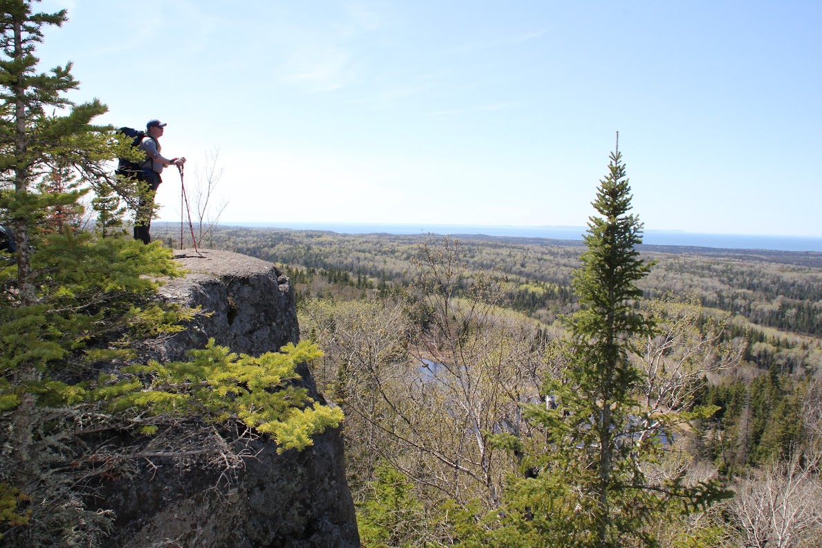
Johnny make surveying What's His from the top of Mt. Franklin
Then, there was a lot of downfall. Like...a lot.
What should of been a normal one-hour hike down to Lane Cove took two now. The downfall was massive, perfectly felled along the trail, and there was a ton. One tree in particular fell perfectly along a boardwalk, making a little exciting tight-rope action. While we were slowly picking our way to Lane Cove, we thought how much of a pain in the ass this would be going back UP tomorrow. To top it off, there was icy spots under a lot of the downfall...snow still existed on the trail! So over, under, around and through we went until we made it to the virtually-indistinguishable Lane Cove camp.
The camp was destroyed. It looked as if a tornado went through it. You could only make out the outhouse...the trails to the camp sites, the campsites themselves, even the markers that indicated each site was covered in downfall. We decided to take site #2 as it had a gorgeous view of the lake and was relatively sheltered. I had read in MikeT's book that this site was recently updated with some nice tent pads, too. Once we negotiated our way into site #2, we set up camp and made some coffee. I noticed at this time that our fuel was already running a tad low...even though I had bought a brand-new canister of fuel, it was already getting light. Then it occurred to me: I hadn't packed enough fuel. On previous trips, we always had TWO stoves...since we were missing one of our core backpacking friends, we were down to one stove now...and therefore, not enough fuel. It was time to go on a fuel ration.
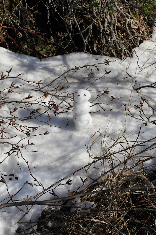
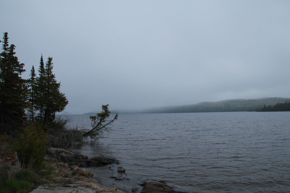
While we sat heating up dinner, we heard a loud moaning noise from further down the cove. We walked the shore to find out where it was coming from. As we walked down the shore, we noticed many patches of snow:
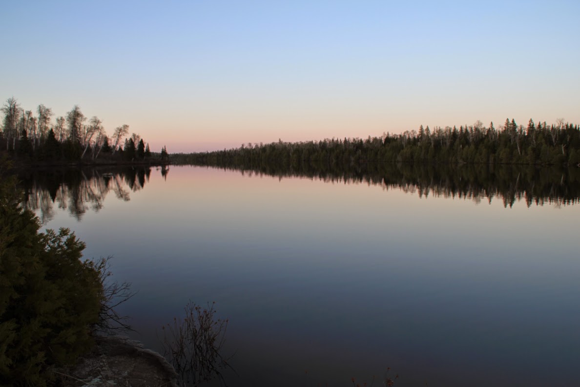
The moaning, as it would turn out, was from a beaver who swam up and down the cove, letting out guttural moans. We didn't see any threats in the area, and could only assume that maybe the beaver had lost it's babies? Either way, the moaning continued for most of the night until the sun was completely down. We grabbed a flask of whisky and watched the sun set. The weather got cold again, but not nearly as cold as it was before...there would be no frost tonight. After some gorgeous colors on the cove, we turned in early.
Your typical, boring sunset at Lane Cove.
Day 3, Monday, 27 May 13: No one was particularly excited about this hike. The hike into Lane Cove was tedious with all the downfall littering the trail. Plus, it was up hill...really up hill. It was the type of uphill where you looked up from the bottom and had to crane your neck to see the top. All my leg muscles were not looking forward to this trek.
Early on, it was decided that to make a game-time decision about staying at Three Mile or Daisy Farm. We said the only motivation to stay at Three Mile would be if there was a fire place or fire grate to warm water up for coffee and food since fuel was at a premium. We set off on our hike.
About 45 minutes into the trek, we ran into two arborists who had volunteered to clear the trails on IR. They were taking a break as we chatted them up. They seemed more exhausted by us MENTIONING that there was a lot more of downfall ahead, rather than being (naturally) tired from all the clearing they had ALREADY done that day. We told them the trail was destroyed further down into Lane Cove, and the cam was indistinguishable. The shouldered their packs, saws and chain saws and set off down the trail like two football players marching onto the field for the second half of the Superbowl. We lauded them with praise for their selflessness and hard work so we could have an easier hike.
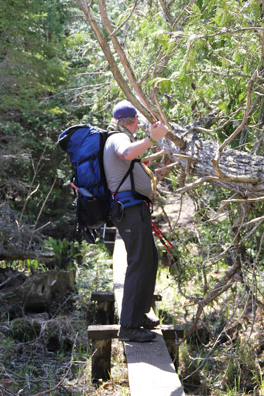
Negotiating downfall on the hike out of Lane Cove.
And lo, was the hike a lot easier. The uphill & switch backs still did a number on us, but it could of been a lot worse with the downfall that had previously been there. If you are reading this, dear arborists who were on the Lane Cove trail on 27 May, bless your hearts. Plus one karma, too.
After we took a short break at the top of Franklin, we cruised down to Three Mile in no time flat, only running into a single, solo hiker the entire way. We explored Three Mile when we got there to find it completely vacant. Alas, there were no fire containment units, so we pressed to Daisy Farm. We knew that there would be no fire rings or grates there, either, but this would make our trip to Moskey shorter so we wouldn't have to burn up so many carbs the next day, and we could sustain on cold meals for the next 24 hours.
After a wet slog from Three Mile to Daisy, we arrived and took shelter #2. There were two other shelters in use, but they were on the other side of the small field that comprised most of Daisy Farm's commons. I soaked my tired feet, read a bit, and fell asleep plenty early. I usually don't enjoy Daisy because it's such a busy area, and it's loud because of that...and also, it's on the lake and the shelters tend to get chilly. But this time there wasn't any of these problems....I slept like a rock the entire time, and remarkably it wasn't that cold. My only complaint was that effing bell on the buoy marking the channel. It's incessant ringing still haunts me to this day...
Day 4, Tuesday, 28 May 13: We awoke early to the sound of your typical Daisy Farm nature sounds...the slamming of shelter doors. I tried to fall asleep and sleep through it but it kept going. I crawled out of my sleeping bag, and headed directly to the sound of the slamming door, which wasn't hard to find. After instructing the occupants of the shelter about the courtesies of letting a shelter door close SLOWLY and QUIETLY, we started breaking camp and were underway to Moskey. This would be an intriguing trip for me. While the hike wasn't that long, I only had fruit snacks and cold oatmeal for breakfast...none of my life-giving coffee that I need to sustain.
The trek, as it turned out, went by fast without coffee. Probably because I was asleep most of the hike. The only time I remember hiking--consciously hiking--was to cross a raging stream with a big waterfall and no bridge system, and to laugh at Johnny Mac's bad "FOX News on Isle Royale" joke:
We arrived posthaste to Moskey and found the entire camp vacant. We grabbed shelter #7 on the little point into the cove and started about camp chores. It was cool out, and there was definitely some rain drifting in from the west. We used the last of the fuel to make dinners, and when I went to warm up a bit more water for coffee, the fuel sputtered to a halt. We had rationed properly, because we knew once we got to Chippewa tomorrow, we could start a fire in a grate and warm up water that way.
After dinner, we bundled up and put on rain gear, then went to the picnic table at shelter #8 to get out of the wind that was currently blowing through shelter #7's camp. We drank whisky, played cribbage, and just enjoyed nature for most of the night as the fog slowly & creepily came down the cove from Lake Superior. We marveled at the lack of bugs all day long, and then about 30 minutes after sunset, we made out a big moose wandering on the shore across the cove, not from shelter #8. It walked along the craggy shore, then ducked into the woods. We tried to track it in the woods for a few minutes, but the large creature mysteriously disappeared into the dense under brush.
The fog creeping into Moskey Basin.
Satisfied with the moose's success in eluding our expert tracking skills, we turned in for the night. The wind was dying down, but the fog continued. Later that night, I'd get up to use the cowpoke's room (a birch) and see the fog mostly burned off and a bright moon once again illuminating the entire island. I debated getting my camera to take a picture of the stark contrast of the sky compared to a few hours ago, but decided not getting frostbite was a better long-term strategy to my happiness and returned to the warmth of my sleeping bag.
Day 5, Wednesday, 29 May 13: We slept in as long as we each wanted this day because the hike to Chippewa Harbor was an easy and well-known hike. We knew nothing supremely challenging lied ahead for the next six miles, so we got up naturally and had cold breakfasts, then broke camp. The sky was steely gray, but no rain had appeared at all. We broke camp and got underway on what I would later discover to be my easiest hike to date. I wasn't sure if it was because I was familiar with the terrain (although I hadn't hiked the Moskey-to-Richie trail, I had a general understanding that it was relatively flat and uneventful), that my body was finally in shape & in rhythm with trail life, or if my pack was just lighter from shedding five days of consumables, but we tore through the six miles into Chippewa in three hours even. For the first time the entire trip, we saw signs of mosquitoes preparing for The Feast: in every puddle along the trail, the larvae swam in quick circles. But the entire hike remained bug-free. We ran into two small groups on the Moskey-to-Richie trail, then no one else from Richie into Chippewa. Matter-of-factly, Chippewa was empty save for us. I believe this is my first time in four visits to Chippewa that we were the only ones there.
We grabbed the shelter closest to the dock (#5 I believe) and set about camp chores, this time including gathering downed wood for a small fire in the fire grate. In no time flat--contrary to what the wet wood wanted--we had a fire going with good coals, and was able to start heating water for dinner & coffee. Hodge sacrificed his nice titanium cup to heat water in so we could survive. I'd also note that he now claims the Blackened Titanium Cup that was Formerly Blue has "more character now."
We were able to warm up enough water for dinner & coffee, then sat around camp and enjoyed the quietness of everything. I finished my book, "Billy Lynn's Long Halftime Walk" after dinner. Johnny Mac had once again recommended a great read for me on the island. I'm generally too dumb to pick out books except for non-fiction about war, so I usually defer to his or my wife's reading selections FOR me. After everyone was satisfied with their relaxation time, we gathered the remaining tobacco and scotch and proceeded to hike up the rock outcropping behind the Chippewa Harbor camp ground to enjoy the sunset over the island. Once again, the entire time: zero bugs.
When we arrived at the top of the rock outcropping, the sun was fighting it's way past some stringy clouds as fog once again drifted in from Lake Superior. We were able to enjoy the sun setting, but not at it's previous intensity (see my profile picture for what I mean by that). Regardless, the scotch was delicious (Hodge sprung a terrific 18-year on us) and the tobacco from the pipe was a smokey compliment. After the sun crept behind the Greenstone and Isle Royale, we picked our way back down to camp and crawled into the sleeping bags for our final night on the island.
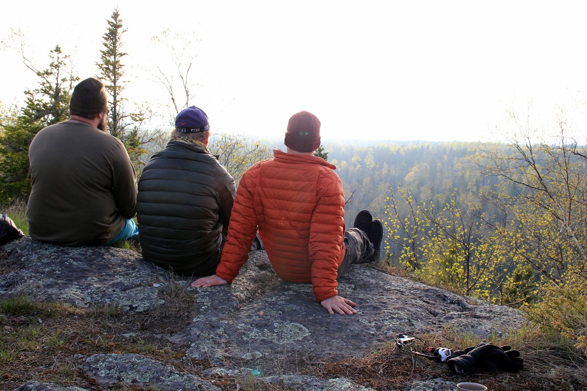
Debriefing at the top of Chippewa Harbor.
I fell asleep almost instantly, and only awoke the sound of distant thunder claps. I listened to the thunder go off for a long time, until the skies opened up and released a torrential downpour that made even the sounds of my own thoughts inaudible. The rain continued for 10 minutes straight like that, until someone shut off the faucet...and just as quickly as the sky dumped rain, it stopped. After about a minute, a giant, very-close clap of thunder shook the shelter. It was such an out-of-place noise--the thunder as quiet the entire time it rained--that it seemed like the BOOM was just an after thought...like the storm brushed by us and said, "oops, forgot THIS *clap*". It was a weird moment. I laughed at the storm, then fell back asleep.
I later awoke to a new noise. This time, it wasn't weather, but the sound of something slowly chewing something outside of the shelter. I sat up and strained my eyes, but the lack of moonlight and the dense screen covering on the shelter made it hard to make out where the noise was coming from. After a good five minutes of focusing, I was able to make out a mama moose munching away on something. It did this for quite a while until it disappeared further into the campsite. The entire time the moose sat chewing, I tried to wake up my hiking partners, but both were dead asleep. I feel back asleep slowly this time, my pulse still quickened about my third moose encounter on the trip.
Day 6, Thursday, 30 May 13: We woke up to the BEEP BEEP BEEP of Hodge's GPS alarm clock. We had an hour to break camp and scarf whatever we wanted for breakfast. The Voyageur II would soon enter the harbor and pick us up for our long journey back to Grand Portage, reality, and responsibility.
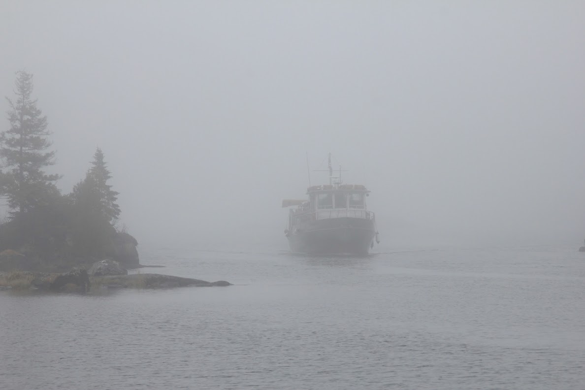
The sky was dark and the fog was thick. So thick, that you could barely make out the island that sat between the dock & the harbor's opening. The only notification that we received of the VII being close was it's fog horn. I waited patiently with my camera to get some pictures of the VII emerging from the fog, and almost immediately it appeared out of the gray, just as a ghost would:
We let a group of six paddler debark, then got on the VII for our foggy ride back. We stopped in Malone and picked up long-time Isle Royale staple (and family friend) Bucket Bob. Rolf Peterson was also on the boat, and we chatted and I shared my pictures with them. By the time we turned the corner around Rainbow Cove, the sky opened up and it got HOT. Hot enough to go from two layers & rain gear down to a T-shirt. Windigo was also warm. It was so warm in Windigo that Ranger Val contemplated aloud going for a swim. We picked up a few more people in Windigo, then were under way back to Grand Portage in short order. Once we cleared the north gap and go onto the Big Lake, however, the clouds and fog returned with the cold in tow. It was as if just the west of Windigo was saved from fog, and instead granted beautiful, warm sunlight. The lake was also a lot more violent here. 30 knot gusts pushed the VII around, and large waves threatened to come over the rails at times as Bucket Bob, Johnny Mac, and myself enjoyed the steam back to Grand Portage.
We arrived in Grand Portage in standard time, loaded up the gear into the car, and changed into some clean clothes for dinner in Grand Marais. We skipped Sven & Ole's (SACRILEGE!) for the Gunflint Tavern, as we heard they had taken to brewing their own beer. As it would turn out, they hadn't started brewing yet, but their beer selection here doesn't disappoint. I had the tuna steak sandwich with chips and a few local IPAs. FACT: nothing tastes better than a beer after a long hike.
Our trip was over. It will probably go down as one of my top three trips, too...great weather (no rain!), our first foray into the backcountry, and some great sunsets. Oh yeah, and NO BUGS.


