TR: 9/7-9/15, 2011 [Minong, Feldtmann Loop, Huginnin]
Posted: Sun Feb 12, 2012 7:46 pm
Greetings:
Now that spring is almost here, it’s probably a good time to file last year’s trip report, and perhaps whet some appetites. I made my second trip to IR the second week of September 2011 as a follow-up to my first trip in August 2010 (link: http://www.isleroyaleforums.com/viewtop ... =a&start=0). Went solo again. No emergency surgery for two years in a row! I must be on a winning streak.
Had a very stressful week at work before the trip. I was waiting and waiting for information from a client so I could wrap up a project before I left. If I didn’t finish the project, I might have had to cancel my trip. Being stressed out meant some sleepless nights. Finally, midweek I got the information I needed. It meant long hours and working Saturday and Sunday, but you gotta do what you gotta do.
Monday 9/5: Destination – Somewhere in WI.
I didn’t want to make a ten hour slog all the way from home to Grand Portage in one day, so I stayed the first night at Amnicon Falls State Park in northwestern Wisconsin. Nothing too special about it, and the adjacent highway and rail line (complete with frequent blasts of train horns) made for a lousy night’s sleep.
Tuesday 9/6: Destination – Grand Portage, or thereabouts.
Up and on the road first thing in the morning. This was the first time I had visited Minnesota. The drive up highway 61 wasn’t as scenic as I thought it would be – views of the lake seemed few and far between; perhaps I wasn’t paying attention. I visited the GP Post Office, then drove to confirm the location of the Voyageur dock so I wouldn’t be panicked the next morning. Took a side trip to Grand Portage State Park and hiked to both waterfalls. Well worth the trip (free admission!). Even though it was September, High Falls was quite impressive – I bet it’s really awesome during the spring snowmelt. Spent the night at nearby Judge Magney State Park. Didn’t sleep too well because of the proximity of the campground to the highway.
Wednesday 9/7: Destination - Todd Harbor.
After a night of little sleep, I departed Magney SP at about 6:00 am. Stopped in the parking lot of the gas station in Grand Portage and did a final run through my checklist. Switching over to my hiking boots, I decided to “gird for battle” by applying a big patch of moleskin to the pad of each of my feet, and wrapped each pinkie toe with a couple of bandaids. On my previous trip to the island (which was also my first-ever backpacking trip) I had problems with blisters the first day, so I thought it best to take some pre-emptive action this time. Once assured that everything was in order I headed to the dock.
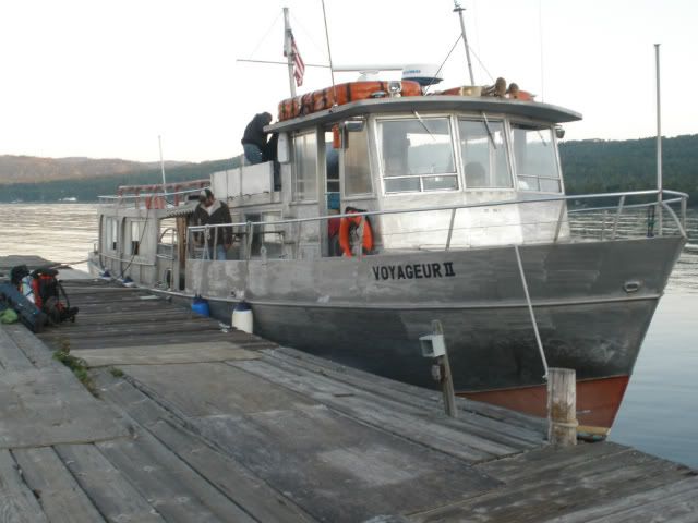
A good crossing on the Voyageur ensued – light winds, sunny – spent the whole trip outside at the stern. Arrived at Windigo by 10:00 am, secured the permit, reboarded and arrived at McCargoe Cove at 1:00 pm.
Looking down McCargoe Cove
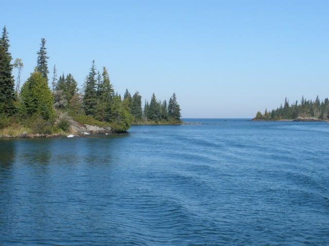
It felt good to be walking on a trail with the pack on – for the last several months I had been in training by going up and down the stairs in my house with the pack loaded up to almost 60 lbs – quite a bore, but quite a workout. Today was a good hike with some nice views.
Otter Lake
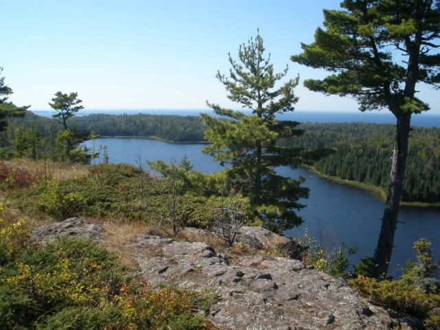
Got to Todd Harbor at 4:15 pm and claimed Site 1. I think all the sites were taken by late afternoon, though I didn’t check out the group sites.
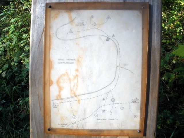
The campsite was nice enough. I wasn’t too hungry, so dinner consisted of only trail mix and a Clif bar. Tried to get some sunset pictures; but wasn’t too successful. In the sack by 8:30 pm.
6.6 miles
Thursday 9/8: Destination – Little Todd Harbor.
Arose at 4:40 am. Slept very well for the first time in a week. A few days before I left home I decided at the last minute to replace the heavy, bulky, cheapo sleeping pad I bought about 15 years ago (probably at Wal-Mart). REI had a sale going on, and I also had a 20% off coupon, so I picked up a Big Agnes 2.5 insulated Aircore pad for a very good price. Very comfy. While not self-inflating, it only took 16 to 18 deep exhalations to inflate. I found it well worth the minor inconvenience. It’s the rectangular (not mummy), long model, and just about fills the floor of my solo tent (REI Chrysalis). After last year’s trip I bought an REI Litecore sleeping pad on sale, but when I took it on a two-night camping trip that fall I slept terribly. I probably shouldn’t blame the pad, but it just didn’t work for me.
Just as I exited the tent a shooting star streaked by. Cool. I was actually hoping for some morning fog, since I’ve seen some neat pictures of the harbor and its islands posted by others, but it was a clear 53º. After a mug of hot cocoa and a couple of Clif bars (white chocolate macadamia nut – yumm) I departed about 8:00 am. Arriving at the Hatchet Lake trail junction I caught up to two women who said they also left Todd that morning and were headed to Little Todd. I passed by them by and went on my way. They would be the only people I encountered on the trail today.
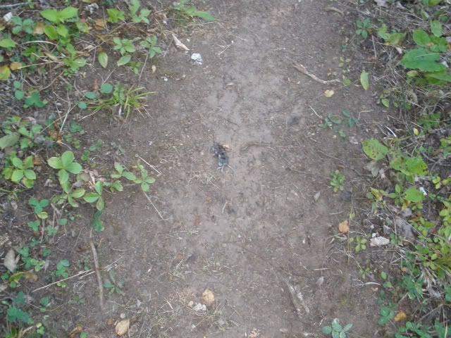
Not too bad of a hike. After crossing the log bridge, I stayed to the left as instructed by others on this forum who posted earlier trip reports. (Thanks!) The only animal sightings were of red squirrels and a dead mouse right in the middle of the trail – how it ended up there I can’t explain.
Road kill?
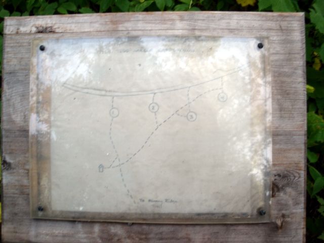
I feasted on two thimbleberries – they may have been the last of the season. Arriving at Little Todd at about 11:30, I had my choice of sites. Sites 1 and 4 were nice, but Sites 2 and 3 are right on top of each other. I chose Site 1.
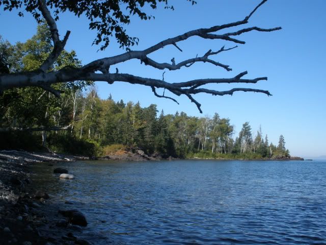
In reading some trip reports, I got the impression that this campground wasn’t too special – some folks even pass right by it without stopping. I liked this spot very much, better than its big brother. I liked the shoreline – instead of just the typical big, jagged blocks of dark gray basalt, the shore here is made up of all kinds and colors of different rock, varying in size from boulders to cobbles to pebbles to almost sand. I hiked along the shore to the point at the far west end, beyond which the waves, pushed by a west wind, were much more powerful than within the harbor. About 100 yards west of the point is a rock outcropping – I climbed to the top and sat for a couple hours, taking in the wind and the waves, enjoying the sunshine and temperature in the 70’s.
Little Todd
My post-hike meal consisted of trail mix, beef jerky, Slim Jims and Crystal Light lemonade. Dinner was a Mountain House Beef Stroganoff, chased down by a Knorr’s rice/pasta side. The instructions for the Knorr’s say to simmer for 7 minutes, but I had success just reusing the MH foil pouch, adding boiling water, and letting it sit for 10-15 minutes. Makes cleanup easy. This was my typical meal plan for each day of the trip – as you can see, I’m not a picky eater.
No good sunset photos were to be had tonight. In bed by 8:40 pm.
6.7 miles
Friday 9/9: Destination - North Lake Desor.
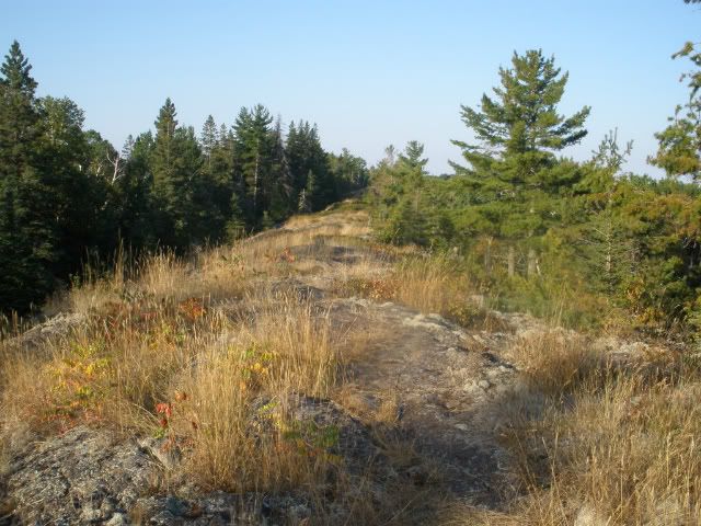
After another good night’s sleep, I arose at 4:30 am. After a breakfast of a couple of Clif bars and hot cocoa and another stroll along the shore, I departed Little Todd at about 7:20 am. What followed was an awesome hike. I’m glad that I had read DuFresne’s book and other’s trip reports describing this stretch of the trail, or else I would have been a really cranky hiker. It was a lot of work, but I was psychologically prepared for all the ups and downs encountered on this relatively short hike. There were many great views, and the cairns were certainly helpful in many places. Where cairns were missing, non-existent, or just not obvious, it was kind of fun to have to figure where the trail should be when traveling along the rocky crest. I encountered no other hikers on the trail.
Along the crest of the Minong Ridge
Upon arrival at the campground at 10:20 am, I scoped out the sites. The only person there was a young man packing up at Site 3. He was headed east. I confirmed his expectations for the stretch to Little Todd, and he told me that while the trek to Windigo wasn’t too hard, it did make for a looong day. I picked Site 1 (notice a pattern here?).
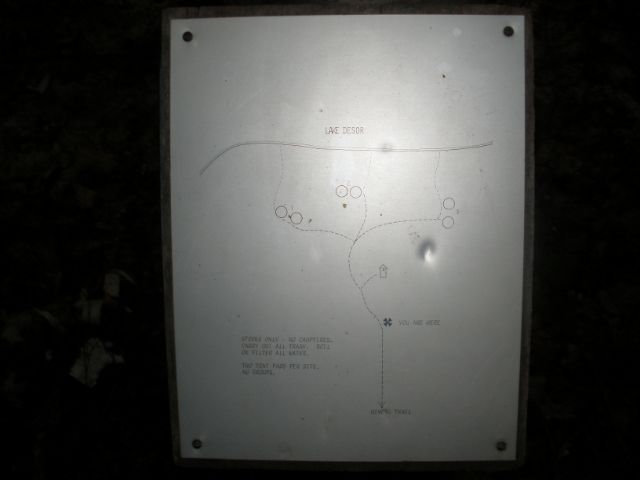
There was evidence that someone had made a fire on the rock slab by the sitting area. I thought that was a no-no at this campground. It was warmer than I had expected; 84º F in the shade at the campsite. Down on the rocks by the lakeshore it felt even warmer due to the sun. After rinsing out my clothes I clambered over the rocks toward the east to where the shoreline turns north. There I found some shade and a slab of rock upon which to lie out and take a nap. By late afternoon the other two sites were occupied.
Site 1 at North Desor
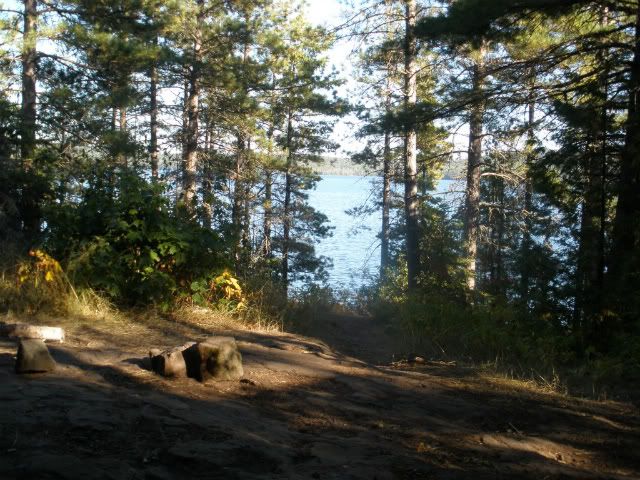
At dusk I finally heard the first loon of the trip. We don’t have loons where I live, so I’m always pleased to hear their calls. They continued to call off-and-on through the night.
5.7 miles
Saturday 9/10: Destination - Windigo.
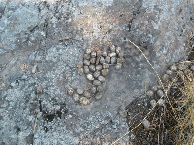
Departed at 6:40 am. The first stretch was similar to the portion east of Desor – ups and downs with some views along the rocky ridge. I observed something unfamiliar along the top of one of the ridges - these pellets, a little bigger than the size of robin's eggs. I didn't know who they belonged to, but when I later asked a ranger at Windigo I was surprised at the answer. Not only did their size seem disproportionate to the source, but I didn't think that their previous owner would have visited the top of a ridge.
Leave No Trace?
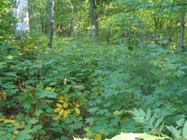
The hike eventually it became a walk in the woods, though still plenty of up-and-down, but few views. Even though it was late in the season, I was surprised by how dense the undergrowth was in some areas, shoulder-high and hiding the trail from view. I followed the guidance found in trip reports posted by others regarding what to do when you encounter the beaver dams, so as not to lose the trail. (Thanks!!)
Where's the trail?
I didn’t encounter any other people today until I passed the junction with the Greenstone Ridge trail – a pair of day hikers. I arrived at Washington Creek campground at 12:10 pm and found it was surprisingly full – even one of the tent sites was being used. I was able to get Shelter 10.
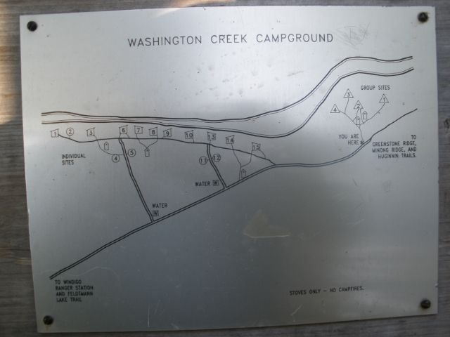
Before unpacking I quickly downed a quart of lemonade – I realized I hadn’t had anything to drink during the whole hike. Stopped in the Visitor Center and was pleased that my package arrived. Because my itinerary had me back at Windigo at the half-way point of my trip, I split up my food and mailed half of it from Grand Portage. I followed the instructions on how to arrange a food drop that Capt Don posted on this forum (link:http://www.isleroyaleforums.com/viewtop ... 9437#p9437), and it worked out just fine. I thought I had to be at the dock when the boat arrived to claim the package, but the rangers treated it just like US Mail and held it for me in the Visitor Center, which was nice of them. Attended that night’s presentation put on by Ranger Lucas. The topic was the various research projects being conducted on IR. Interesting. He played to an SRO crowd.
A long 12.6 miles.
Sunday 9/11: Destination – Feldtmann Lake.
Left Windigo at 7:00 am. Not a very remarkable hike. The only people I encountered were two men going the opposite direction. Arrived at Feldtmann at about 10:30 am and took Site 2; 1 and 4 were already taken.
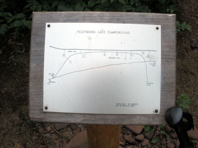
I didn’t find Feldtmann Lake too special – a thin sandy shoreline with lots of decaying vegetation and a so-so view. Just my opinion.
Grace Harbor is down there somewhere
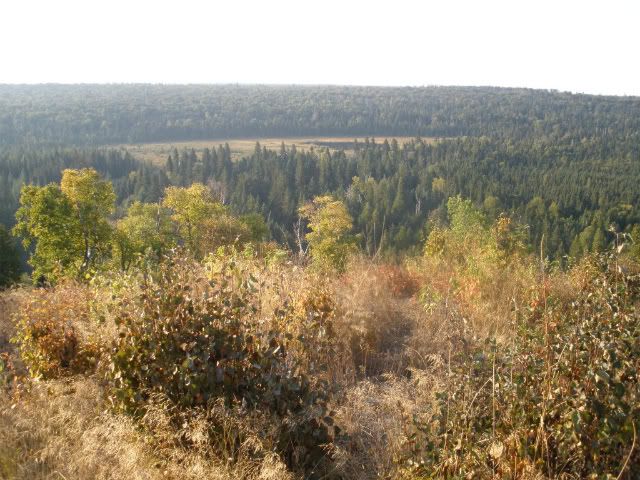
On the other hand . . . .
. . . . . Rainbow Cove is really cool.
After setting up camp I took the 0.8 mile trail to the Lake Superior shore. There was a strong west wind so the waves were really crashing against the long, wide, brown pebbled shoreline. I didn’t see anybody else when I arrived, and I started to hike towards the point at the south end, after first making note of where the trail met the beach – someone had thoughtfully arranged some driftwood to mark the location because otherwise it might have been difficult to find on the return trip. I kept walking and walking, mostly along the shore, heading up into the trees where the shore was impassable. As I continued past Rainbow Point I was thinking to myself, “You wanted solitude? You can’t get much more solitude than this!” I thought I’d see just how far I could go, then just as I round another rock I see someone laying out, sunning himself on the rock slab. So I guess somebody else had the same idea. How far does a guy have to go to get some solitude? I returned to the point where a driftwood tree trunk made for a good place to take a break and lay down. At about 11:30 the Voyageur II passed by, heading to Windigo. The folks on board were having quite a rollercoaster ride because of the waves. As I dozed off-and-on, a butterfly made my acquaintance and hung around for about half-an-hour.
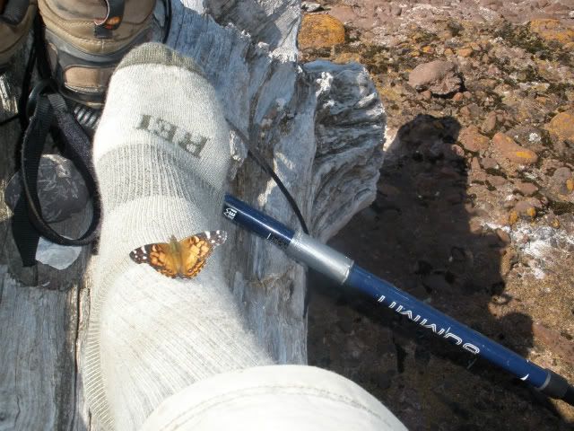
Returned to the campground, had dinner, then headed back to the Cove at about 6:00 pm, hoping to get some sunset pictures. Unfortunately it wasn’t much of a sunset – the sun basically just faded in the haze over the lake. I brought my Thermarest chair (a luxury item) and sat watching the waves crashing into the beach, and munched on that day’s trail mix. There was a full moon that night, so I hung out at the beach, reading my notes for tomorrow’s hike, until about 9:30 pm. I brought my headlamp, but the moonlight was bright enough that I was able to make it all the way back to camp without using it, even though it got a bit dicey a few times.
Rainbow Cove sunset
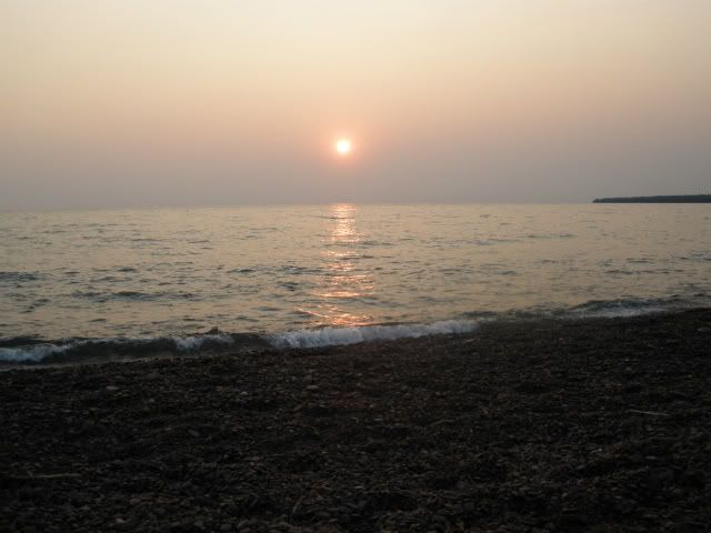
When I was ready for bed, it was still quite warm so I figured I wouldn’t need to unpack the sleeping bag, just sleep in my longjohns and a fleece jacket. About an hour after falling asleep I was awakened by the sound of splashing water along the shoreline. As the splashing continued I realized it must be a moose. I got out of the tent to take a look, but instead of a moose it was just the waves washing up on shore – the wind had changed direction and was now coming out of the northeast. So no moose. I don’t even know if moose are active at night. The change in wind direction also made it much cooler. I tried curling up and using the tent fly as a blanket to keep warm, but without much success. I didn’t feel like rummaging to the bottom of my pack to get to the sleeping bag, so I paid for it with a lousy night’s sleep.
8.8 miles with the pack on; 3.2 without.
Monday 9/12: Destination – Siskiwit Bay.
After Clif bars and cocoa, I departed at about 7:00 am. After about half an hour and some climbing there are some nice views looking down at Feldtmann Lake. It was here that I had my first and only moose sighting for this trip, swimming east in the lake.
Spot the moose
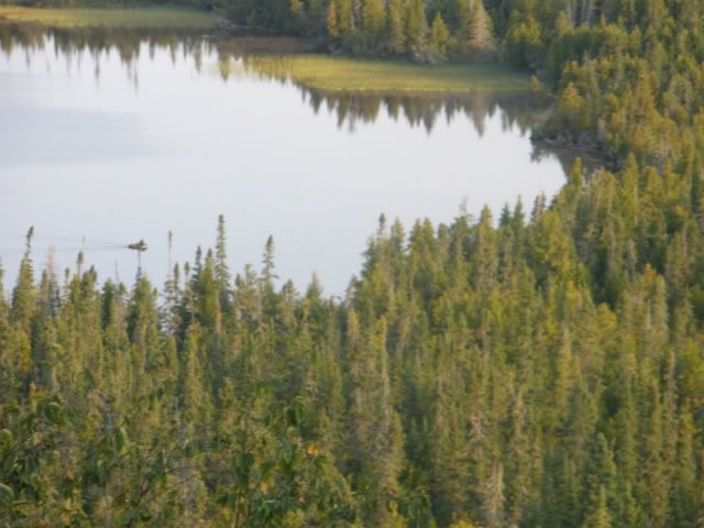
(I have a simple point-and-shoot camera, so don't expect any high-quality photos). Arriving at Feldtmann Tower about 9:00 am, I climbed as high as allowed and took in the view. It was somewhat disappointing because it had become a bit hazy. I didn’t even take any pictures. The weather forecast posted at the Windigo Visitor center on Sunday morning indicated a 50% chance of rain for today, so I kept moving along, hoping to avoid traveling while wet. Much of the rest of this hike wasn’t too special – mostly through the trees with few views – but the grassy crests were a nice change from the rocky ones on the Minong. I encountered no other hikers on the trail today, except for a second dead mouse, right in the middle of the footpath. How it decided to up and die right there, I don’t know.
Feldtmann Tower
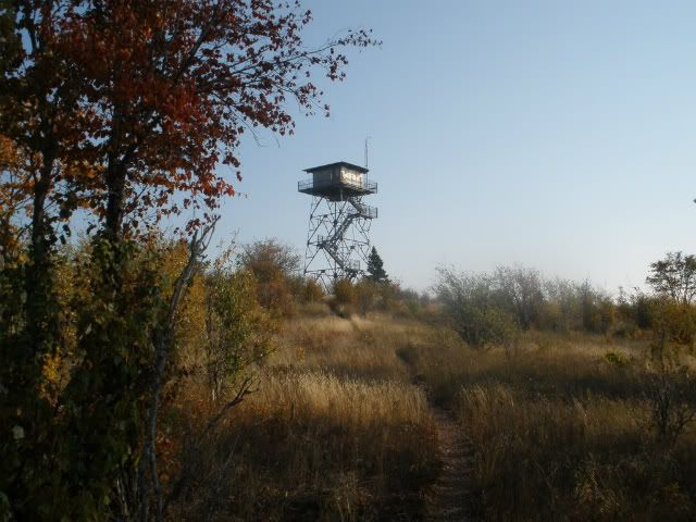
Arrived at Siskiwit Bay at about 11:00 am. It was good to see there were no boats at the dock when it came into view, and there was nobody else in the campground.
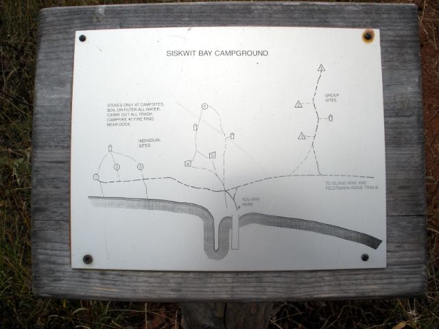
I checked out the sites as the clouds started to thicken and chose Shelter 5. I rinsed out my clothes, hung them to dry, unfurled the Big Agnes and took a nap for two hours, making up somewhat for the previous night’s poor sleep. It had rained a bit while I slept, and two gents had arrived in the campground. It stayed cloudy the rest of the day, and late in the afternoon thunderstorms developed – you could see lightening up over the ridges. It was very stormy overnight, and very windy – the shelter door kept blowing open and slamming shut. I tried wedging something in the door to keep it closed, but to no avail. I was glad I had a shelter this night.
10.3 miles.
Siskiwit Bay Shelter 5
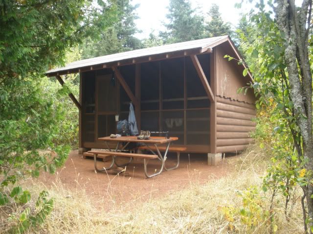
Tuesday 9/13: Destination – Huginnin Cove.
The sunshine returned this morning and I departed at about 7:45 am. I started out walking along the beach instead of the trail which runs just inside the brush. I passed a post indicating a link between the beach and the trail, but I decided to continue further along the beach, thinking it will be easy enough to bushwhack to the trail. A bit before reaching Senter Point I headed into the brush to walk to the trail. And walked. And walked. Where’s the trail? It can’t be this far from the shore! Getting a little frustrated I decided to cut my losses, go back to the beach, and head back to the post to get on the trail. I walked hurriedly through the undergrowth until my shin made acquaintance with an unseen fallen tree. Ouch!! Not only that - Face plant!! Ugghh!! Irritated, I got up, got untangled from the brush, straightened out and adjusted the pack, and made my way back to the beach and south a ways to the post. Once back on the formal trail I came to understand how I missed it while walking through the brush – the undergrowth was thick enough that I must have crossed the trail without knowing it. Oh well. The mishap resulted in the trip’s only injury. Better this than blisters.
Ouch!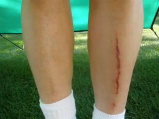
The hike up the Island Mine Trail wasn’t bad. I poked around the mine site a bit. While Island Mine campground had no views and wasn’t on any lake, it didn’t seem like it would be a bad place to spend a night if you had to. I’m glad I didn’t have to rely on the little trickle which passes for the water source for that campground.
Continuing along the trail I noticed something was amiss. I keep a bottle in the outside pocket of my pack, but it was gone. It quickly became obvious that it fell out when I took the tumble earlier. I was certain that I wouldn’t be able to find the spot where I fell, so I accepted the fact that it was lost. If anybody finds a well-worn blue Nalgene with an REI logo, filled with Crystal Light lemonade, it’s all yours. What’s ironic is that last year I used a little loop of mason’s string between the bottle cap and a strap on my pack, long enough that I’d be able to get a drink, but able to retain the bottle if it popped out of the pocket. I don’t know why I didn’t do the same thing this trip. I confess that I failed the “Leave No Trace” ethic. It left me with only one bottle to use for the rest of the trip.
Reached the Greenstone Ridge by 10:00 am. As has been noted by many, the walk west on the Greenstone is pretty much like a walk in the park – well-trodden, wide, generally downhill, and not much to see but trees. I was surprised how quickly I came to the post indicating the end of the Greenstone trail, but it had been 4 hours since I left Siskiwit Bay. I guess the time flies by when the walking is easy. I proceeded onto the West Huginnin Cove trail, which involved going up and over three ridges. I was starting to get tired and it seemed that this leg was taking longer than I thought it would, but I arrived at the campground at 1:25 pm, so I guess I still made pretty good time. Even though it was a long hike on three different trails, I didn’t meet any other hikers today.
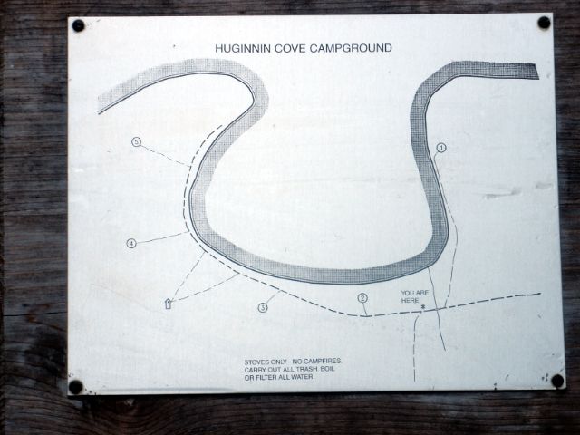
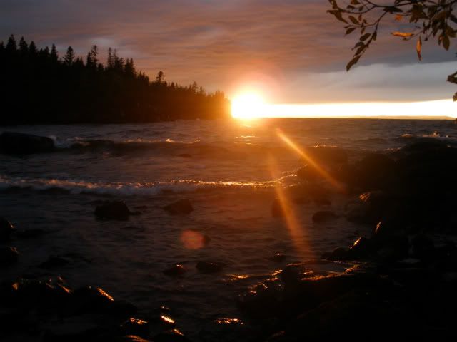
There was no one in the campground when I arrived, and after scoping out the sites I selected (you guessed it) Site 1. Awesome site! The northerly wind had the surf crashing into the shore. After a while dark clouds started to gather to the north and appeared to be heading in my direction. Just in case rain would arrive, I pulled out and set up my new tarp (10’x10’ CCS Tundra that I bought for myself the previous Christmas). My first-ever tarp setup! Turned out to be a good idea as it rained for a bit, and though it certainly could have been tolerable without the tarp, it was nice to keep the area dry. Had the last dinner of MH Beef Stroganoff. The skies cleared soon afterwards and I pulled out the Thermarest chair again and watched the sunset. I had the cove all to myself tonight. Even with the crashing waves, sleeping was easy.
14.4 miles
Looking towards Site 1 at Huginnin Cove
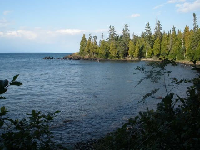
Wednesday 9/14: Destination – Stay put!
My original itinerary had been to hike from Siskiwit Bay to Washington Creek on Tuesday, then going to Huginnin Cove on Wednesday, thinking that trekking 14.4 miles would be a bit much for one day, especially because I’d be crossing the island transversely, thus going up and down several ridges. But after arriving at the western terminus of the Greenstone Ridge trail by noon Tuesday, I was feeling fine and I thought, “Why not?” and made a right turn at the junction. Thus the reason for my “bonus” day at Huginnin Cove, which turned out to be a good choice.
Had another great night’s sleep, and didn’t get up until 6:30 (which is very late for me). The northerly wind continued unabated. After a couple of Clif bars, some cocoa and just plain hanging around, at about 9:30 am I took a hike west from the campground, scrambling along the rocks and bluffs along the shore. I came to an area of wide flat rocks which seemed to be a good place to spend some time to take in the views, and enjoy the sunshine and pleasant temperatures. I was looking for the Voyageur II to pass by, but I didn’t see it – perhaps it was running early and passed by while I was still at the campsite.
Had the last Knorr’s for dinner, then again set up the Thermarest chair and ate that day’s trail mix, watching the sunset. And the crashing waves. Had the whole place to myself again. And another good night’s sleep.
0.0 miles
Thursday 9/15: Destination – Grand Portage, and beyond.
Took my time packing up since there was no hurry to leave. I wanted to be at the Windigo dock by noon to be sure I had plenty of cushion to catch the Voyageur II, so I had ample time. Had my last breakfast of Clif bars and hot cocoa, watching the waves crashing into the shore pushed by the persistent north wind. Took the East Huginnin Cove trail for the final leg of my journey. A very nice trail with the first mile running right above the shoreline before turning inland and heading uphill.
Arriving at a mostly empty Washington Creek campground 4.5 miles later I dropped off my pack at a shelter and headed to the Visitor Center to drop off my permit and to confirm the status of the Voyageur II. As I neared the Visitor Center, imagine my surprise when I see the boat already docked at 9:00 am! The ranger explained that because of Wednesday’s high winds the boat didn’t make its outbound run, so today it was making a round trip from Grand Portage to Rock Harbor and back, traversing only the south side of the island. That explains why I didn’t see it go past Huginnin Cove the day before. On the dock there were about a half-dozen people with all kinds of non-backpacking gear waiting to be loaded. It turns out they were a team of researchers with the U.S. Fish & Wildlife Service. I talked to the crew and was told that they were still on the eastbound trip and expected to be back at Windigo at 4:30 – 5:00 pm. So we suddenly had several extra hours of time to kill.
I went back to the shelter to clean up. The shower house and water had been turned off Sunday, but I was prepared with half a packet of disposable wet wipes. They worked very well, and it felt good to be cleaned up and to have a complete set of clean clothes on.
I walked the nearby Nature Loop trail, then spent some time in the Visitor Center, though I had taken in all the exhibits last year. By 5:30 the Voyageur had not yet returned, so while hanging around the dock I talked a bit with another gentleman waiting for the boat. We talked about our experiences on the Island, and as it turns out, he lives only 4 towns down the road from where I live, about 25 miles. Talk about a small world!
We finally departed at 5:50 pm. Knowing that I am somewhat prone to motion sickness, I spent the trip on the bench at the stern, preferring the fresh air instead of being in the cabin. Apparently a woman with the USFWS team had the same concerns, so she stayed outside as well. Even though I brought some Dramamine with me, I decided not to take any, and take my chances. The waves really picked up after we left the harbor – maybe 5-6 feet. It turned out to be quite a wild ride – up and down, cold and wet. I kept my eyes fixed on the horizon and it prevented me from feeling queasy. The First Mate was very nice and came back several times to ask the woman how she was doing, and kept her up-to-date on about how long it would be before we docked.
She almost made it. Maybe 15 minutes before we passed the blinking lights at the harbor entrance, she came over to me and said, “You need to move. I have to throw up.” Apparently she wasn’t keen on puking to port, perhaps because of the wind direction, so I was more than willing to get out of her way. Between the groan of the engines and the crashing of the waves I couldn’t discern whether or not she actually did the deed, but I didn’t want to know. Although I was feeling fine, I’ve read that once someone succumbs, it can become contagious.
(Photo not available)
We didn’t dock until about 8:15 pm. My original plan, assuming we were to arrive at about 3:00 pm, had been to drive to Grand Marais and hit Sven & Olie’s for pizza, since that seems to be “de rigueur” according to many of the trip reports I’ve read, both here and on a BWCA forum. Too late for that. Oh well, maybe next time, if there is one.
After we got to our cars there was some confusion about where to pay the parking fee, because the office was closed. Then somebody said we could just mail a check; I was hoping they were right. Cold and tired I didn’t want to drive too far, so I stayed again at Judge Magney State Park. I was too tired to set up camp, so I just unzipped my sleeping bag, used it as a blanket, and slept surprisingly well in the car, considering that I’m 6-0, 200 lbs and I drive a dinky little Ford Fiesta.
I had planned to stop at another northern Wisconsin state park for Friday night, but after spending a week on IR I knew that anything less would be a letdown, so I just drove the ten hours home.
Epilogue:
This was another good trip – only my 2nd backpacking trip in 54 years. My six months of training served me well again – I didn’t have any discomfort with the pack, and I didn’t have trouble enduring the nearly 70 miles of hiking, except maybe towards the end of the 14.4 mile day when the last couple of miles seemed to take a long time. I started out this time with a 46 lb. pack, which was achieved because I split my food in half. This allowed me a couple of “luxuries” – the Thermarest chair (making use of the REI Litecore pad) and a tarp. I didn’t have any problems with my feet this year; applying moleskin and bandaids before the first step did the trick.
Once again, except for one stormy night and a little rain one afternoon, there were mostly sunny skies, pleasant temperatures, and there were no bugs.
Mea Maxima Culpa! - I was remiss in filing the report for my 2010 trip – I should have credited most of its (and this year’s) success to the information I gleaned from this forum. I must have read every post in the year-and-a-half I planned for that first trip. If anyone happens to be reading this and is planning a first trip to IR, I strongly suggest poring over all the experiences and great advice found here.
Lessons learned this trip:
1) Apply moleskin and bandaids to the feet before starting.
2) Two water bottles are enough.
3) One trekking pole is enough.
4) It is possible to have too many Clif bars.
5) Slim Jims are nasty.
I don’t know if I’ll get back to IR. The only places accessible by foot that I haven’t been to are Lane Cove, Lookout Louise and Malone Bay. And I only passed through, not staying the night, at McCargoe Cove and Moskey Basin, which seem to get rave reviews. I’ve been researching a solo trip to the BWCA. Outfitters there are telling me that, even considering portaging, a canoe trip is easier than backpacking, but I’m not too sure about that.
Maybe . . . . . . . .
Now that spring is almost here, it’s probably a good time to file last year’s trip report, and perhaps whet some appetites. I made my second trip to IR the second week of September 2011 as a follow-up to my first trip in August 2010 (link: http://www.isleroyaleforums.com/viewtop ... =a&start=0). Went solo again. No emergency surgery for two years in a row! I must be on a winning streak.
Had a very stressful week at work before the trip. I was waiting and waiting for information from a client so I could wrap up a project before I left. If I didn’t finish the project, I might have had to cancel my trip. Being stressed out meant some sleepless nights. Finally, midweek I got the information I needed. It meant long hours and working Saturday and Sunday, but you gotta do what you gotta do.
Monday 9/5: Destination – Somewhere in WI.
I didn’t want to make a ten hour slog all the way from home to Grand Portage in one day, so I stayed the first night at Amnicon Falls State Park in northwestern Wisconsin. Nothing too special about it, and the adjacent highway and rail line (complete with frequent blasts of train horns) made for a lousy night’s sleep.
Tuesday 9/6: Destination – Grand Portage, or thereabouts.
Up and on the road first thing in the morning. This was the first time I had visited Minnesota. The drive up highway 61 wasn’t as scenic as I thought it would be – views of the lake seemed few and far between; perhaps I wasn’t paying attention. I visited the GP Post Office, then drove to confirm the location of the Voyageur dock so I wouldn’t be panicked the next morning. Took a side trip to Grand Portage State Park and hiked to both waterfalls. Well worth the trip (free admission!). Even though it was September, High Falls was quite impressive – I bet it’s really awesome during the spring snowmelt. Spent the night at nearby Judge Magney State Park. Didn’t sleep too well because of the proximity of the campground to the highway.
Wednesday 9/7: Destination - Todd Harbor.
After a night of little sleep, I departed Magney SP at about 6:00 am. Stopped in the parking lot of the gas station in Grand Portage and did a final run through my checklist. Switching over to my hiking boots, I decided to “gird for battle” by applying a big patch of moleskin to the pad of each of my feet, and wrapped each pinkie toe with a couple of bandaids. On my previous trip to the island (which was also my first-ever backpacking trip) I had problems with blisters the first day, so I thought it best to take some pre-emptive action this time. Once assured that everything was in order I headed to the dock.

A good crossing on the Voyageur ensued – light winds, sunny – spent the whole trip outside at the stern. Arrived at Windigo by 10:00 am, secured the permit, reboarded and arrived at McCargoe Cove at 1:00 pm.
Looking down McCargoe Cove

It felt good to be walking on a trail with the pack on – for the last several months I had been in training by going up and down the stairs in my house with the pack loaded up to almost 60 lbs – quite a bore, but quite a workout. Today was a good hike with some nice views.
Otter Lake

Got to Todd Harbor at 4:15 pm and claimed Site 1. I think all the sites were taken by late afternoon, though I didn’t check out the group sites.

The campsite was nice enough. I wasn’t too hungry, so dinner consisted of only trail mix and a Clif bar. Tried to get some sunset pictures; but wasn’t too successful. In the sack by 8:30 pm.
6.6 miles
Thursday 9/8: Destination – Little Todd Harbor.
Arose at 4:40 am. Slept very well for the first time in a week. A few days before I left home I decided at the last minute to replace the heavy, bulky, cheapo sleeping pad I bought about 15 years ago (probably at Wal-Mart). REI had a sale going on, and I also had a 20% off coupon, so I picked up a Big Agnes 2.5 insulated Aircore pad for a very good price. Very comfy. While not self-inflating, it only took 16 to 18 deep exhalations to inflate. I found it well worth the minor inconvenience. It’s the rectangular (not mummy), long model, and just about fills the floor of my solo tent (REI Chrysalis). After last year’s trip I bought an REI Litecore sleeping pad on sale, but when I took it on a two-night camping trip that fall I slept terribly. I probably shouldn’t blame the pad, but it just didn’t work for me.
Just as I exited the tent a shooting star streaked by. Cool. I was actually hoping for some morning fog, since I’ve seen some neat pictures of the harbor and its islands posted by others, but it was a clear 53º. After a mug of hot cocoa and a couple of Clif bars (white chocolate macadamia nut – yumm) I departed about 8:00 am. Arriving at the Hatchet Lake trail junction I caught up to two women who said they also left Todd that morning and were headed to Little Todd. I passed by them by and went on my way. They would be the only people I encountered on the trail today.
Not too bad of a hike. After crossing the log bridge, I stayed to the left as instructed by others on this forum who posted earlier trip reports. (Thanks!) The only animal sightings were of red squirrels and a dead mouse right in the middle of the trail – how it ended up there I can’t explain.
Road kill?

I feasted on two thimbleberries – they may have been the last of the season. Arriving at Little Todd at about 11:30, I had my choice of sites. Sites 1 and 4 were nice, but Sites 2 and 3 are right on top of each other. I chose Site 1.

In reading some trip reports, I got the impression that this campground wasn’t too special – some folks even pass right by it without stopping. I liked this spot very much, better than its big brother. I liked the shoreline – instead of just the typical big, jagged blocks of dark gray basalt, the shore here is made up of all kinds and colors of different rock, varying in size from boulders to cobbles to pebbles to almost sand. I hiked along the shore to the point at the far west end, beyond which the waves, pushed by a west wind, were much more powerful than within the harbor. About 100 yards west of the point is a rock outcropping – I climbed to the top and sat for a couple hours, taking in the wind and the waves, enjoying the sunshine and temperature in the 70’s.
Little Todd

My post-hike meal consisted of trail mix, beef jerky, Slim Jims and Crystal Light lemonade. Dinner was a Mountain House Beef Stroganoff, chased down by a Knorr’s rice/pasta side. The instructions for the Knorr’s say to simmer for 7 minutes, but I had success just reusing the MH foil pouch, adding boiling water, and letting it sit for 10-15 minutes. Makes cleanup easy. This was my typical meal plan for each day of the trip – as you can see, I’m not a picky eater.
No good sunset photos were to be had tonight. In bed by 8:40 pm.
6.7 miles
Friday 9/9: Destination - North Lake Desor.
After another good night’s sleep, I arose at 4:30 am. After a breakfast of a couple of Clif bars and hot cocoa and another stroll along the shore, I departed Little Todd at about 7:20 am. What followed was an awesome hike. I’m glad that I had read DuFresne’s book and other’s trip reports describing this stretch of the trail, or else I would have been a really cranky hiker. It was a lot of work, but I was psychologically prepared for all the ups and downs encountered on this relatively short hike. There were many great views, and the cairns were certainly helpful in many places. Where cairns were missing, non-existent, or just not obvious, it was kind of fun to have to figure where the trail should be when traveling along the rocky crest. I encountered no other hikers on the trail.
Along the crest of the Minong Ridge

Upon arrival at the campground at 10:20 am, I scoped out the sites. The only person there was a young man packing up at Site 3. He was headed east. I confirmed his expectations for the stretch to Little Todd, and he told me that while the trek to Windigo wasn’t too hard, it did make for a looong day. I picked Site 1 (notice a pattern here?).

There was evidence that someone had made a fire on the rock slab by the sitting area. I thought that was a no-no at this campground. It was warmer than I had expected; 84º F in the shade at the campsite. Down on the rocks by the lakeshore it felt even warmer due to the sun. After rinsing out my clothes I clambered over the rocks toward the east to where the shoreline turns north. There I found some shade and a slab of rock upon which to lie out and take a nap. By late afternoon the other two sites were occupied.
Site 1 at North Desor

At dusk I finally heard the first loon of the trip. We don’t have loons where I live, so I’m always pleased to hear their calls. They continued to call off-and-on through the night.
5.7 miles
Saturday 9/10: Destination - Windigo.
Departed at 6:40 am. The first stretch was similar to the portion east of Desor – ups and downs with some views along the rocky ridge. I observed something unfamiliar along the top of one of the ridges - these pellets, a little bigger than the size of robin's eggs. I didn't know who they belonged to, but when I later asked a ranger at Windigo I was surprised at the answer. Not only did their size seem disproportionate to the source, but I didn't think that their previous owner would have visited the top of a ridge.
Leave No Trace?

The hike eventually it became a walk in the woods, though still plenty of up-and-down, but few views. Even though it was late in the season, I was surprised by how dense the undergrowth was in some areas, shoulder-high and hiding the trail from view. I followed the guidance found in trip reports posted by others regarding what to do when you encounter the beaver dams, so as not to lose the trail. (Thanks!!)
Where's the trail?

I didn’t encounter any other people today until I passed the junction with the Greenstone Ridge trail – a pair of day hikers. I arrived at Washington Creek campground at 12:10 pm and found it was surprisingly full – even one of the tent sites was being used. I was able to get Shelter 10.

Before unpacking I quickly downed a quart of lemonade – I realized I hadn’t had anything to drink during the whole hike. Stopped in the Visitor Center and was pleased that my package arrived. Because my itinerary had me back at Windigo at the half-way point of my trip, I split up my food and mailed half of it from Grand Portage. I followed the instructions on how to arrange a food drop that Capt Don posted on this forum (link:http://www.isleroyaleforums.com/viewtop ... 9437#p9437), and it worked out just fine. I thought I had to be at the dock when the boat arrived to claim the package, but the rangers treated it just like US Mail and held it for me in the Visitor Center, which was nice of them. Attended that night’s presentation put on by Ranger Lucas. The topic was the various research projects being conducted on IR. Interesting. He played to an SRO crowd.
A long 12.6 miles.
Sunday 9/11: Destination – Feldtmann Lake.
Left Windigo at 7:00 am. Not a very remarkable hike. The only people I encountered were two men going the opposite direction. Arrived at Feldtmann at about 10:30 am and took Site 2; 1 and 4 were already taken.

I didn’t find Feldtmann Lake too special – a thin sandy shoreline with lots of decaying vegetation and a so-so view. Just my opinion.
Grace Harbor is down there somewhere

On the other hand . . . .
. . . . . Rainbow Cove is really cool.
After setting up camp I took the 0.8 mile trail to the Lake Superior shore. There was a strong west wind so the waves were really crashing against the long, wide, brown pebbled shoreline. I didn’t see anybody else when I arrived, and I started to hike towards the point at the south end, after first making note of where the trail met the beach – someone had thoughtfully arranged some driftwood to mark the location because otherwise it might have been difficult to find on the return trip. I kept walking and walking, mostly along the shore, heading up into the trees where the shore was impassable. As I continued past Rainbow Point I was thinking to myself, “You wanted solitude? You can’t get much more solitude than this!” I thought I’d see just how far I could go, then just as I round another rock I see someone laying out, sunning himself on the rock slab. So I guess somebody else had the same idea. How far does a guy have to go to get some solitude? I returned to the point where a driftwood tree trunk made for a good place to take a break and lay down. At about 11:30 the Voyageur II passed by, heading to Windigo. The folks on board were having quite a rollercoaster ride because of the waves. As I dozed off-and-on, a butterfly made my acquaintance and hung around for about half-an-hour.

Returned to the campground, had dinner, then headed back to the Cove at about 6:00 pm, hoping to get some sunset pictures. Unfortunately it wasn’t much of a sunset – the sun basically just faded in the haze over the lake. I brought my Thermarest chair (a luxury item) and sat watching the waves crashing into the beach, and munched on that day’s trail mix. There was a full moon that night, so I hung out at the beach, reading my notes for tomorrow’s hike, until about 9:30 pm. I brought my headlamp, but the moonlight was bright enough that I was able to make it all the way back to camp without using it, even though it got a bit dicey a few times.
Rainbow Cove sunset

When I was ready for bed, it was still quite warm so I figured I wouldn’t need to unpack the sleeping bag, just sleep in my longjohns and a fleece jacket. About an hour after falling asleep I was awakened by the sound of splashing water along the shoreline. As the splashing continued I realized it must be a moose. I got out of the tent to take a look, but instead of a moose it was just the waves washing up on shore – the wind had changed direction and was now coming out of the northeast. So no moose. I don’t even know if moose are active at night. The change in wind direction also made it much cooler. I tried curling up and using the tent fly as a blanket to keep warm, but without much success. I didn’t feel like rummaging to the bottom of my pack to get to the sleeping bag, so I paid for it with a lousy night’s sleep.
8.8 miles with the pack on; 3.2 without.
Monday 9/12: Destination – Siskiwit Bay.
After Clif bars and cocoa, I departed at about 7:00 am. After about half an hour and some climbing there are some nice views looking down at Feldtmann Lake. It was here that I had my first and only moose sighting for this trip, swimming east in the lake.
Spot the moose

(I have a simple point-and-shoot camera, so don't expect any high-quality photos). Arriving at Feldtmann Tower about 9:00 am, I climbed as high as allowed and took in the view. It was somewhat disappointing because it had become a bit hazy. I didn’t even take any pictures. The weather forecast posted at the Windigo Visitor center on Sunday morning indicated a 50% chance of rain for today, so I kept moving along, hoping to avoid traveling while wet. Much of the rest of this hike wasn’t too special – mostly through the trees with few views – but the grassy crests were a nice change from the rocky ones on the Minong. I encountered no other hikers on the trail today, except for a second dead mouse, right in the middle of the footpath. How it decided to up and die right there, I don’t know.
Feldtmann Tower

Arrived at Siskiwit Bay at about 11:00 am. It was good to see there were no boats at the dock when it came into view, and there was nobody else in the campground.

I checked out the sites as the clouds started to thicken and chose Shelter 5. I rinsed out my clothes, hung them to dry, unfurled the Big Agnes and took a nap for two hours, making up somewhat for the previous night’s poor sleep. It had rained a bit while I slept, and two gents had arrived in the campground. It stayed cloudy the rest of the day, and late in the afternoon thunderstorms developed – you could see lightening up over the ridges. It was very stormy overnight, and very windy – the shelter door kept blowing open and slamming shut. I tried wedging something in the door to keep it closed, but to no avail. I was glad I had a shelter this night.
10.3 miles.
Siskiwit Bay Shelter 5

Tuesday 9/13: Destination – Huginnin Cove.
The sunshine returned this morning and I departed at about 7:45 am. I started out walking along the beach instead of the trail which runs just inside the brush. I passed a post indicating a link between the beach and the trail, but I decided to continue further along the beach, thinking it will be easy enough to bushwhack to the trail. A bit before reaching Senter Point I headed into the brush to walk to the trail. And walked. And walked. Where’s the trail? It can’t be this far from the shore! Getting a little frustrated I decided to cut my losses, go back to the beach, and head back to the post to get on the trail. I walked hurriedly through the undergrowth until my shin made acquaintance with an unseen fallen tree. Ouch!! Not only that - Face plant!! Ugghh!! Irritated, I got up, got untangled from the brush, straightened out and adjusted the pack, and made my way back to the beach and south a ways to the post. Once back on the formal trail I came to understand how I missed it while walking through the brush – the undergrowth was thick enough that I must have crossed the trail without knowing it. Oh well. The mishap resulted in the trip’s only injury. Better this than blisters.
Ouch!

The hike up the Island Mine Trail wasn’t bad. I poked around the mine site a bit. While Island Mine campground had no views and wasn’t on any lake, it didn’t seem like it would be a bad place to spend a night if you had to. I’m glad I didn’t have to rely on the little trickle which passes for the water source for that campground.
Continuing along the trail I noticed something was amiss. I keep a bottle in the outside pocket of my pack, but it was gone. It quickly became obvious that it fell out when I took the tumble earlier. I was certain that I wouldn’t be able to find the spot where I fell, so I accepted the fact that it was lost. If anybody finds a well-worn blue Nalgene with an REI logo, filled with Crystal Light lemonade, it’s all yours. What’s ironic is that last year I used a little loop of mason’s string between the bottle cap and a strap on my pack, long enough that I’d be able to get a drink, but able to retain the bottle if it popped out of the pocket. I don’t know why I didn’t do the same thing this trip. I confess that I failed the “Leave No Trace” ethic. It left me with only one bottle to use for the rest of the trip.
Reached the Greenstone Ridge by 10:00 am. As has been noted by many, the walk west on the Greenstone is pretty much like a walk in the park – well-trodden, wide, generally downhill, and not much to see but trees. I was surprised how quickly I came to the post indicating the end of the Greenstone trail, but it had been 4 hours since I left Siskiwit Bay. I guess the time flies by when the walking is easy. I proceeded onto the West Huginnin Cove trail, which involved going up and over three ridges. I was starting to get tired and it seemed that this leg was taking longer than I thought it would, but I arrived at the campground at 1:25 pm, so I guess I still made pretty good time. Even though it was a long hike on three different trails, I didn’t meet any other hikers today.

There was no one in the campground when I arrived, and after scoping out the sites I selected (you guessed it) Site 1. Awesome site! The northerly wind had the surf crashing into the shore. After a while dark clouds started to gather to the north and appeared to be heading in my direction. Just in case rain would arrive, I pulled out and set up my new tarp (10’x10’ CCS Tundra that I bought for myself the previous Christmas). My first-ever tarp setup! Turned out to be a good idea as it rained for a bit, and though it certainly could have been tolerable without the tarp, it was nice to keep the area dry. Had the last dinner of MH Beef Stroganoff. The skies cleared soon afterwards and I pulled out the Thermarest chair again and watched the sunset. I had the cove all to myself tonight. Even with the crashing waves, sleeping was easy.
14.4 miles
Looking towards Site 1 at Huginnin Cove

Wednesday 9/14: Destination – Stay put!
My original itinerary had been to hike from Siskiwit Bay to Washington Creek on Tuesday, then going to Huginnin Cove on Wednesday, thinking that trekking 14.4 miles would be a bit much for one day, especially because I’d be crossing the island transversely, thus going up and down several ridges. But after arriving at the western terminus of the Greenstone Ridge trail by noon Tuesday, I was feeling fine and I thought, “Why not?” and made a right turn at the junction. Thus the reason for my “bonus” day at Huginnin Cove, which turned out to be a good choice.
Had another great night’s sleep, and didn’t get up until 6:30 (which is very late for me). The northerly wind continued unabated. After a couple of Clif bars, some cocoa and just plain hanging around, at about 9:30 am I took a hike west from the campground, scrambling along the rocks and bluffs along the shore. I came to an area of wide flat rocks which seemed to be a good place to spend some time to take in the views, and enjoy the sunshine and pleasant temperatures. I was looking for the Voyageur II to pass by, but I didn’t see it – perhaps it was running early and passed by while I was still at the campsite.
Had the last Knorr’s for dinner, then again set up the Thermarest chair and ate that day’s trail mix, watching the sunset. And the crashing waves. Had the whole place to myself again. And another good night’s sleep.

0.0 miles
Thursday 9/15: Destination – Grand Portage, and beyond.
Took my time packing up since there was no hurry to leave. I wanted to be at the Windigo dock by noon to be sure I had plenty of cushion to catch the Voyageur II, so I had ample time. Had my last breakfast of Clif bars and hot cocoa, watching the waves crashing into the shore pushed by the persistent north wind. Took the East Huginnin Cove trail for the final leg of my journey. A very nice trail with the first mile running right above the shoreline before turning inland and heading uphill.
Arriving at a mostly empty Washington Creek campground 4.5 miles later I dropped off my pack at a shelter and headed to the Visitor Center to drop off my permit and to confirm the status of the Voyageur II. As I neared the Visitor Center, imagine my surprise when I see the boat already docked at 9:00 am! The ranger explained that because of Wednesday’s high winds the boat didn’t make its outbound run, so today it was making a round trip from Grand Portage to Rock Harbor and back, traversing only the south side of the island. That explains why I didn’t see it go past Huginnin Cove the day before. On the dock there were about a half-dozen people with all kinds of non-backpacking gear waiting to be loaded. It turns out they were a team of researchers with the U.S. Fish & Wildlife Service. I talked to the crew and was told that they were still on the eastbound trip and expected to be back at Windigo at 4:30 – 5:00 pm. So we suddenly had several extra hours of time to kill.
I went back to the shelter to clean up. The shower house and water had been turned off Sunday, but I was prepared with half a packet of disposable wet wipes. They worked very well, and it felt good to be cleaned up and to have a complete set of clean clothes on.
I walked the nearby Nature Loop trail, then spent some time in the Visitor Center, though I had taken in all the exhibits last year. By 5:30 the Voyageur had not yet returned, so while hanging around the dock I talked a bit with another gentleman waiting for the boat. We talked about our experiences on the Island, and as it turns out, he lives only 4 towns down the road from where I live, about 25 miles. Talk about a small world!
We finally departed at 5:50 pm. Knowing that I am somewhat prone to motion sickness, I spent the trip on the bench at the stern, preferring the fresh air instead of being in the cabin. Apparently a woman with the USFWS team had the same concerns, so she stayed outside as well. Even though I brought some Dramamine with me, I decided not to take any, and take my chances. The waves really picked up after we left the harbor – maybe 5-6 feet. It turned out to be quite a wild ride – up and down, cold and wet. I kept my eyes fixed on the horizon and it prevented me from feeling queasy. The First Mate was very nice and came back several times to ask the woman how she was doing, and kept her up-to-date on about how long it would be before we docked.
She almost made it. Maybe 15 minutes before we passed the blinking lights at the harbor entrance, she came over to me and said, “You need to move. I have to throw up.” Apparently she wasn’t keen on puking to port, perhaps because of the wind direction, so I was more than willing to get out of her way. Between the groan of the engines and the crashing of the waves I couldn’t discern whether or not she actually did the deed, but I didn’t want to know. Although I was feeling fine, I’ve read that once someone succumbs, it can become contagious.
(Photo not available)
We didn’t dock until about 8:15 pm. My original plan, assuming we were to arrive at about 3:00 pm, had been to drive to Grand Marais and hit Sven & Olie’s for pizza, since that seems to be “de rigueur” according to many of the trip reports I’ve read, both here and on a BWCA forum. Too late for that. Oh well, maybe next time, if there is one.
After we got to our cars there was some confusion about where to pay the parking fee, because the office was closed. Then somebody said we could just mail a check; I was hoping they were right. Cold and tired I didn’t want to drive too far, so I stayed again at Judge Magney State Park. I was too tired to set up camp, so I just unzipped my sleeping bag, used it as a blanket, and slept surprisingly well in the car, considering that I’m 6-0, 200 lbs and I drive a dinky little Ford Fiesta.
I had planned to stop at another northern Wisconsin state park for Friday night, but after spending a week on IR I knew that anything less would be a letdown, so I just drove the ten hours home.
Epilogue:
This was another good trip – only my 2nd backpacking trip in 54 years. My six months of training served me well again – I didn’t have any discomfort with the pack, and I didn’t have trouble enduring the nearly 70 miles of hiking, except maybe towards the end of the 14.4 mile day when the last couple of miles seemed to take a long time. I started out this time with a 46 lb. pack, which was achieved because I split my food in half. This allowed me a couple of “luxuries” – the Thermarest chair (making use of the REI Litecore pad) and a tarp. I didn’t have any problems with my feet this year; applying moleskin and bandaids before the first step did the trick.
Once again, except for one stormy night and a little rain one afternoon, there were mostly sunny skies, pleasant temperatures, and there were no bugs.
Mea Maxima Culpa! - I was remiss in filing the report for my 2010 trip – I should have credited most of its (and this year’s) success to the information I gleaned from this forum. I must have read every post in the year-and-a-half I planned for that first trip. If anyone happens to be reading this and is planning a first trip to IR, I strongly suggest poring over all the experiences and great advice found here.
Lessons learned this trip:
1) Apply moleskin and bandaids to the feet before starting.
2) Two water bottles are enough.
3) One trekking pole is enough.
4) It is possible to have too many Clif bars.
5) Slim Jims are nasty.
I don’t know if I’ll get back to IR. The only places accessible by foot that I haven’t been to are Lane Cove, Lookout Louise and Malone Bay. And I only passed through, not staying the night, at McCargoe Cove and Moskey Basin, which seem to get rave reviews. I’ve been researching a solo trip to the BWCA. Outfitters there are telling me that, even considering portaging, a canoe trip is easier than backpacking, but I’m not too sure about that.
Maybe . . . . . . . .