May 2017: RH-MoB-TH-DF-RH hike
Moderator: Tom
-
torpified
- IR Expert
- Posts: 649
- Joined: Wed Apr 20, 2016 5:06 pm
- Isle Royale Visits: 8
- Location: Ann Arbor, MI
- Has thanked: 83 times
- Been thanked: 61 times
- Contact:
May 2017: RH-MoB-TH-DF-RH hike
I apologize for all the words. Executive summary: it was totally awesome! I saw snow, got snowed on, met 10 moose, 7 snowshoe hare, two foxes, two bald eagles (or possibly the same bald eagle twice) and one very busy beaver. And I loved the "cross-grain" trails I took -- Lake Ritchie, Indian Portage, Daisy Farm, Mt. Ojibway.
I'll probably --mostly for my own bookkeeping -- put up a separate post about early season challenges, rewards, and strategies. But I wanted to crank the trip report out before the island mood evaporated.
*************
Preamble. I had a few days of work and family missions in and near Chicago, and decided it made sense to return to Ann Arbor via IR. Between Chicagoland sub-missions I stretched my legs in a handy state park, where I saw 17 sand hill cranes laying waste to a field, and a boy scout troop on some sort of backpacking practice hike. I felt ready.
Sunday 7 May. Hawthorn Woods, IL to Copper Harbor, MI
I drove from the suburbs to the backwoods. I knew I had made it when the Starbucks gave way to handlettered signs offering such services as “bass scrapping” and “deer skull boiling.” I had a quarter pounder in Kravitz, Wisconsin, and my first view of the lake they call Gitchigoomee in L’Anse, MI.
There’s a speed bump in the parking lot of Copper Harbor’s Bella Vista motel. In the course of checkin scuttling back and forth between the office and my room, I tripped over it three times. Each incident had witnesses. Not sure what this bodes for pratfalls during the hike.
Monday 8 May. Copper Harbor to Moskey Basin.
2017’s inaugural voyage for the Isle Royale Queen IV! About 30 passengers, including a large group from MSU (but no identifiable boy scout troops), enjoyed a smooth passage under clear cool skies. I shared a table with Jason, who’d just finished at UM-Duluth and was squeezing in a quick trip to some real wilderness before heading west to assume his first post-graduation job as a front/backcountry ranger in Glacier National Park. IR’s own Ranger Marshall oriented and permitted us, and I was underway a bit before 1.
This was about an hour later than I’d been hoping. While I harbored hopes of reaching Chippewa Harbor tonight, I’d also set myself a strict rule that I could carry on past the Moskey Basin only if I made it there by 5. (I thought discretion was called for because I wasn’t sure how readily navigable the trail to Chippewa was, whereas I was certain that it was cold and I was alone.) So I started on the Tobin Harbor trail on the (in retrospect naïve) assumption it would be quicker going than the Rock Harbor trail.
However, I hit a snag. Or rather dozens. The issue wasn’t snow (there were patches, but they were no big deal) but a whole winter’s worth of deadfall, a number of stretches of which left me feeling like the protagonist of “War Horse” when he gets so entangled in the barbed wire that he can’t gallop any more. Trying not to dwell on Ranger Marshall’s vividly clinical mention of “impalement injuries,” I pressed on. I never, ever, got the knack of divining which fallen tree parts would snap like toothpicks under pressure and which would prove as infrangible as concrete. (In the course of the trip, a twig I thought would evaporate in a stiff breeze knocked the wind out of me when I tried to walk through it, and a tree about as big around as Arnold Schwarzenegger’s thigh toppled when I rested my hand against it for balance.)
Finally, I made it to the Mt. Franklin junction, and reached back to grab my water bottle for a celebratory drink. Only it wasn’t there. Presumably it had been stripped off during one of my War Horse Maneuvers.
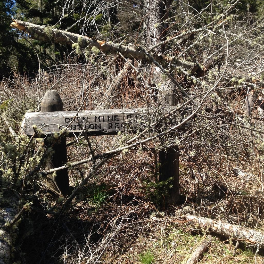
Stinging from this epic Leave No Trace fail, I carried on toward Daisy Farm. Downed trees there were, but none were too dispiriting. Bushwacking around one, I realized that it had fallen ON the sign announcing the presence of the Siskiwit Mines, and warning hikers that off-trail travel required extreme caution.
I stopped for a late lunch at Daisy Farm. There I encountered Jason, who had been wandering the compound ergodically in search of the Mt Ojibway trail.
The walk to Moskey was my favorite part of the day—the rocky pathway, ridge views, a soaring hawk. It helped that either a trail crew or an extremely considerate precision beaver had already been through, so I had zero trees to clamber over.
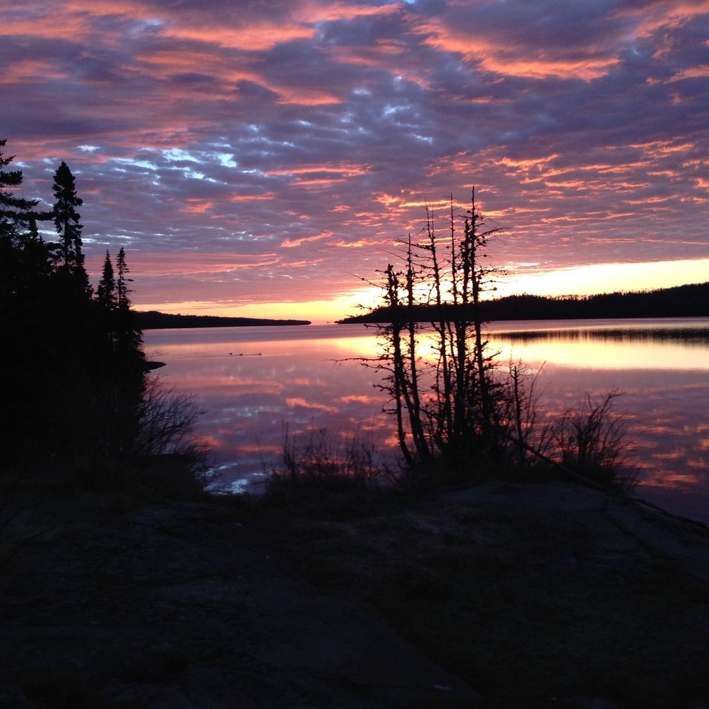
So earnest was I about the “Moskey Basin by 5” deal that I didn’t allow myself to check my clock until I got there. It was 5:05. I settled into shelter #2 and watched the moon rise over mergansers.
Tuesday 9 May. Moskey Basin to Todd Harbor, via Hatchet Lake.
My routine is to rinse out my socks and undervears every evening. [Editors note: it is a convention in the author’s household, whenever it becomes necessary to mention unmentionables, to refer to them as “undervears”. The explanation of this convention (omitted) involves two Hungarians and the trans-Siberian railroad.] Undervears dry quickly, and the socks have two days to dry (because I carry two pair to walk in, plus a sleeping pair), so this usually works out fine, and minimizes blisters and other skin unpleasantries. By 5:30 am, it had gotten too cold for me to languish any longer in bed. So I bolted into action, only to find that my socks, undervears, and boots had frozen solid overnight.
There’s a scene in “Nanook of the North” where Ms. Nanook, the first up in the morning, emerges from a pile of seal furs to don a reindeer-skin frock and begin chewing on Mr. Nanook’s boots, to render them sufficiently flexible to put on, so that he can go out and murder some walrus. I had neglected to bring Ms. Nanook along, so I shoved my feet into the frozen boots as best I could. My undervears –mid-thigh length compression shorts—defied my best attempts to pry apart their leg openings. So I folded them in half, shoved them in an outside pocket of my backpack, and hoped for sublimation.
I loved the trail from Moskey to Lake Ritchie (this will become a tiresome theme). I startled a snowshoe hare, and my boots melted enough to tighten properly. I detoured a few feet to climb an outcropping that afforded my first view of Lake Ritchie, and checked on my undervears. They were still frozen solid. Figuring that now that I could feel my feet, I had body heat to spare, I launched the backup plan of inducing a solid to liquid phase transition. I folded the undervears in half again, and shoved them between my under and outer shirt, creating a reasonable facsimile of a potbelly
Lake Ritchie was a sheet of glass, etched by the wakes of loons and mergansers. Along the Indian Portage Trail, ridges (warmer) alternate with lakes and bogs (brisk f-ing cold!), thick with the gaping maws of man-eating pitcher plants. Joining the Greenstone Ridge trail westbound, I flip my undervears, which are still frozen solid, over, so that their other side could fail to be melted by my body heat. I also hear precipitation – but don’t seem to be getting wet. IT IS SNOWING. But only for a minute or so---nature making a point, I think.
The delightful climb out of west chickenbone finally leaves my undervears pliable enough that I can wear them like clothes instead of deploying them as a prosthetic gut. They bring me good luck. In quick succession, I see a singleton moose, and then a trio (a cow and two yearlings?) galumphing across the trail with comic furtiveness. They are all beiger than I think of moose as being. At first, I conjecture that this is because the moose I see are usually wet, and they’re darker when they’re wet. Then I come across a stack of short beige fur at the base of a tree and hypothesize that it’s some sort of winter undercoat they’re desperately shedding now that the snow storms last only 30 seconds. (Does anybody know the truth??)
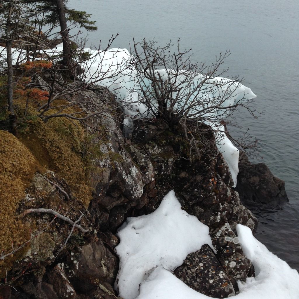
After lunch at Hatchet Lake, I head to Todd Harbor, which is deserted. To stay warm, I explore the Hays Mine, admire the wind-carved snow mounds along the Superior shore, and take a real estate tour. (Weirdest feature: the person whose ethos requires them to topple cairns over but allows them not only to use backwoods privies [and presumably other public and commercial wilderness infrastructures, such as ferries] but to deface them with graffiti bragging about how many cairns have been toppled.) After dinner, the sun comes out, and I spent some time lying on stony shoreline, enjoying the sensation of being warm without having to either exert myself or insert myself into a bag of feathers. Walking back to the shelter, I peer down the trail to see if company is coming. There is, a party of 3 – moose!
Wednesday 10 May. Todd Harbor to Daisy Farm (via Minong Ridge, Indian Portage, Greenstone Ridge, and Daisy Farm).
A warmer night, and I managed to stay in my bag of feathers until the sun was well up. Underway by 8:30, I relished the Minong Ridge trail, particularly when it had the courage of its convictions and actually followed the ridge instead of huddling below it. I’d been looking forward to exploring Minong Mine – but where there was a signpost for the mine spur, I couldn’t see a trail, and where I could see a trail, there wasn’t a signpost. So I chickened out.
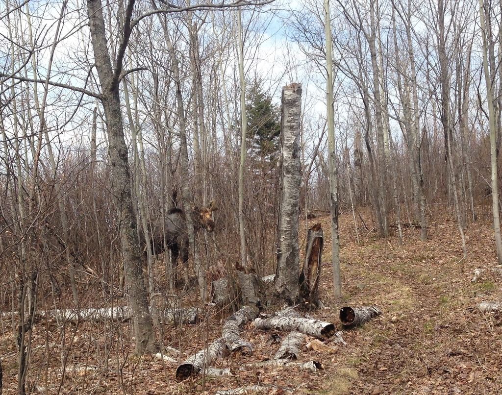
On the GRT, the sun came out, and so did the mayflies. I soaked up the former and tried not to inhale the latter. Abut a mile short of the Daisy Farm trail, I activated a pair of snowshoe hares, whose flight instinct seems to have gone awry. Instead of fleeing, they ran giddy circles around me for minutes before bounding off, having reduced their predator to ineffectual dizziness. At the Daisy Farm junction, I activated a bull moose, who’d been napping, more or less on the GRT, just east of there. As I backed nervously away scanning my surroundings for a tree to climb in case he took umbrage, he lumbered to his feet and, paying me no mind, set himself to scratching his giant neck against a birch tree and emitting moose snorts. I decided to take the Daisy Farm Trail.
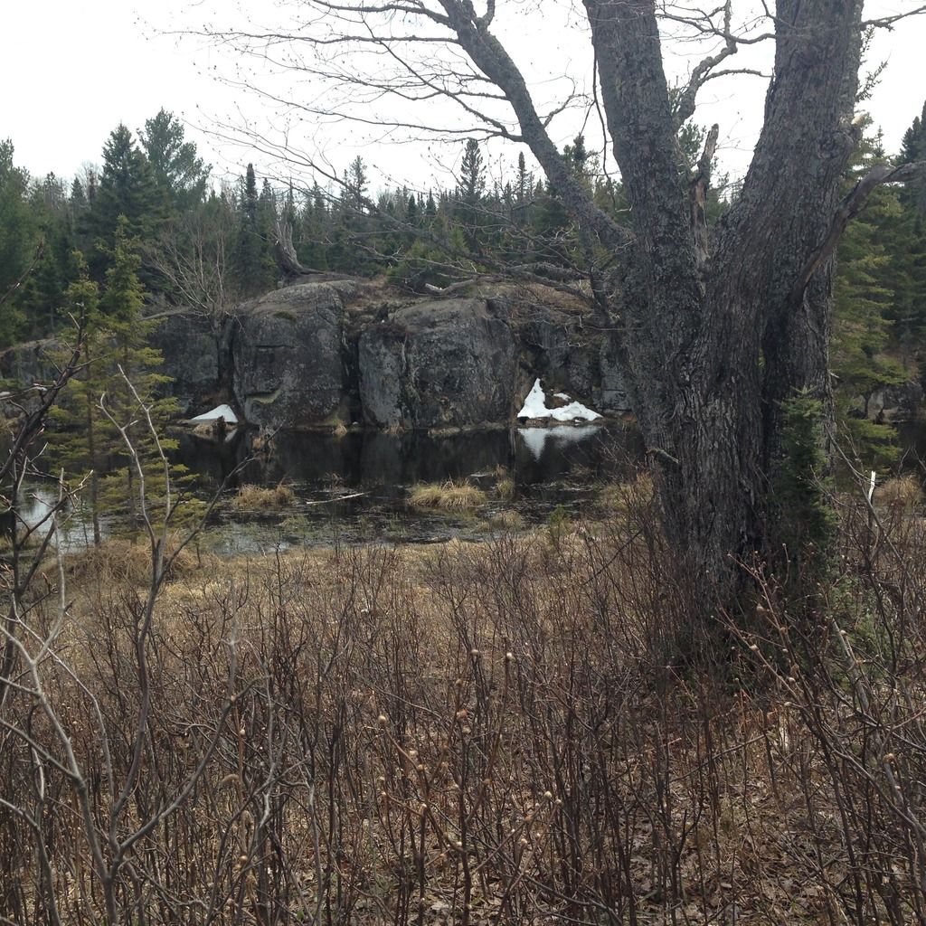
I was glad I did. There’s a lovely nameless lake whose shoreside mini-cliffs sheltered a lingering pyramid of snow—Isle Royale’s answer to Ansel Adams’ iconic “Lake with Frozen Cliffs” image. There are boardwalks and creeks and ponds and sweet little ridges carving the country up into neighborhoods, each with their own flavor. I got to Daisy Farm too soon.
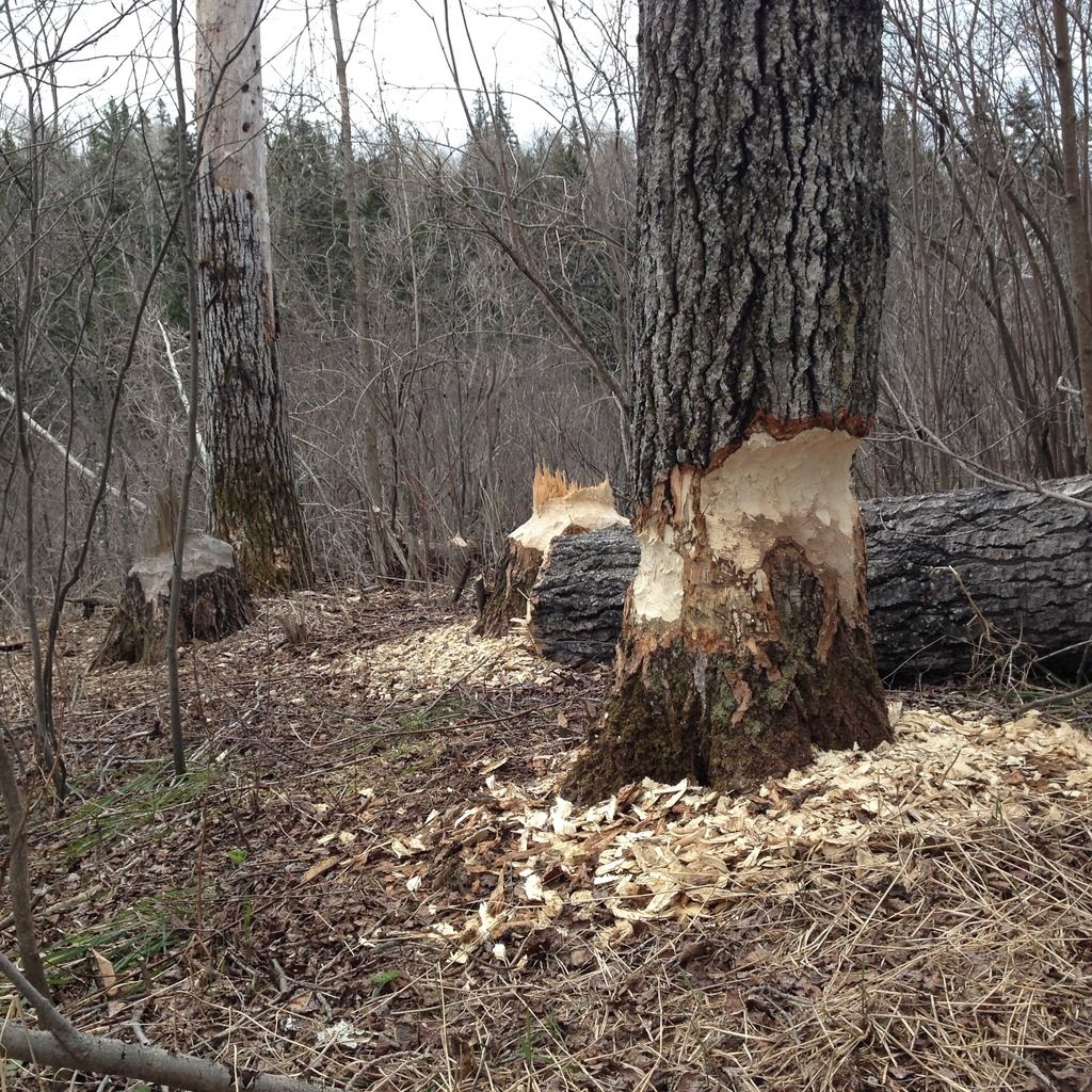
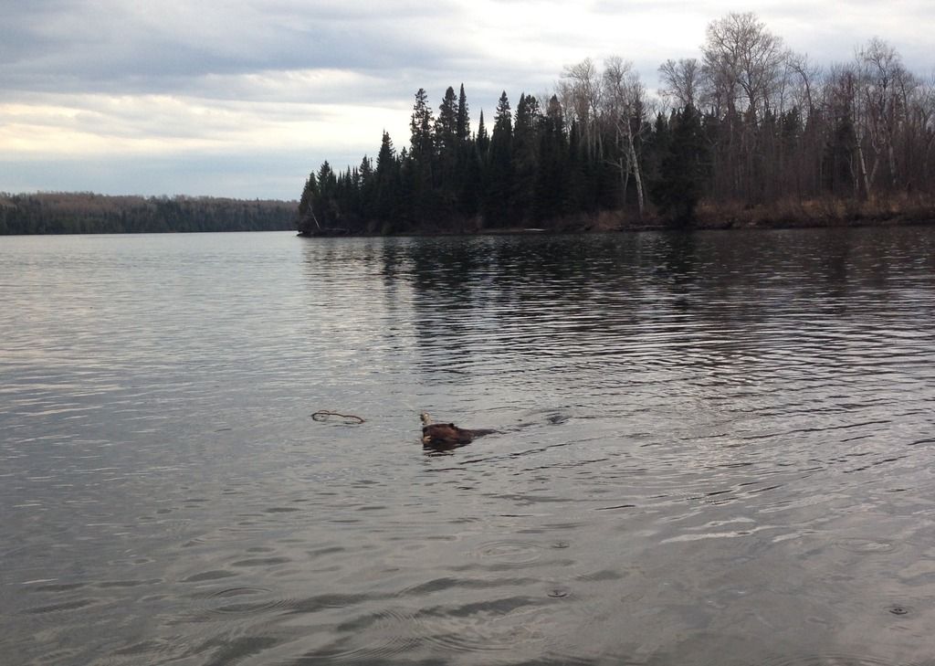
It was soggy. I set up in a shelter on high land, and went off on what turned out to be the most exciting watering expedition ever. I will now proceed to recount it in lurid detail. I didn’t trust the creek through camp – it seemed too contiguous with the pit toilets—and most of the Superior shore was so wave-battered that collecting ungritty water without soaking my feet was impossible. So I collected water from the dock, lying on my belly so that I could reach the lake. It was from this position that I saw the beaver. She was swimming just west of the dock, and trying to figure out how to wrangle a giant branch she had collected to contribute to the earthworks just east of the dock. (These earthworks were already considerable, and had submerged/destabilized enough of the boardwalk across the creek outlet to make crossing it an adventure.) She couldn’t seem to get a comfortable grip on the branch, and kept trying new configurations. Finally, she found one to her liking, and starting swimming with purpose – straight under the dock. Hoping to get a rare aerial beaver picture, I got to my feet and tiptoed to where I judged she’d emerge on the other side.
I was exactly right. I was also horribly wrong. Emerging from the dock directly beleow me, what she saw was a monster looming over her. She slapped her tail against the water, JUST LIKE THEY SAY ALARMED BEAVERS DO, dropped her branch, and raced far, far away. I fell to the dock full of remorse at disturbing a hardworking beaver. I decided to stay that way in case she calmed down and returned. Sure enough, pretty soon, she popped up about 20 yards away, looking wistfully at her branch, which was drifting out to sea, and at the dock, where she had reason to suspect a monster lurked. She treaded water, contemplating her situation for a while. (“There’s a monster. But that’s MY BRANCH. But there’s a monster. But that’s MY BRANCH …”) Eventually she could no longer resist the lure of the branch. She went for it, swooping in to collect the branch then speeding off toward the earthworks so fast that her front end rose out of the water like a power boat.
Thursday 11 May. Daisy Farm to Rock Harbor…via Lookout Louise.
I’ve been setting up my tent inside the shelter, for added warmth. This means I can’t tell which rattling sounds at night are rainfall and which are rodents attempting to breach the shelter screens to get at my gorp. This morning, I could tell, from Daisy Farm’s increased sogginess, that at least some of the noise was rain. But it’s crystal clear now, and possibly a little warmer—with more warmth promised by the prospect of the walk up the Mt Ojibway Trail back to the Greenstone Ridge.
The fire tower is eerily free of boy scouts. I climb up for a look around, then head east on the GRT.
The ridge walking in the next few miles might be my favorite stretch of the GRT. I’m delighted by the contrast between the details underfoot and the big picture. Imagine a close up shot of someone walking here. It looks like they’re in a pretty nice, sorta flat, field, possibly in one of Toledo’s more rugged metroparks. Then the camera pans out and – Holy Archipelego!
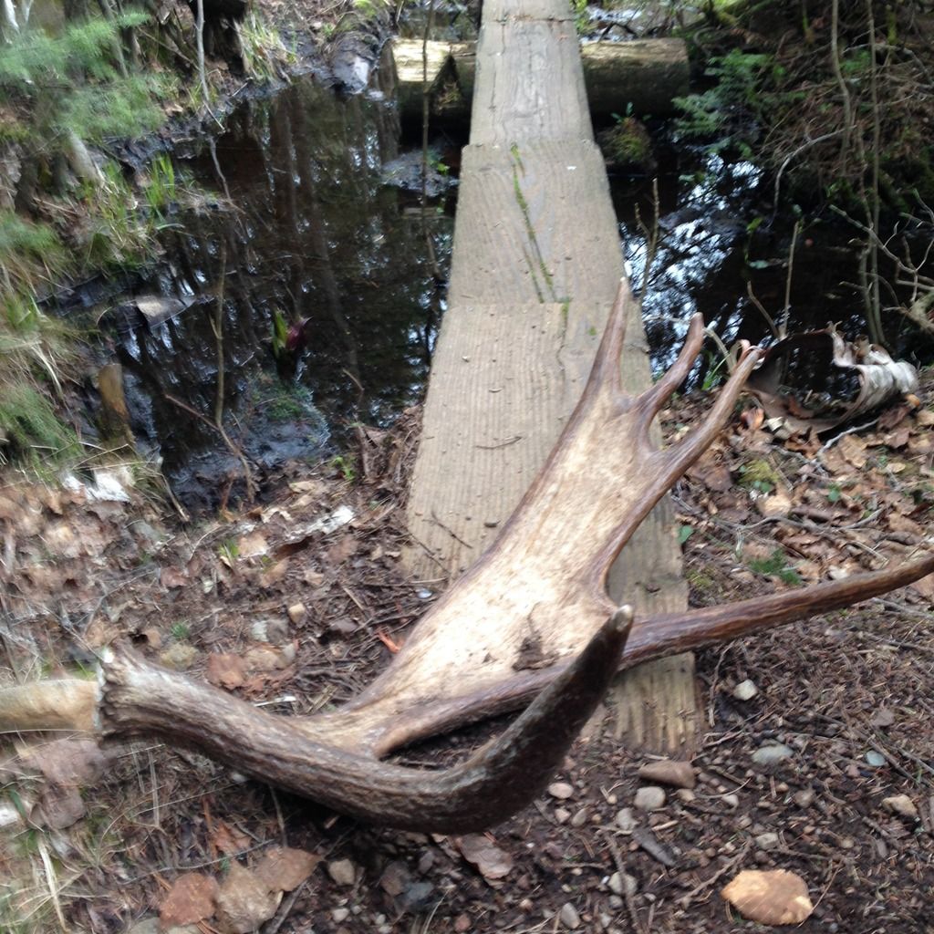
As if floating through the views weren’t enough to divert me, two moose and a bald eagle appear. I stop at Mt Franklin for an obligatory selfie, then take care of some unfinished business. Plan A last year was to walk the GRT to the end, and be collected from Hidden Lake Dock by the water taxi. Only I didn’t manage to line up the water taxi before my walk started, and I wound up skipping the easternmost segment—Mt Franklin Trail junction to Lookout Louise-- of the GRT. Today I mean to walk it twice, out and back. After about a mile, I ran into a trail crew who had been working their way east from the junction, clearing deadfall. Three miles later I ran into a second trail crew, who were working their way west from Hidden Lake. In between there were plenty of downed trees, most readily navigable, but a few real stinkers. One of the worst stinkers had fallen directly on what looked like a pretty fresh moose antler. I hoped that would be a nice treat for whichever crew got to clear it.
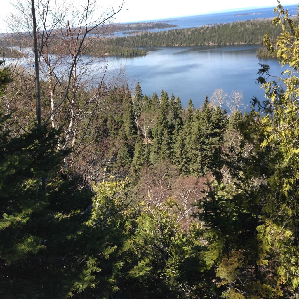
At Lookout Louise, I looked out (seeing another – or possibly the same—bald eagle) and lunched. The highlight of the walk back was finding the stinker antler deadfall cleared, and the antler conspicuously displayed on a freshcut stump.
At the bottom of the Mount Franklin Trail, a hardy garter snake was guarding the Rock Harbor trail. Bravely I stepped over him and headed east. While the stretch of the Rock Harbor Trail between 3 mile and Daisy Farm didn’t really do it for me on Monday – I think the sight and sound of Mott Island HQ diluted the experience a little—this stretch from 3 miles to Rock Harbor was stupendous: striking views, fun rocks to clamber over, water birds and wave song.
At Rock Harbor, a novelty: other people in the campground! We’re serenaded by unearthly howls and wails ---loons? cranes? wolves? We survive.
Friday 12 May. Rock Harbor to Marquette.
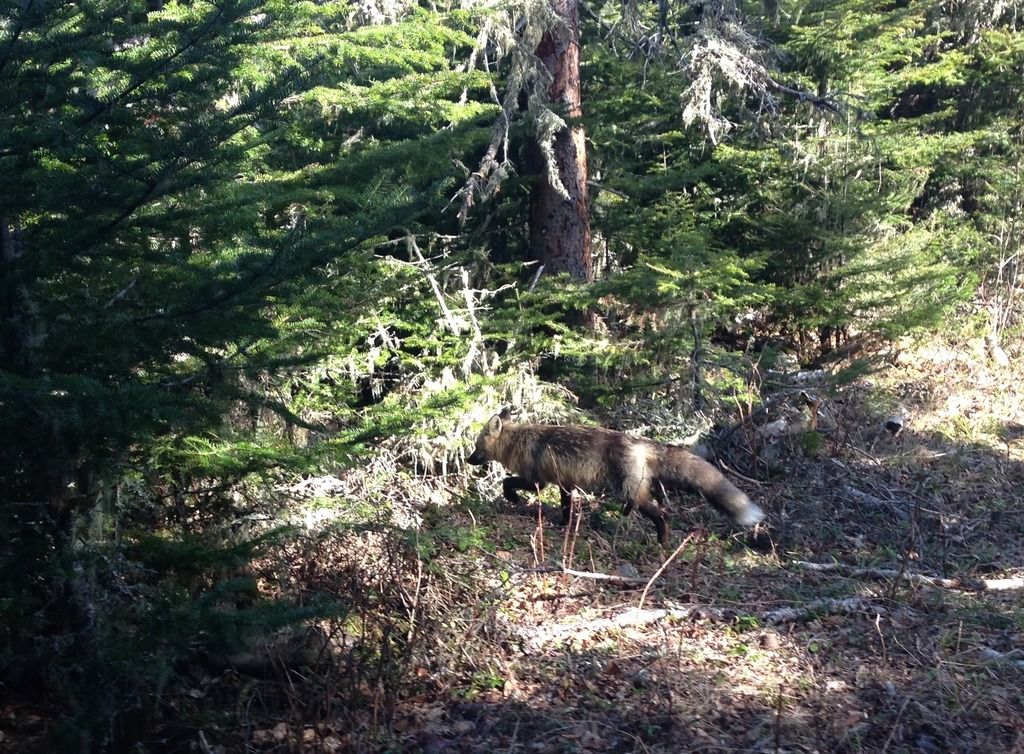
Having survived a backpacking trip, I like to take a day or so making a victory lap of the frontcountry. It’s a transitional zone between wilderness and civilization – and also often hosts some mind-blowing not-to-be-missed stuff: Yosemite Falls. General Sherman. The Stoll Point Trail, which I am strolling this morning. Without my poles clicking or my gaiters rasping or my backpack creaking, I’m hoping I can see some animals before they see me. And I do: a snowshoe hare who crouches demurely under a bush, and a bushy-coated fox who unnervingly continues to walk straight toward me down the trail before veering away. I share Scoville Point with the seagulls for a while before heading back to Rock Harbor. There’s still plenty of time before the ferry leaves, so I do a lap of the Tobin Harbor trail, looking for my water bottle—and also for otters, the critter I’d hoped to see but haven’t yet. Heroic trail crews have cleared the fallen trees; fresh stumps and sawdust are my only clues as to where the snag were. I don’t find my water bottle. And I don’t see otters. When will these adorable little weasels stop eluding me?
I gather at the dock with the other evacuees. Since Monday, the IRQIV’s pilot has found his Captain Steubing outfit. The trip back to Copper Harbor on what he describes as “two inch waves” is smooth and bittersweet. Otters and the unexplored southern half of the Indian Portage Trail are just two reasons I hope I’ll be back!
Last edited by torpified on Mon May 15, 2017 7:39 am, edited 1 time in total.
- Ingo
- Forum Moderator
- Posts: 2020
- Joined: Wed Sep 12, 2007 2:11 pm
- Isle Royale Visits: 15
- Location: Hillsborough, NC
- Has thanked: 72 times
- Been thanked: 59 times
Re: May 17, 2017: RH-MoB-TH-DF-RH hike
Great report! Really enjoyed reading it, especially since I'm getting ready for my trip in 2 weeks  .
.
25: MB | 24: MB | 22: BI | 21: RH-DF | 18: MC-DF | 17: WI-SB-WC | 16: RH-CI-RH | 14: BI-MB | 13: RH | 12: MC-TH | 11: WC-HC-WC | 09: MC-RH | 05: MI-MB-RH | 02: MC-CH | 01: BI-RH | 79: RH
- jrwiesz
- May actually live on IR
- Posts: 353
- Joined: Mon Jan 24, 2011 3:42 am
- Isle Royale Visits: 3
- Location: Michigan
- Been thanked: 1 time
Re: May 17, 2017: RH-MoB-TH-DF-RH hike
I think you saved the island mood from evaporation in your trip report. Fantastic read!
You helped kindle the fire in this camp.
You helped kindle the fire in this camp.
"And standing on the the crest of the Greenstone Ridge, I suddenly had this desire to retreat north to where I just come, to stay in the backcountry, to spend another day in a place where the only deadline I had was to pitch the tent before dark."
Jim DuFresne
Jim DuFresne
- Midwest Ed
- IR Expert
- Posts: 1397
- Joined: Sat Jul 03, 2010 2:25 am
- Isle Royale Visits: 8
- Location: Quad Cities, IL
- Has thanked: 24 times
- Been thanked: 28 times
- Contact:
Re: May 17, 2017: RH-MoB-TH-DF-RH hike
A very eloquent journey you took us on, so picturesque that I almost hate to ask; did you take any actual photos you might share?
-
Tightlines01
- May actually live on IR
- Posts: 320
- Joined: Sun May 08, 2011 10:19 pm
- Isle Royale Visits: 7
- Location: Kentwood MI
Re: May 17, 2017: RH-MoB-TH-DF-RH hike
Nice report. Thanks for the read. I laughed good (because I can imagine the shock) when you realized the drawers/socks/boots were frozen solid.
Sent from my iPhone using Tapatalk
Sent from my iPhone using Tapatalk
-
torpified
- IR Expert
- Posts: 649
- Joined: Wed Apr 20, 2016 5:06 pm
- Isle Royale Visits: 8
- Location: Ann Arbor, MI
- Has thanked: 83 times
- Been thanked: 61 times
- Contact:
Re: May 17, 2017: RH-MoB-TH-DF-RH hike
Midwest Ed,
I'm deficient at this whole internet thing and haven't got myself set up on a photo-sharing site. (It's on my to do list though!) I did take some extremely low quality Iphone pictures, the highlights of which I posted to the IR facebook group.
ALSO--I fabricated some of your patented dryer lint + candle wax fire starter and took it with me. I never had both motive and opportunity to use it, but I was glad to have it....
-
Tortuga
- Trailblazer
- Posts: 188
- Joined: Sat Jun 11, 2016 1:11 pm
- Isle Royale Visits: 3
- Location: Midwest
- Has thanked: 4 times
- Been thanked: 10 times
Re: May 17, 2017: RH-MoB-TH-DF-RH hike
You're getting everyone excited about their upcoming trips, so kudos to you.
Glad you were able to see such a large amount of wildlife, including so many moose. Sounds like you had a very peaceful and solitary trip to the Island, which must have been magical. I saw two moose last year on the Greenstone pretty much right where you did. I'll never forget it.
Thanks for a peek at the joy of winter hiking up there.
- MikeT
- IR Pro
- Posts: 362
- Joined: Fri Oct 29, 2010 2:32 pm
- Isle Royale Visits: 23
- Location: Port Sanilac, Michigan
- Been thanked: 1 time
- Contact:
Re: May 2017: RH-MoB-TH-DF-RH hike
Thanks for the great trip report!
Mike T.
"Isle Royale Info - A Comprehensive Guide to Isle Royale National Park" available at: http://www.isleroyale.info
"Isle Royale Itinerary Generator" an intuitive program to create and manage itineraries. Description at: http://www.isleroyale.info/ig_description.html
"Half the fun is in the planning"
"Isle Royale Info - A Comprehensive Guide to Isle Royale National Park" available at: http://www.isleroyale.info
"Isle Royale Itinerary Generator" an intuitive program to create and manage itineraries. Description at: http://www.isleroyale.info/ig_description.html
"Half the fun is in the planning"
-
torpified
- IR Expert
- Posts: 649
- Joined: Wed Apr 20, 2016 5:06 pm
- Isle Royale Visits: 8
- Location: Ann Arbor, MI
- Has thanked: 83 times
- Been thanked: 61 times
- Contact:
Re: May 2017: RH-MoB-TH-DF-RH hike
I've crept another millimeter into the 21st century and acquired a photosharing account. (Maybe someday I'll also acquire a decent camera and photographic know-how.) Here goes nothing.
A warning sign that wasn't preceded by a warning sign warning that further warning signs could be obscured by deafall:
Moskey Basin sunrise:
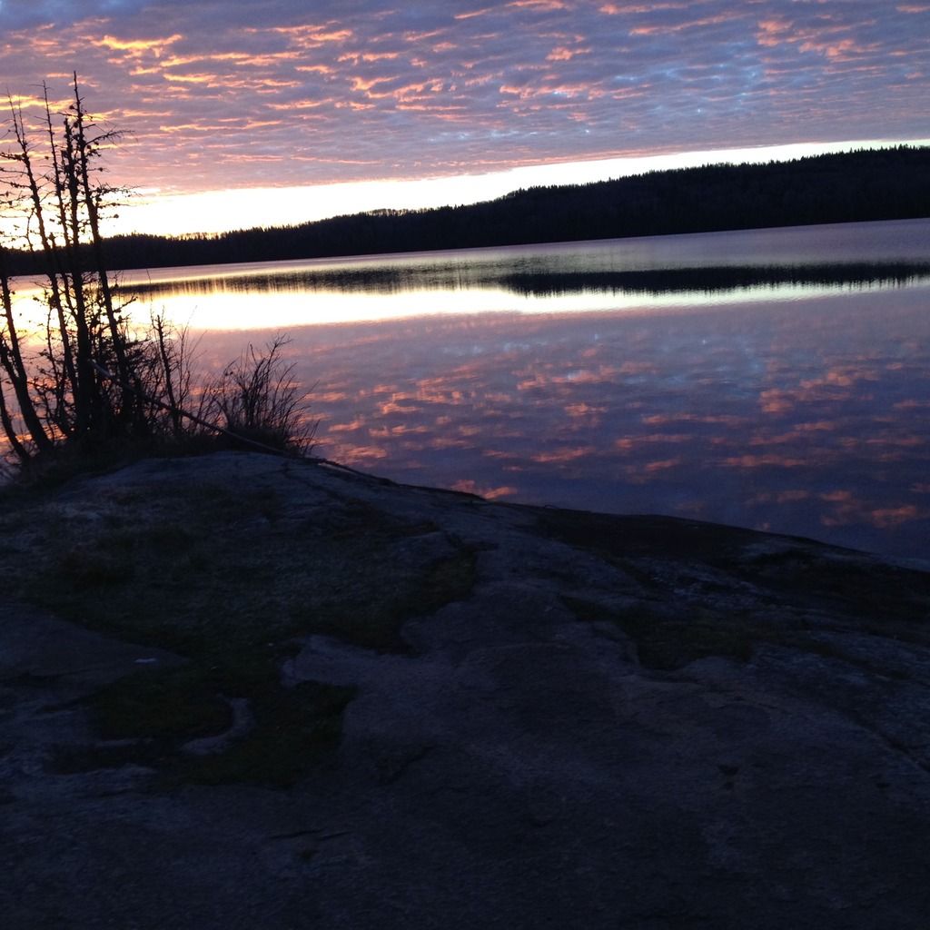
More of the same:
Indian Portage Boardwalk Hazard:
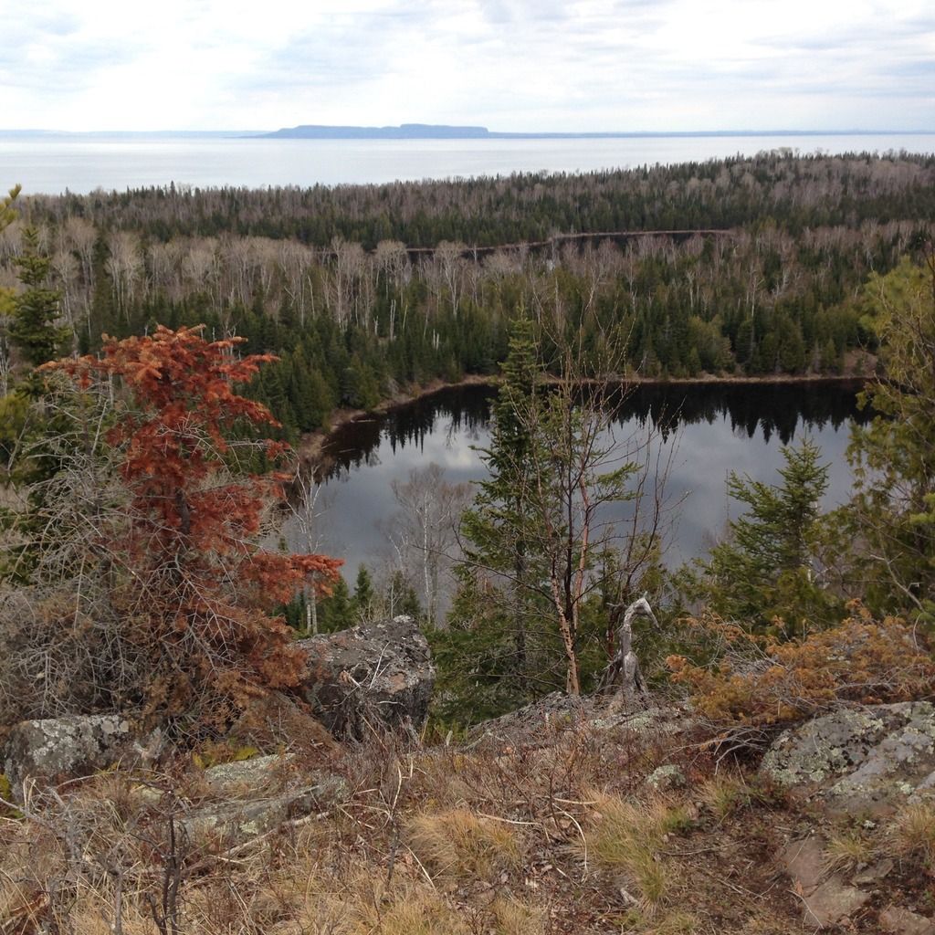
Beaver and Otter Lakes, Pie Island (from Minong Ridge):
Shore snow at Todd Harbor:
Beaver hubris at McCargoe Cove:
Moose, GRT:
The unnamed lake on the Daisy Farm Trail that reminded me of this Ansel Adams picture: https://www.sfmoma.org/artwork/63.19.101.P
the Daisy Farm beaver!!!:
From Lookout Loiuse:
Fox reluctantly ceding Stoll Point trail right o f way:
A warning sign that wasn't preceded by a warning sign warning that further warning signs could be obscured by deafall:

Moskey Basin sunrise:

More of the same:

Indian Portage Boardwalk Hazard:

Beaver and Otter Lakes, Pie Island (from Minong Ridge):

Shore snow at Todd Harbor:

Beaver hubris at McCargoe Cove:

Moose, GRT:

The unnamed lake on the Daisy Farm Trail that reminded me of this Ansel Adams picture: https://www.sfmoma.org/artwork/63.19.101.P

the Daisy Farm beaver!!!:

From Lookout Loiuse:

Fox reluctantly ceding Stoll Point trail right o f way:

- Montana
- NewbieCake
- Posts: 37
- Joined: Fri Dec 16, 2016 10:36 am
- Isle Royale Visits: 1
- Location: Missoula, Montana
Re: May 2017: RH-MoB-TH-DF-RH hike
I think you underestimate your photography skills! Great report & photos!
-
Tortuga
- Trailblazer
- Posts: 188
- Joined: Sat Jun 11, 2016 1:11 pm
- Isle Royale Visits: 3
- Location: Midwest
- Has thanked: 4 times
- Been thanked: 10 times
Re: May 2017: RH-MoB-TH-DF-RH hike
That's an understatement! Amazing pictures! Wow, I'm really jazzed now.Montana wrote: Mon May 15, 2017 4:40 pm I think you underestimate your photography skills! Great report & photos!
-
Basbh1
- NewbieCake
- Posts: 17
- Joined: Sat May 06, 2017 2:15 pm
- Isle Royale Visits: 1
- Location: Southern Wisconsin
Re: May 2017: RH-MoB-TH-DF-RH hike
Awesome pictures and report im really jazzed also . Less than 72 hours away from the epic adventures of Isle Royal. I switched from days to hours on the count down as of now
